
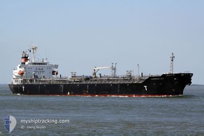
LYDERHORN
Oil/Chemical Tanker
Current Trip
| Time Travelled | 19 h, 8 mins |
|---|---|
| Remaining Time | --- |
| Distance Travelled | 186.84 nm |
| Remaining Distance | --- |
| AVG Speed | 10.1 Knop |
| MAX Speed | 11 Knop |
| AVG Wind | 14.6 knots |
| MAX Wind | 17.9 knots |
| MIN Temp | 18.2°C / 64.76°F |
| MAX Temp | 20°C / 68°F |
| Djupgående | 10 m |
| Position mottagen | 9 h, 39 m sen |
Current Position
| Longitud | -14.31660° |
|---|---|
| Latitude | 29.41884° |
| Status | Under way using engine |
| Fart | 10.5 Knop |
| Kurs | 32° |
| Område | North Atlantic Ocean |
| Station | T-AIS |
| Position mottagen | 9 h, 39 m sen |
Info
Information
The current position of LYDERHORN is in North Atlantic Ocean with coordinates 29.41884° / -14.31660° as reported on 2024-04-25 09:35 by AIS to our vessel tracker app. The vessel's current speed is 10.5 Knop and is heading at the port of AUGUSTA. The estimated time of arrival as calculated by MyShipTracking vessel tracking app is 2024-05-01 08:00 LT
The vessel LYDERHORN (IMO: 9325855, MMSI: 257710000) is a Oil/Chemical Tanker that was built in 2006 ( 18 År gammal ). It's sailing under the flag of [NO] Norway.
In this page you can find informations about the vessels current position, last detected port calls, and current voyage information. If the vessels is not in coverage by AIS you will find the latest position.
The current position of LYDERHORN is detected by our AIS receivers and we are not responsible for the reliability of the data. The last position was recorded while the vessel was in Coverage by the Ais receivers of our vessel tracking app.
The current draught of LYDERHORN as reported by AIS is 10 meters
Weather
| Temperature | 18.2°C / 64.76°F |
|---|---|
| Wind Speed | 17 knots |
| Direction | 21° NNE |
| Pressure | 1015.6 hPa |
| Humidity | 72.1 % |
| Cloud Coverage | --- |
Featured Company
Last Port Calls
| Port | Arrival | Departure | Time In Port |
|---|---|---|---|
| 2024-04-23 23:38 | 2024-04-25 00:07 | 1 d | |
| 2024-03-27 09:48 | 2024-03-28 13:40 | 1 d | |
| 2024-03-08 12:09 | 2024-03-09 18:25 | 1 d | |
| 2024-03-07 18:41 | 2024-03-08 10:45 | 16 h | |
| 2024-02-10 21:46 | 2024-02-13 09:50 | 2 d |
Most Visited Ports (Last year)
| Port | Arrivals | |
|---|---|---|
| 3 | ||
| 3 | ||
| 3 | ||
| 3 | ||
| 2 | ||
| 2 |
Last Trips
| Origin | Departure | Destination | Arrival | Distance | |
|---|---|---|---|---|---|
| 2024-03-28 16:40 | 2024-04-24 00:38 | 7147.87 nm | |||
| 2024-03-10 02:25 | 2024-03-27 12:48 | 4359.08 nm | |||
| 2024-03-08 18:45 | 2024-03-08 20:09 | 9.72 nm | |||
| 2024-02-13 15:20 | 2024-03-08 02:41 | 3276.33 nm | |||
| 2023-12-25 18:59 | 2024-02-11 03:16 | 10428.29 nm |
Events
| Tid | Event | Detaljer | Position / Dest | Information |
|---|---|---|---|---|
| 2024-04-25 09:39 | Status ändrad | Default Under way using engine |
29.42779 / -14.30942
IT AUG
|
Fart: 10.5 kn Kurs: 32° |
| 2024-04-25 09:35 | UTANFÖR täckningsområde |
29.41884 / -14.31660
North Atlantic Ocean
IT AUG
|
Fart: 10.5 kn Kurs: 32° |
|
| 2024-04-25 09:29 | Status ändrad | Under way using engine Default |
29.40236 / -14.32958
IT AUG
|
Fart: 10.6 kn Kurs: 36° |
| 2024-04-25 09:00 | Status ändrad | Default Under way using engine |
29.33444 / -14.38613
IT AUG
|
Fart: 10.5 kn Kurs: 37.5° |
| 2024-04-25 08:56 | Status ändrad | Under way using engine Default |
29.32550 / -14.39382
IT AUG
|
Fart: 10.5 kn Kurs: 38° |
| 2024-04-25 08:54 | Status ändrad | Default Under way using engine |
29.32034 / -14.39826
IT AUG
|
Fart: 10.5 kn Kurs: 35.1° |
| 2024-04-25 08:44 | Status ändrad | Under way using engine Default |
29.29703 / -14.41735
IT AUG
|
Fart: 10.2 kn Kurs: 36° |
| 2024-04-25 08:44 | I täckningsområde |
29.30339 / -14.41229
North Atlantic Ocean
IT AUG
|
Fart: 10.5 kn Kurs: 34° |
|
| 2024-04-25 07:33 | Status ändrad | Default Under way using engine |
29.13132 / -14.55026
IT AUG
|
Fart: 10.1 kn Kurs: 36.7° |
| 2024-04-25 07:30 | UTANFÖR täckningsområde |
29.12292 / -14.55721
North Atlantic Ocean
IT AUG
|
Fart: 10.1 kn Kurs: 36.7° |