
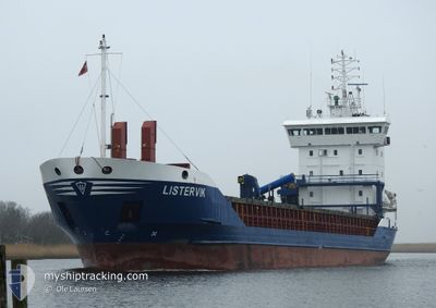
LISTERVIK
General Cargo
Current Trip
| Time Travelled | 13 h, 4 mins |
|---|---|
| Remaining Time | 6 h, 37 mins |
| Distance Travelled | 146.26 nm |
| Remaining Distance | 79.26 nm |
| AVG Speed | 11.2 Knop |
| MAX Speed | 12 Knop |
| AVG Wind | 7.8 knots |
| MAX Wind | 11.5 knots |
| MIN Temp | 2.5°C / 36.5°F |
| MAX Temp | 5.7°C / 42.26°F |
| Djupgående | 5.9 m |
| Position mottagen | 1 m sen |
Current Position
| Longitud | 15.56614° |
|---|---|
| Latitude | 54.65289° |
| Status | Under way using engine |
| Fart | 11.8 Knop |
| Kurs | 251.4° |
| Område | Baltic Sea |
| Station | T-AIS |
| Position mottagen | 1 m sen |
Info
Information
The current position of LISTERVIK is in Baltic Sea with coordinates 54.65289° / 15.56614° as reported on 2024-04-24 13:01 by AIS to our vessel tracker app. The vessel's current speed is 11.8 Knop and is heading at the port of LUBMIN. The estimated time of arrival as calculated by MyShipTracking vessel tracking app is 2024-04-24 19:39 LT
The vessel LISTERVIK (IMO: 9136216, MMSI: 231025000) is a General Cargo that was built in 1996 ( 28 År gammal ). It's sailing under the flag of [FO] Faroe Is.
In this page you can find informations about the vessels current position, last detected port calls, and current voyage information. If the vessels is not in coverage by AIS you will find the latest position.
The current position of LISTERVIK is detected by our AIS receivers and we are not responsible for the reliability of the data. The last position was recorded while the vessel was in Coverage by the Ais receivers of our vessel tracking app.
The current draught of LISTERVIK as reported by AIS is 5.9 meters
Weather
| Temperature | 5.2°C / 41.36°F |
|---|---|
| Wind Speed | 10 knots |
| Direction | 77° ENE |
| Pressure | 1008.6 hPa |
| Humidity | 73.2 % |
| Cloud Coverage | 8 % |
Featured Company
Last Port Calls
| Port | Arrival | Departure | Time In Port |
|---|---|---|---|
| 2024-04-22 11:06 | 2024-04-23 23:58 | 1 d | |
| 2024-04-19 04:02 | 2024-04-20 12:57 | 1 d | |
| 2024-04-17 07:20 | 2024-04-18 09:13 | 1 d | |
| 2024-04-13 11:06 | 2024-04-15 11:46 | 2 d | |
| 2024-04-10 18:06 | 2024-04-10 18:46 | 40 m | |
| 2024-04-09 03:44 | 2024-04-10 13:11 | 1 d | |
| 2024-04-08 22:57 | 2024-04-08 23:16 | 19 m | |
| 2024-04-04 04:57 | 2024-04-05 14:52 | 1 d | |
| 2024-04-01 04:50 | 2024-04-03 08:46 | 2 d | |
| 2024-03-27 12:07 | 2024-03-28 17:37 | 1 d |
Most Visited Ports (Last year)
| Port | Arrivals | |
|---|---|---|
| 29 | ||
| 13 | ||
| 13 | ||
| 12 | ||
| 10 | ||
| 8 |
Last Trips
| Origin | Departure | Destination | Arrival | Distance | |
|---|---|---|---|---|---|
| 2024-04-20 14:57 | 2024-04-22 13:06 | 195.73 nm | |||
| 2024-04-18 12:13 | 2024-04-19 06:02 | 213.37 nm | |||
| 2024-04-15 13:46 | 2024-04-17 10:20 | 504.61 nm | |||
| 2024-04-10 20:46 | 2024-04-13 13:06 | 376.51 nm | |||
| 2024-04-10 15:11 | 2024-04-10 20:06 | 49.13 nm | |||
| 2024-04-09 01:16 | 2024-04-09 05:44 | 49.39 nm | |||
| 2024-04-05 17:52 | 2024-04-09 00:57 | 615.14 nm | |||
| 2024-04-03 10:46 | 2024-04-04 07:57 | 215.51 nm | |||
| 2024-03-28 18:37 | 2024-04-01 06:50 | 707.92 nm | |||
| 2024-03-20 13:01 | 2024-03-27 13:07 | 648.06 nm |
Events
| Tid | Event | Detaljer | Position / Dest | Information |
|---|---|---|---|---|
| 2024-04-24 11:56 | Status ändrad | Under way using engine Default |
54.71164 / 15.92032
DEVIW
|
Fart: 11 kn Kurs: 252° |
| 2024-04-24 11:08 | Status ändrad | Default Under way using engine |
54.75834 / 16.17833
DEVIW
|
Fart: 11.7 kn Kurs: 251.5° |
| 2024-04-24 10:55 | Status ändrad | Under way using engine Default |
54.77284 / 16.25080
DEVIW
|
Fart: 11 kn Kurs: 251° |
| 2024-04-24 10:55 | I täckningsområde |
54.77284 / 16.25080
Baltic Sea
DEVIW
|
Fart: 11.7 kn Kurs: 251.5° |
|
| 2024-04-24 05:30 | Status ändrad | Default Under way using engine |
54.95775 / 18.03789
DEVIW
|
Fart: 11.3 kn Kurs: 270.7° |
| 2024-04-24 05:24 | UTANFÖR täckningsområde |
54.95766 / 18.07082
Baltic Sea
DEVIW
|
Fart: 11.3 kn Kurs: 270.7° |
|
| 2024-04-24 00:14 | ETA ändrat | 2024/04/24 21:00 2024/04/24 19:00 |
54.53300 / 18.64653
DEVIW
|
Fart: 11 kn Kurs: 95.9° |
| 2024-04-23 23:58 | AVGÅTT HAMN |
|
54.53549 / 18.56622
DEVIW
|
Fart: 8 kn Kurs: 93° |
| 2024-04-23 23:46 | STARTAR förflyttning |
54.53189 / 18.53733
[PL] GDYNIA
|
Fart: 4.3 kn Kurs: 53° |
|
| 2024-04-23 23:38 | Status ändrad | Under way using engine Moored |
54.53013 / 18.53483
[PL] GDYNIA
|
Fart: Kurs: 58° |