
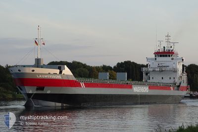
LAUWERSBORG
General Cargo
Current Trip
WRNDELAAR
| Time Travelled | 1 day |
|---|---|
| Remaining Time | --- |
| Distance Travelled | 361.43 nm |
| Remaining Distance | --- |
| AVG Speed | 8.7 Knop |
| MAX Speed | 12.1 Knop |
| AVG Wind | 13.4 knots |
| MAX Wind | 27 knots |
| MIN Temp | 11.9°C / 53.42°F |
| MAX Temp | 23.3°C / 73.94°F |
| Djupgående | 4.4 m |
| Position mottagen | 3 m sen |
Current Position
| Longitud | -9.44692° |
|---|---|
| Latitude | 43.65818° |
| Status | Under way using engine |
| Fart | 8.1 Knop |
| Kurs | 26.3° |
| Område | North Atlantic Ocean |
| Station | T-AIS |
| Position mottagen | 3 m sen |
Info
Information
The current position of LAUWERSBORG is in North Atlantic Ocean with coordinates 43.65818° / -9.44692° as reported on 2024-04-24 11:37 by AIS to our vessel tracker app. The vessel's current speed is 8.1 Knop
The vessel LAUWERSBORG (IMO: 9399387, MMSI: 244828000) is a General Cargo that was built in 2007 ( 17 År gammal ). It's sailing under the flag of [NL] Netherlands.
In this page you can find informations about the vessels current position, last detected port calls, and current voyage information. If the vessels is not in coverage by AIS you will find the latest position.
The current position of LAUWERSBORG is detected by our AIS receivers and we are not responsible for the reliability of the data. The last position was recorded while the vessel was in Coverage by the Ais receivers of our vessel tracking app.
The current draught of LAUWERSBORG as reported by AIS is 4.4 meters
Weather
| Temperature | 12°C / 53.6°F |
|---|---|
| Wind Speed | 10 knots |
| Direction | 18° NNE |
| Pressure | 1024 hPa |
| Humidity | 75.4 % |
| Cloud Coverage | 82 % |
Featured Company
Last Port Calls
| Port | Arrival | Departure | Time In Port |
|---|---|---|---|
| 2024-04-21 09:09 | 2024-04-22 17:27 | 1 d | |
| 2024-04-15 15:33 | 2024-04-17 19:03 | 2 d | |
| 2024-04-01 08:23 | 2024-04-07 16:19 | 6 d | |
| 2024-03-09 03:55 | 2024-03-14 05:13 | 5 d | |
| 2024-03-07 03:12 | 2024-03-08 09:38 | 1 d | |
| 2024-03-03 14:37 | 2024-03-06 06:13 | 2 d | |
| 2024-02-25 12:02 | 2024-03-02 19:32 | 6 d | |
| 2024-02-24 04:16 | 2024-02-24 06:10 | 1 h | |
| 2024-02-20 18:18 | |||
| 2024-02-13 14:09 | 2024-02-18 03:40 | 4 d |
Last Trips
| Origin | Departure | Destination | Arrival | Distance | |
|---|---|---|---|---|---|
| 2024-04-17 21:03 | 2024-04-21 10:09 | 736.95 nm | |||
| 2024-04-07 18:19 | 2024-04-15 17:33 | 1733.61 nm | |||
| 2024-03-14 06:13 | 2024-04-01 10:23 | 1836.84 nm | |||
| 2024-03-08 09:38 | 2024-03-09 04:55 | 203.39 nm | |||
| 2024-03-06 07:13 | 2024-03-07 03:12 | 187.94 nm | |||
| 2024-03-02 20:32 | 2024-03-03 15:37 | 69.39 nm | |||
| 2024-02-24 07:10 | 2024-02-25 13:02 | 312.85 nm | |||
| 2024-02-20 19:18 | 2024-02-24 05:16 | 812.08 nm | |||
| 2024-02-08 03:23 | 2024-02-13 16:09 | 1207.68 nm | |||
| 2024-01-30 10:03 | 2024-02-05 22:19 | 443.12 nm |
Events
| Tid | Event | Detaljer | Position / Dest | Information |
|---|---|---|---|---|
| 2024-04-24 11:16 | Status ändrad | Under way using engine Default |
43.61478 / -9.47613
WRNDELAAR
|
Fart: 8.4 kn Kurs: 27° |
| 2024-04-24 11:04 | Status ändrad | Default Under way using engine |
43.58958 / -9.49390
WRNDELAAR
|
Fart: 8.4 kn Kurs: 29.3° |
| 2024-04-24 11:02 | Status ändrad | Under way using engine Default |
43.58610 / -9.49629
WRNDELAAR
|
Fart: 8.2 kn Kurs: 25° |
| 2024-04-24 10:46 | Status ändrad | Default Under way using engine |
43.55362 / -9.51916
WRNDELAAR
|
Fart: 8.2 kn Kurs: 25.2° |
| 2024-04-24 10:26 | Status ändrad | Under way using engine Default |
43.51136 / -9.55145
WRNDELAAR
|
Fart: 8.2 kn Kurs: 29° |
| 2024-04-24 09:49 | Status ändrad | Default Under way using engine |
43.43552 / -9.61060
WRNDELAAR
|
Fart: 9.2 kn Kurs: 29.1° |
| 2024-04-24 08:55 | Upptäckt i hav | Spanish part of the North Atlantic Ocean |
43.31519 / -9.69539
North Atlantic Ocean
WRNDELAAR
|
Fart: 8.9 kn Kurs: 26.2° |
| 2024-04-24 08:55 | Status ändrad | Under way using engine Default |
43.31519 / -9.69539
WRNDELAAR
|
Fart: 8.9 kn Kurs: 27° |
| 2024-04-24 08:55 | I täckningsområde |
43.31519 / -9.69539
North Atlantic Ocean
WRNDELAAR
|
Fart: 8.9 kn Kurs: 26.2° |
|
| 2024-04-23 21:41 | UTANFÖR täckningsområde |
41.75928 / -9.69280
North Atlantic Ocean
WRNDELAAR
|
Fart: 7.3 kn Kurs: 357.5° |