
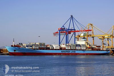
LAUST MAERSK
Container Ship
Current Trip
PAMANTM
| Time Travelled | 5 days |
|---|---|
| Remaining Time | --- |
| Distance Travelled | 1849.65 nm |
| Remaining Distance | --- |
| AVG Speed | 14.3 Knop |
| MAX Speed | 18 Knop |
| AVG Wind | 15 knots |
| MAX Wind | 26.7 knots |
| MIN Temp | 14.4°C / 57.92°F |
| MAX Temp | 21.1°C / 69.98°F |
| Djupgående | 10 m |
| Position mottagen | 4 d sen |
Current Position
| Longitud | -9.47376° |
|---|---|
| Latitude | 35.86578° |
| Status | Under way using engine |
| Fart | 15.1 Knop |
| Kurs | 261.8° |
| Område | North Atlantic Ocean |
| Station | T-AIS |
| Position mottagen | 4 d sen |
Info
Information
The current position of LAUST MAERSK is in North Atlantic Ocean with coordinates 35.86578° / -9.47376° as reported on 2024-04-20 23:18 by AIS to our vessel tracker app. The vessel's current speed is 15.1 Knop
The vessel LAUST MAERSK (IMO: 9190743, MMSI: 477681900) is a Container Ship that was built in 2001 ( 23 År gammal ). It's sailing under the flag of [HK] Hong Kong.
In this page you can find informations about the vessels current position, last detected port calls, and current voyage information. If the vessels is not in coverage by AIS you will find the latest position.
The current position of LAUST MAERSK is detected by our AIS receivers and we are not responsible for the reliability of the data. The last position was recorded while the vessel was in Coverage by the Ais receivers of our vessel tracking app.
The current draught of LAUST MAERSK as reported by AIS is 10 meters
Weather
| Temperature | 21.2°C / 70.16°F |
|---|---|
| Wind Speed | 20 knots |
| Direction | 59° ENE |
| Pressure | 1020.8 hPa |
| Humidity | 76 % |
| Cloud Coverage | --- |
Featured Company
Last Port Calls
| Port | Arrival | Departure | Time In Port |
|---|---|---|---|
| 2024-04-19 06:09 | 2024-04-20 08:51 | 1 d | |
| 2024-04-17 05:55 | 2024-04-17 19:10 | 13 h | |
| 2024-04-04 22:45 | 2024-04-06 09:25 | 1 d | |
| 2024-04-03 15:41 | 2024-04-04 07:46 | 16 h | |
| 2024-03-31 06:19 | 2024-04-01 07:39 | 1 d | |
| 2024-03-30 03:25 | 2024-03-30 22:12 | 18 h | |
| 2024-03-26 16:04 | 2024-03-27 20:42 | 1 d | |
| 2024-03-24 21:08 | 2024-03-25 14:25 | 17 h | |
| 2024-03-22 16:38 | 2024-03-23 09:53 | 17 h | |
| 2024-03-17 08:32 | 2024-03-18 00:19 | 15 h |
Most Visited Ports (Last year)
| Port | Arrivals | |
|---|---|---|
| 13 | ||
| 13 | ||
| 11 | ||
| 7 | ||
| 7 | ||
| 7 |
Last Trips
| Origin | Departure | Destination | Arrival | Distance | |
|---|---|---|---|---|---|
| 2024-04-17 20:10 | 2024-04-19 08:09 | 125.74 nm | |||
| 2024-04-06 04:25 | 2024-04-17 06:55 | 4338.89 nm | |||
| 2024-04-04 02:46 | 2024-04-04 17:45 | 45.95 nm | |||
| 2024-04-01 02:39 | 2024-04-03 10:41 | 782.89 nm | |||
| 2024-03-30 17:12 | 2024-03-31 01:19 | 63.40 nm | |||
| 2024-03-27 15:42 | 2024-03-29 22:25 | 794.23 nm | |||
| 2024-03-25 09:25 | 2024-03-26 11:04 | 363.24 nm | |||
| 2024-03-23 04:53 | 2024-03-24 16:08 | 418.79 nm | |||
| 2024-03-17 20:19 | 2024-03-22 11:38 | 2016.79 nm | |||
| 2024-03-07 15:00 | 2024-03-17 04:32 | 3981.31 nm |
Events
| Tid | Event | Detaljer | Position / Dest | Information |
|---|---|---|---|---|
| 2024-04-20 23:45 | Status ändrad | Default Under way using engine |
35.84709 / -9.63962
PAMANTM
|
Fart: 15.1 kn Kurs: 261.8° |
| 2024-04-20 23:18 | Status ändrad | Under way using engine Default |
35.86578 / -9.47376
PAMANTM
|
Fart: 15.1 kn Kurs: 262° |
| 2024-04-20 23:18 | UTANFÖR täckningsområde |
35.86578 / -9.47376
North Atlantic Ocean
PAMANTM
|
Fart: 15.1 kn Kurs: 261.8° |
|
| 2024-04-20 23:08 | I täckningsområde |
35.86578 / -9.47376
North Atlantic Ocean
PAMANTM
|
Fart: 15.1 kn Kurs: 261.8° |
|
| 2024-04-20 22:36 | Status ändrad | Default Under way using engine |
35.88961 / -9.28724
PAMANTM
|
Fart: 14.8 kn Kurs: 261° |
| 2024-04-20 22:02 | UTANFÖR täckningsområde |
35.91555 / -9.05630
North Atlantic Ocean
PAMANTM
|
Fart: 14.8 kn Kurs: 261° |
|
| 2024-04-20 21:22 | Status ändrad | Under way using engine Default |
35.93308 / -8.91366
PAMANTM
|
Fart: 14.8 kn Kurs: 263° |
| 2024-04-20 21:05 | I täckningsområde |
35.93308 / -8.91366
North Atlantic Ocean
PAMANTM
|
Fart: 14.8 kn Kurs: 262.3° |
|
| 2024-04-20 19:13 | Status ändrad | Default Under way using engine |
35.95615 / -8.26153
PAMANTM
|
Fart: 14.8 kn Kurs: 270.3° |
| 2024-04-20 19:04 | UTANFÖR täckningsområde |
35.95575 / -8.21539
North Atlantic Ocean
PAMANTM
|
Fart: 14.8 kn Kurs: 270.3° |