
JORDANIA
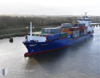
Container Ship
Current Trip
| Time Travelled | 1 day |
|---|---|
| Remaining Time | --- |
| Distance Travelled | 352.19 nm |
| Remaining Distance | 3.22 nm |
| AVG Speed | 10.2 Knop |
| MAX Speed | 12.2 Knop |
| AVG Wind | 8.4 knots |
| MAX Wind | 29.2 knots |
| MIN Temp | 14.8°C / 58.64°F |
| MAX Temp | 28.2°C / 82.76°F |
| Djupgående | 7.4 m |
| Position mottagen | 1 m sen |
Current Position
| Longitud | 28.75202° |
|---|---|
| Latitude | 40.96402° |
| Status | Under way using engine |
| Fart | 0.4 Knop |
| Kurs | 349° |
| Område | Sea of Marmara |
| Station | T-AIS |
| Position mottagen | 1 m sen |
Info
Information
The current position of JORDANIA is in Sea of Marmara with coordinates 40.96402° / 28.75202° as reported on 2024-04-25 11:21 by AIS to our vessel tracker app. The vessel's current speed is 0.4 Knop and is heading at the port of AMBARLI. The estimated time of arrival as calculated by MyShipTracking vessel tracking app is 2024-04-24 10:00 LT
The vessel JORDANIA (IMO: 9123805, MMSI: 357779000) is a Container Ship that was built in 1995 ( 29 År gammal ). It's sailing under the flag of [PA] Panama.
In this page you can find informations about the vessels current position, last detected port calls, and current voyage information. If the vessels is not in coverage by AIS you will find the latest position.
The current position of JORDANIA is detected by our AIS receivers and we are not responsible for the reliability of the data. The last position was recorded while the vessel was in Coverage by the Ais receivers of our vessel tracking app.
The current draught of JORDANIA as reported by AIS is 7.4 meters
Weather
| Temperature | 19.9°C / 67.82°F |
|---|---|
| Wind Speed | 6 knots |
| Direction | 261° W |
| Pressure | 1003.6 hPa |
| Humidity | 68.1 % |
| Cloud Coverage | 100 % |
Featured Company
Last Port Calls
| Port | Arrival | Departure | Time In Port |
|---|---|---|---|
| 2024-04-22 16:35 | 2024-04-23 12:58 | 20 h | |
| 2024-04-20 16:03 | |||
| 2024-04-15 10:15 | 2024-04-16 16:12 | 1 d | |
| 2024-04-08 00:29 | 2024-04-09 05:38 | 1 d | |
| 2024-04-05 09:32 | 2024-04-06 02:15 | 16 h | |
| 2024-04-02 05:13 | 2024-04-03 11:53 | 1 d | |
| 2024-03-23 11:42 | 2024-03-23 16:22 | 4 h | |
| 2024-03-22 02:42 | 2024-03-22 11:15 | 8 h | |
| 2024-03-18 21:14 | 2024-03-20 01:50 | 1 d | |
| 2024-03-12 08:26 | 2024-03-12 21:17 | 12 h |
Most Visited Ports (Last year)
| Port | Arrivals | |
|---|---|---|
| 22 | ||
| 19 | ||
| 11 | ||
| 10 | ||
| 5 | ||
| 4 |
Last Trips
| Origin | Departure | Destination | Arrival | Distance | |
|---|---|---|---|---|---|
| 2024-04-20 18:03 | 2024-04-22 19:35 | 584.87 nm | |||
| 2024-04-09 08:38 | 2024-04-15 12:15 | 1030.34 nm | |||
| 2024-04-06 05:15 | 2024-04-08 03:29 | 292.54 nm | |||
| 2024-04-03 13:53 | 2024-04-05 12:32 | 574.36 nm | |||
| 2024-03-23 19:22 | 2024-04-02 07:13 | 843.06 nm | |||
| 2024-03-22 14:15 | 2024-03-23 14:42 | 277.34 nm | |||
| 2024-03-20 03:50 | 2024-03-22 05:42 | 586.31 nm | |||
| 2024-03-13 00:17 | 2024-03-18 23:14 | 992.43 nm | |||
| 2024-03-11 11:16 | 2024-03-12 11:26 | 275.04 nm | |||
| 2024-03-01 19:02 | 2024-03-11 04:17 | 1086.12 nm |
Events
| Tid | Event | Detaljer | Position / Dest | Information |
|---|---|---|---|---|
| 2024-04-25 11:14 | STOPPAR förflyttning | 3.35 nm, West of YESILKOY |
40.96354 / 28.75284
AMBARLI
|
Fart: 0.3 kn Kurs: 350° |
| 2024-04-25 06:59 | STARTAR förflyttning | 1.05 nm, West of DILISKELESI |
40.76722 / 29.51420
AMBARLI
|
Fart: 3.7 kn Kurs: 201° |
| 2024-04-25 06:58 | Status ändrad | Under way using engine Moored |
40.76830 / 29.51360
AMBARLI
|
Fart: 0.3 kn Kurs: 142° |
| 2024-04-25 06:27 | Djupgående ändrat | 7.4 7.2 |
40.76908 / 29.51326
AMBARLI
|
Fart: Kurs: 140° |
| 2024-04-25 06:21 | Destination ändrad | AMBARLI BELDEPORT |
40.76906 / 29.51328
AMBARLI
|
Fart: Kurs: 140° |
| 2024-04-24 17:17 | Status ändrad | Moored Under way using engine |
40.76911 / 29.51324
BELDEPORT
|
Fart: Kurs: 142° |
| 2024-04-24 17:05 | STOPPAR förflyttning | 1.13 nm, West of DILISKELESI |
40.76876 / 29.51272
BELDEPORT
|
Fart: 0.3 kn Kurs: 120° |
| 2024-04-24 12:09 | Status ändrad | Under way using engine Default |
40.73920 / 28.43563
BELDEPORT
|
Fart: 11.1 kn Kurs: 90° |
| 2024-04-24 11:57 | I täckningsområde |
40.73918 / 28.44239
Sea of Marmara
BELDEPORT
|
Fart: 11 kn Kurs: 90° |
|
| 2024-04-24 10:50 | UTANFÖR täckningsområde |
40.73556 / 28.11284
Sea of Marmara
BELDEPORT
|
Fart: 11 kn Kurs: 87.6° |