
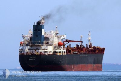
JANAKI
Oil/Chemical Tanker
Current Trip
| Time Travelled | 9 days |
|---|---|
| Remaining Time | --- |
| Distance Travelled | 395.49 nm |
| Remaining Distance | --- |
| AVG Speed | 17.2 Knop |
| MAX Speed | 17.2 Knop |
| AVG Wind | 7.5 knots |
| MAX Wind | 16 knots |
| MIN Temp | 12.4°C / 54.32°F |
| MAX Temp | 18.7°C / 65.66°F |
| Djupgående | 6.5 m |
| Position mottagen | Nu |
Current Position
| Longitud | 37.91569° |
|---|---|
| Latitude | 44.22276° |
| Status | Under way using engine |
| Fart | 0.1 Knop |
| Kurs | 61° |
| Område | Black Sea |
| Station | T-AIS |
| Position mottagen | Nu |
Info
Information
The current position of JANAKI is in Black Sea with coordinates 44.22276° / 37.91569° as reported on 2024-04-23 10:11 by AIS to our vessel tracker app. The vessel's current speed is 0.1 Knop
The vessel JANAKI (IMO: 9259915, MMSI: 636022017) is a Oil/Chemical Tanker that was built in 2003 ( 21 År gammal ). It's sailing under the flag of [LR] Liberia.
In this page you can find informations about the vessels current position, last detected port calls, and current voyage information. If the vessels is not in coverage by AIS you will find the latest position.
The current position of JANAKI is detected by our AIS receivers and we are not responsible for the reliability of the data. The last position was recorded while the vessel was in Coverage by the Ais receivers of our vessel tracking app.
The current draught of JANAKI as reported by AIS is 6.5 meters
Weather
| Temperature | 14.3°C / 57.74°F |
|---|---|
| Wind Speed | 2 knots |
| Direction | 60° ENE |
| Pressure | 1023.1 hPa |
| Humidity | 67.4 % |
| Cloud Coverage | 81 % |
Featured Company
Most Visited Ports (Last year)
| Port | Arrivals | |
|---|---|---|
| 2 | ||
| 2 | ||
| 2 | ||
| 1 | ||
| 1 | ||
| 1 |
Events
| Tid | Event | Detaljer | Position / Dest | Information |
|---|---|---|---|---|
| 2024-04-23 09:36 | Status ändrad | Under way using engine Default |
44.22192 / 37.91519
RUNVS
|
Fart: 0.1 kn Kurs: 46° |
| 2024-04-23 09:31 | Status ändrad | Default Under way using engine |
44.22172 / 37.91510
RUNVS
|
Fart: 0.1 kn Kurs: 49° |
| 2024-04-23 09:20 | Status ändrad | Under way using engine Default |
44.22127 / 37.91494
RUNVS
|
Fart: 0.2 kn Kurs: 56° |
| 2024-04-23 09:12 | Status ändrad | Default Under way using engine |
44.22087 / 37.91469
RUNVS
|
Fart: 0.2 kn Kurs: 61° |
| 2024-04-23 08:15 | Status ändrad | Under way using engine Default |
44.21822 / 37.91309
RUNVS
|
Fart: 0.1 kn Kurs: 61° |
| 2024-04-23 08:10 | Status ändrad | Default Under way using engine |
44.21804 / 37.91318
RUNVS
|
Fart: 0.1 kn Kurs: 60° |
| 2024-04-23 07:24 | Status ändrad | Under way using engine Default |
44.21813 / 37.91508
RUNVS
|
Fart: Kurs: 97° |
| 2024-04-23 07:10 | Status ändrad | Default Under way using engine |
44.21867 / 37.91604
RUNVS
|
Fart: Kurs: 122° |
| 2024-04-23 07:02 | Status ändrad | Under way using engine Default |
44.21896 / 37.91672
RUNVS
|
Fart: Kurs: 136° |
| 2024-04-23 06:58 | Status ändrad | Default Under way using engine |
44.21908 / 37.91716
RUNVS
|
Fart: Kurs: 143° |