
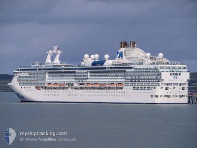
ISLAND PRINCESS
Passengers Ship
Current Trip
| Time Travelled | 8 days |
|---|---|
| Remaining Time | 5 mins |
| Distance Travelled | 3371.36 nm |
| Remaining Distance | 5.90 nm |
| AVG Speed | 17 Knop |
| MAX Speed | 20 Knop |
| AVG Wind | 12.3 knots |
| MAX Wind | 25.8 knots |
| MIN Temp | 16.3°C / 61.34°F |
| MAX Temp | 24.3°C / 75.74°F |
| Djupgående | 8.2 m |
| Position mottagen | Nu |
Current Position
| Longitud | -80.03712° |
|---|---|
| Latitude | 26.09412° |
| Status | Under way using engine |
| Fart | 7.9 Knop |
| Kurs | 269.3° |
| Område | North Atlantic Ocean |
| Station | T-AIS |
| Position mottagen | Nu |
Info
Information
The current position of ISLAND PRINCESS is in North Atlantic Ocean with coordinates 26.09412° / -80.03712° as reported on 2024-04-25 07:39 by AIS to our vessel tracker app. The vessel's current speed is 7.9 Knop and is heading at the port of FORT LAUDERDALE. The estimated time of arrival as calculated by MyShipTracking vessel tracking app is 2024-04-25 07:44 LT
The vessel ISLAND PRINCESS (IMO: 9230402, MMSI: 310384000) is a Passengers Ship that was built in 2003 ( 21 År gammal ). It's sailing under the flag of [BM] Bermuda.
In this page you can find informations about the vessels current position, last detected port calls, and current voyage information. If the vessels is not in coverage by AIS you will find the latest position.
The current position of ISLAND PRINCESS is detected by our AIS receivers and we are not responsible for the reliability of the data. The last position was recorded while the vessel was in Coverage by the Ais receivers of our vessel tracking app.
The current draught of ISLAND PRINCESS as reported by AIS is 8.2 meters
Weather
| Temperature | 23.3°C / 73.94°F |
|---|---|
| Wind Speed | 10 knots |
| Direction | 82° E |
| Pressure | 1019.2 hPa |
| Humidity | 59.4 % |
| Cloud Coverage | --- |
Featured Company
Last Port Calls
| Port | Arrival | Departure | Time In Port |
|---|---|---|---|
| 2024-04-16 05:39 | 2024-04-16 16:04 | 10 h | |
| 2024-04-14 04:19 | 2024-04-14 15:00 | 10 h | |
| 2024-04-13 04:38 | 2024-04-13 17:03 | 12 h | |
| 2024-04-09 03:06 | 2024-04-09 15:02 | 11 h | |
| 2024-04-08 03:07 | 2024-04-08 15:24 | 12 h | |
| 2024-04-07 03:39 | 2024-04-07 17:40 | 14 h | |
| 2024-04-06 03:36 | 2024-04-06 18:02 | 14 h | |
| 2024-04-04 07:17 | 2024-04-04 17:56 | 10 h | |
| 2024-04-03 04:18 | 2024-04-03 17:11 | 12 h | |
| 2024-04-01 08:00 | 2024-04-02 18:50 | 1 d |
Most Visited Ports (Last year)
| Port | Arrivals | |
|---|---|---|
| 10 | ||
| 4 | ||
| 4 | ||
| 4 | ||
| 4 | ||
| 4 |
Last Trips
| Origin | Departure | Destination | Arrival | Distance | |
|---|---|---|---|---|---|
| 2024-04-14 17:00 | 2024-04-16 06:39 | 674.94 nm | |||
| 2024-04-13 19:03 | 2024-04-14 06:19 | 130.57 nm | |||
| 2024-04-09 18:02 | 2024-04-13 06:38 | 1508.63 nm | |||
| 2024-04-08 18:24 | 2024-04-09 06:06 | 198.85 nm | |||
| 2024-04-07 20:40 | 2024-04-08 06:07 | 105.07 nm | |||
| 2024-04-06 21:02 | 2024-04-07 06:39 | 128.87 nm | |||
| 2024-04-04 19:56 | 2024-04-06 06:36 | 509.32 nm | |||
| 2024-04-03 19:11 | 2024-04-04 09:17 | 232.39 nm | |||
| 2024-04-02 20:50 | 2024-04-03 06:18 | 169.74 nm | |||
| 2024-03-31 21:08 | 2024-04-01 10:00 | 194.03 nm |
Events
| Tid | Event | Detaljer | Position / Dest | Information |
|---|---|---|---|---|
| 2024-04-25 06:08 | Byter havsområde | United States part of the North Atlantic Ocean Bahamas part of the North Atlantic Ocean |
26.13239 / -79.60062
North Atlantic Ocean
|
Fart: 16.7 kn Kurs: 262.3° |
| 2024-04-25 05:23 | Destination ändrad | US FLL BM WE1 |
26.15303 / -79.40698
US FLL
|
Fart: 13.3 kn Kurs: 264.9° |
| 2024-04-25 05:23 | ETA ändrat | 2024/04/24 23:45 2024/04/22 04:30 |
26.15303 / -79.40698
US FLL
|
Fart: 13.3 kn Kurs: 264.9° |
| 2024-04-25 04:52 | Status ändrad | Under way using engine Default |
26.16414 / -79.28180
BM WE1
|
Fart: 13 kn Kurs: 265° |
| 2024-04-25 04:46 | I täckningsområde |
26.16399 / -79.28385
North Atlantic Ocean
|
Fart: 13.2 kn Kurs: 265.6° |
|
| 2024-04-25 02:12 | Status ändrad | Default Under way using engine |
26.10167 / -78.64833
BM WE1
|
Fart: 14 kn Kurs: 283.3° |
| 2024-04-25 02:07 | UTANFÖR täckningsområde |
26.09705 / -78.62774
North Atlantic Ocean
|
Fart: 14 kn Kurs: 283.3° |
|
| 2024-04-25 01:48 | Status ändrad | Under way using engine Default |
26.07926 / -78.54624
BM WE1
|
Fart: 15 kn Kurs: 284° |
| 2024-04-25 00:57 | Status ändrad | Default Under way using engine |
26.02833 / -78.31834
BM WE1
|
Fart: 14.7 kn Kurs: 283.9° |
| 2024-04-24 20:02 | Status ändrad | Under way using engine Default |
25.78359 / -77.01834
BM WE1
|
Fart: 16 kn Kurs: 251° |