
IOLE R
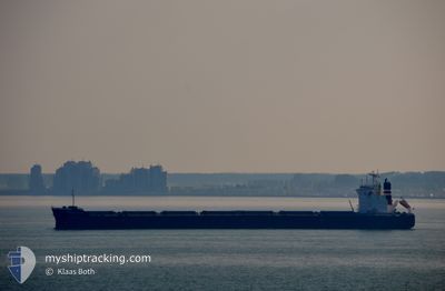
Bulk Carrier
Current Trip
| Time Travelled | 15 days |
|---|---|
| Remaining Time | 21 days |
| Distance Travelled | 3845.29 nm |
| Remaining Distance | 6928.01 nm |
| AVG Speed | 11 Knop |
| MAX Speed | 15.4 Knop |
| AVG Wind | 9.5 knots |
| MAX Wind | 18.8 knots |
| MIN Temp | 21.6°C / 70.88°F |
| MAX Temp | 29.8°C / 85.64°F |
| Djupgående | 7.2 m |
| Position mottagen | 7 d sen |
Current Position
| Longitud | 103.58458° |
|---|---|
| Latitude | 1.19468° |
| Status | Under way using engine |
| Fart | 13.2 Knop |
| Kurs | 281° |
| Område | Singapore Strait |
| Station | T-AIS |
| Position mottagen | 7 d sen |
Info
Information
The current position of IOLE R is in Singapore Strait with coordinates 1.19468° / 103.58458° as reported on 2024-04-17 16:10 by AIS to our vessel tracker app. The vessel's current speed is 13.2 Knop and is heading at the port of SANTOS. The estimated time of arrival as calculated by MyShipTracking vessel tracking app is 2024-05-17 06:19 LT
The vessel IOLE R (IMO: 9363132, MMSI: 538008645) is a Bulk Carrier that was built in 2008 ( 16 År gammal ). It's sailing under the flag of [MH] Marshall Is.
In this page you can find informations about the vessels current position, last detected port calls, and current voyage information. If the vessels is not in coverage by AIS you will find the latest position.
The current position of IOLE R is detected by our AIS receivers and we are not responsible for the reliability of the data. The last position was recorded while the vessel was in Coverage by the Ais receivers of our vessel tracking app.
The current draught of IOLE R as reported by AIS is 7.2 meters
Weather
| Temperature | 28°C / 82.4°F |
|---|---|
| Wind Speed | 14 knots |
| Direction | 95° E |
| Pressure | 1009 hPa |
| Humidity | 75.3 % |
| Cloud Coverage | 39 % |
Featured Company
Last Port Calls
| Port | Arrival | Departure | Time In Port |
|---|---|---|---|
| 2024-04-04 04:04 | 2024-04-10 05:01 | 6 d | |
| 2024-02-15 13:57 | 2024-02-16 21:01 | 1 d | |
| 2024-02-01 23:10 | 2024-02-06 06:36 | 4 d |
Most Visited Ports (Last year)
| Port | Arrivals | |
|---|---|---|
| 1 | ||
| 1 | ||
| 1 | ||
| 1 | ||
| 1 | ||
| 1 |
Last Trips
| Origin | Departure | Destination | Arrival | Distance | |
|---|---|---|---|---|---|
| 2024-02-16 18:01 | 2024-04-04 12:04 | 7218.07 nm | |||
| 2024-02-06 03:36 | 2024-02-15 10:57 | 535.13 nm | |||
| 2023-12-12 13:59 | 2024-02-01 20:10 | 6023.47 nm |
Events
| Tid | Event | Detaljer | Position / Dest | Information |
|---|---|---|---|---|
| 2024-04-17 16:13 | Status ändrad | Default Under way using engine |
1.19737 / 103.57333
SANTOS
|
Fart: 13.2 kn Kurs: 281° |
| 2024-04-17 16:10 | Byter havsområde | Malaysian part of the Singapore Strait Indonesian part of the Singapore Strait |
1.19468 / 103.58458
Singapore Strait
|
Fart: 13.2 kn Kurs: 281° |
| 2024-04-17 16:10 | Status ändrad | Under way using engine Default |
1.19468 / 103.58458
SANTOS
|
Fart: 12.7 kn Kurs: 279° |
| 2024-04-17 16:10 | UTANFÖR täckningsområde |
1.19468 / 103.58458
Singapore Strait
|
Fart: 13.2 kn Kurs: 281° |
|
| 2024-04-17 16:05 | Status ändrad | Default Under way using engine |
1.19125 / 103.60122
SANTOS
|
Fart: 12.2 kn Kurs: 271° |
| 2024-04-17 15:41 | Byter havsområde | Indonesian part of the Singapore Strait Singaporean part of the Singapore Strait |
1.17355 / 103.67763
Singapore Strait
|
Fart: 11.2 kn Kurs: 299° |
| 2024-04-17 15:17 | Status ändrad | Under way using engine Default |
1.14213 / 103.74218
SANTOS
|
Fart: 12.6 kn Kurs: 238° |
| 2024-04-17 15:13 | Status ändrad | Default Under way using engine |
1.14910 / 103.75407
SANTOS
|
Fart: 12.6 kn Kurs: 240° |
| 2024-04-17 13:56 | Byter havsområde | Singaporean part of the Singapore Strait Indonesian part of the Singapore Strait |
1.25367 / 103.99355
Singapore Strait
|
Fart: 11.6 kn Kurs: 257° |
| 2024-04-17 13:29 | Upptäckt i hav | Indonesian part of the Singapore Strait |
1.26835 / 104.08232
Singapore Strait
|
Fart: 12 kn Kurs: 261° |