
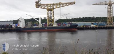
KOGA RANGER
General Cargo
Current Trip
| Time Travelled | 16 days |
|---|---|
| Remaining Time | --- |
| Distance Travelled | 2798.11 nm |
| Remaining Distance | --- |
| AVG Speed | 13 Knop |
| MAX Speed | 15.2 Knop |
| AVG Wind | 11.3 knots |
| MAX Wind | 31 knots |
| MIN Temp | 15.3°C / 59.54°F |
| MAX Temp | 29.4°C / 84.92°F |
| Djupgående | 6.2 m |
| Position mottagen | 13 m sen |
Current Position
| Longitud | -6.51509° |
|---|---|
| Latitude | 36.41446° |
| Status | At anchor |
| Fart | |
| Kurs | 336° |
| Område | North Atlantic Ocean |
| Station | T-AIS |
| Position mottagen | 13 m sen |
Info
Information
The current position of KOGA RANGER is in North Atlantic Ocean with coordinates 36.41446° / -6.51509° as reported on 2024-04-25 07:48 by AIS to our vessel tracker app. The vessel's current speed is 0 Knop
The vessel KOGA RANGER (IMO: 9277280, MMSI: 636092311) is a General Cargo that was built in 2005 ( 19 År gammal ). It's sailing under the flag of [LR] Liberia.
In this page you can find informations about the vessels current position, last detected port calls, and current voyage information. If the vessels is not in coverage by AIS you will find the latest position.
The current position of KOGA RANGER is detected by our AIS receivers and we are not responsible for the reliability of the data. The last position was recorded while the vessel was in Coverage by the Ais receivers of our vessel tracking app.
The current draught of KOGA RANGER as reported by AIS is 6.2 meters
Weather
| Temperature | 17.3°C / 63.14°F |
|---|---|
| Wind Speed | 12 knots |
| Direction | 344° NNW |
| Pressure | 1011.8 hPa |
| Humidity | 67.3 % |
| Cloud Coverage | 72 % |
Featured Company
Last Port Calls
| Port | Arrival | Departure | Time In Port |
|---|---|---|---|
| 2024-04-02 14:51 | 2024-04-09 01:15 | 6 d | |
| 2024-03-23 05:47 | 2024-03-27 15:32 | 4 d | |
| 2024-03-14 17:58 | 2024-03-17 16:32 | 2 d | |
| 2024-03-11 06:22 | 2024-03-11 14:16 | 7 h | |
| 2024-03-07 06:00 | 2024-03-07 15:52 | 9 h | |
| 2024-02-11 15:07 | 2024-02-13 07:49 | 1 d |
Most Visited Ports (Last year)
| Port | Arrivals | |
|---|---|---|
| 5 | ||
| 4 | ||
| 2 | ||
| 1 | ||
| 1 | ||
| 1 |
Last Trips
| Origin | Departure | Destination | Arrival | Distance | |
|---|---|---|---|---|---|
| 2024-03-27 15:32 | 2024-04-02 14:51 | 2132.81 nm | |||
| 2024-03-17 17:32 | 2024-03-23 05:47 | 1795.49 nm | |||
| 2024-03-11 16:16 | 2024-03-14 18:58 | 944.47 nm | |||
| 2024-03-07 16:52 | 2024-03-11 08:22 | 767.10 nm | |||
| 2024-02-13 08:49 | 2024-03-07 07:00 | 4096.27 nm | |||
| 2024-01-30 20:32 | 2024-02-11 16:07 | 2932.67 nm |
Events
| Tid | Event | Detaljer | Position / Dest | Information |
|---|---|---|---|---|
| 2024-04-25 07:54 | Status ändrad | Default At anchor |
36.41460 / -6.51482
FOR ORDER
|
Fart: Kurs: 336° |
| 2024-04-25 07:48 | Status ändrad | At anchor Default |
36.41446 / -6.51509
FOR ORDER
|
Fart: Kurs: 325° |
| 2024-04-25 07:42 | Status ändrad | Default At anchor |
36.41467 / -6.51480
FOR ORDER
|
Fart: 0.1 kn Kurs: 333° |
| 2024-04-25 07:36 | Status ändrad | At anchor Default |
36.41452 / -6.51496
FOR ORDER
|
Fart: 0.1 kn Kurs: 324° |
| 2024-04-25 07:06 | Status ändrad | Default At anchor |
36.41462 / -6.51493
FOR ORDER
|
Fart: Kurs: 328° |
| 2024-04-25 06:33 | Status ändrad | At anchor Default |
36.41448 / -6.51525
FOR ORDER
|
Fart: Kurs: 335° |
| 2024-04-25 06:24 | Status ändrad | Default At anchor |
36.41449 / -6.51529
FOR ORDER
|
Fart: 0.1 kn Kurs: 333° |
| 2024-04-25 06:15 | Status ändrad | At anchor Default |
36.41450 / -6.51524
FOR ORDER
|
Fart: Kurs: 338° |
| 2024-04-25 06:00 | Status ändrad | Default At anchor |
36.41448 / -6.51534
FOR ORDER
|
Fart: 0.5 kn Kurs: 343° |
| 2024-04-25 05:57 | Status ändrad | At anchor Default |
36.41444 / -6.51543
FOR ORDER
|
Fart: 0.3 kn Kurs: 344° |