
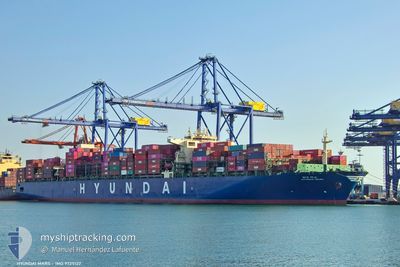
HYUNDAI MARS
Cargo A
Current Trip
| Time Travelled | 22 days |
|---|---|
| Remaining Time | 13 days |
| Distance Travelled | 5765.95 nm |
| Remaining Distance | 5702.45 nm |
| AVG Speed | 13.7 Knop |
| MAX Speed | 17.7 Knop |
| AVG Wind | 12.5 knots |
| MAX Wind | 24.8 knots |
| MIN Temp | 14.5°C / 58.1°F |
| MAX Temp | 28.3°C / 82.94°F |
| Djupgående | 13.7 m |
| Position mottagen | 4 d sen |
Current Position
| Longitud | --- |
|---|---|
| Latitude | --- |
| Status | Under way using engine |
| Fart | 13.1 Knop |
| Kurs | 130.7° |
| Område | South Atlantic Ocean |
| Station | T-AIS |
| Position mottagen | 4 d sen |
Info
Information
The current position of HYUNDAI MARS is in South Atlantic Ocean with coordinates -33.63034° / 17.08866° as reported on 2025-12-04 08:53 by AIS to our vessel tracker app. The vessel's current speed is 13.1 Knop and is heading at the port of SINGAPORE. The estimated time of arrival as calculated by MyShipTracking vessel tracking app is 2025-12-22 19:38 LT
The vessel HYUNDAI MARS (IMO: 9725122, MMSI: 232024773) is a Cargo A It's sailing under the flag of [GB] United Kingdom.
In this page you can find informations about the vessels current position, last detected port calls, and current voyage information. If the vessels is not in coverage by AIS you will find the latest position.
The current position of HYUNDAI MARS is detected by our AIS receivers and we are not responsible for the reliability of the data. The last position was recorded while the vessel was in Coverage by the Ais receivers of our vessel tracking app.
The current draught of HYUNDAI MARS as reported by AIS is 13.7 meters
Weather
| Temperature | 20°C / 68°F |
|---|---|
| Wind Speed | 16 knots |
| Direction | 162° SSE |
| Pressure | 1014.5 hPa |
| Humidity | 79.8 % |
| Cloud Coverage | 19 % |
Featured Company
Events
| Tid | Event | Detaljer | Position / Dest | Information |
|---|---|---|---|---|
| 2025-12-04 09:00 | Status ändrad | Default Under way using engine |
-33.64595 / 17.11007
SGSIN
|
Fart: 13.1 kn Kurs: 130.7° |
| 2025-12-04 08:53 | UTANFÖR täckningsområde |
-33.63034 / 17.08866
South Atlantic Ocean
SGSIN
|
Fart: 13.1 kn Kurs: 130.7° |
|
| 2025-12-04 08:39 | Status ändrad | Under way using engine Default |
-33.59458 / 17.04079
SGSIN
|
Fart: 13.3 kn Kurs: 131° |
| 2025-12-04 07:56 | Status ändrad | Default Under way using engine |
-33.49183 / 16.89637
SGSIN
|
Fart: 13.4 kn Kurs: 137.2° |
| 2025-12-04 07:41 | Byter havsområde | South African part of the South Atlantic Ocean Gambian part of the North Atlantic Ocean |
-33.45030 / 16.85149
South Atlantic Ocean
SGSIN
|
Fart: 13.5 kn Kurs: 137.8° |
| 2025-12-04 07:40 | Status ändrad | Under way using engine Default |
-33.44938 / 16.85050
SGSIN
|
Fart: 13.6 kn Kurs: 138° |
| 2025-12-04 07:32 | I täckningsområde |
-33.45030 / 16.85149
South Atlantic Ocean
SGSIN
|
Fart: 13.5 kn Kurs: 137.8° |