
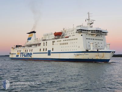
HUCKLEBERRY FINN
Ro-Ro/Passenger Ship
Current Trip
| Time Travelled | 6 h, 5 mins |
|---|---|
| Remaining Time | 1 h, 38 mins |
| Distance Travelled | 90.16 nm |
| Remaining Distance | --- |
| AVG Speed | 14.2 Knop |
| MAX Speed | 16.6 Knop |
| AVG Wind | 13.9 knots |
| MAX Wind | 18 knots |
| MIN Temp | 5.4°C / 41.72°F |
| MAX Temp | 6.9°C / 44.42°F |
| Djupgående | 5.6 m |
| Position mottagen | 1 m sen |
Current Position
| Longitud | 11.50827° |
|---|---|
| Latitude | 54.23486° |
| Status | Under way using engine |
| Fart | 15.6 Knop |
| Kurs | 242.9° |
| Område | Baltic Sea |
| Station | T-AIS |
| Position mottagen | 1 m sen |
Info
Information
The current position of HUCKLEBERRY FINN is in Baltic Sea with coordinates 54.23486° / 11.50827° as reported on 2024-04-25 20:22 by AIS to our vessel tracker app. The vessel's current speed is 15.6 Knop and is heading at the port of TRAVEMUNDE. The estimated time of arrival as calculated by MyShipTracking vessel tracking app is 2024-04-25 22:02 LT
The vessel HUCKLEBERRY FINN (IMO: 8618358, MMSI: 265874000) is a Ro-Ro/Passenger Ship that was built in 1988 ( 36 År gammal ). It's sailing under the flag of [SE] Sweden.
In this page you can find informations about the vessels current position, last detected port calls, and current voyage information. If the vessels is not in coverage by AIS you will find the latest position.
The current position of HUCKLEBERRY FINN is detected by our AIS receivers and we are not responsible for the reliability of the data. The last position was recorded while the vessel was in Coverage by the Ais receivers of our vessel tracking app.
The current draught of HUCKLEBERRY FINN as reported by AIS is 5.6 meters
Weather
| Temperature | 6.3°C / 43.34°F |
|---|---|
| Wind Speed | 3 knots |
| Direction | 190° S |
| Pressure | 1003.7 hPa |
| Humidity | 83.3 % |
| Cloud Coverage | 100 % |
Featured Company
Last Port Calls
| Port | Arrival | Departure | Time In Port |
|---|---|---|---|
| 2024-04-24 17:16 | 2024-04-25 14:19 | 21 h | |
| 2024-04-24 05:51 | 2024-04-24 11:34 | 5 h | |
| 2024-04-21 08:19 | 2024-04-23 17:35 | 2 d | |
| 2024-04-20 18:16 | 2024-04-20 19:53 | 1 h | |
| 2024-04-20 10:24 | 2024-04-20 12:50 | 2 h | |
| 2024-04-19 22:13 | 2024-04-20 02:35 | 4 h | |
| 2024-04-19 12:27 | 2024-04-19 15:04 | 2 h | |
| 2024-04-19 03:45 | 2024-04-19 06:24 | 2 h | |
| 2024-04-18 20:14 | 2024-04-18 22:28 | 2 h | |
| 2024-04-18 10:53 | 2024-04-18 13:25 | 2 h |
Most Visited Ports (Last year)
| Port | Arrivals | |
|---|---|---|
| 240 | ||
| 132 | ||
| 83 | ||
| 66 | ||
| 60 | ||
| 10 |
Last Trips
| Origin | Departure | Destination | Arrival | Distance | |
|---|---|---|---|---|---|
| 2024-04-24 13:34 | 2024-04-24 19:16 | 101.54 nm | |||
| 2024-04-23 20:35 | 2024-04-24 07:51 | 217.35 nm | |||
| 2024-04-20 21:53 | 2024-04-21 11:19 | 217.52 nm | |||
| 2024-04-20 14:50 | 2024-04-20 20:16 | 97.80 nm | |||
| 2024-04-20 04:35 | 2024-04-20 12:24 | 119.63 nm | |||
| 2024-04-19 17:04 | 2024-04-20 00:13 | 119.54 nm | |||
| 2024-04-19 08:24 | 2024-04-19 14:27 | 80.35 nm | |||
| 2024-04-19 00:28 | 2024-04-19 05:45 | 83.31 nm | |||
| 2024-04-18 15:25 | 2024-04-18 22:14 | 119.83 nm | |||
| 2024-04-18 09:42 | 2024-04-18 12:53 | 47.85 nm |
Events
| Tid | Event | Detaljer | Position / Dest | Information |
|---|---|---|---|---|
| 2024-04-25 18:49 | Byter havsområde | German part of the Baltic Sea Danish part of the Baltic Sea |
54.41018 / 12.10938
Baltic Sea
|
Fart: 10.2 kn Kurs: 206.2° |
| 2024-04-25 18:40 | Byter havsområde | Danish part of the Baltic Sea German part of the Baltic Sea |
54.43111 / 12.13523
Baltic Sea
|
Fart: 10.7 kn Kurs: 223.1° |
| 2024-04-25 18:25 | Byter havsområde | German part of the Baltic Sea Danish part of the Baltic Sea |
54.47703 / 12.19243
Baltic Sea
|
Fart: 14.3 kn Kurs: 202.6° |
| 2024-04-25 15:26 | Byter havsområde | Danish part of the Baltic Sea Swedish part of the Baltic Sea |
55.13948 / 12.82456
Baltic Sea
|
Fart: 15.8 kn Kurs: 221° |
| 2024-04-25 14:26 | Djupgående ändrat | 5.6 5.3 |
55.33867 / 13.13536
DE TRA
|
Fart: 14.6 kn Kurs: 217.3° |
| 2024-04-25 14:19 | AVGÅTT HAMN |
|
55.35850 / 13.14864
DE TRA
|
Fart: 9 kn Kurs: 195° |
| 2024-04-25 14:17 | STARTAR förflyttning |
55.36317 / 13.15227
[SE] TRELLEBORG
|
Fart: 3.3 kn Kurs: 212° |
|
| 2024-04-25 13:50 | Destination ändrad | DE TRA SE TRE |
55.36555 / 13.16089
[SE] TRELLEBORG
|
Fart: Kurs: 59° |
| 2024-04-25 13:50 | ETA ändrat | 2024/04/24 22:45 2024/04/24 16:00 |
55.36555 / 13.16089
[SE] TRELLEBORG
|
Fart: Kurs: 59° |
| 2024-04-25 13:48 | Status ändrad | Under way using engine Moored |
55.36555 / 13.16089
[SE] TRELLEBORG
|
Fart: Kurs: 59° |