
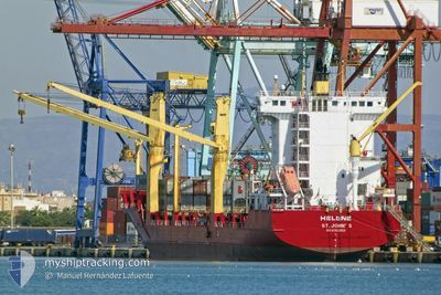
HELENE
Container Ship
Current Trip
| Time Travelled | 4 days |
|---|---|
| Remaining Time | --- |
| Distance Travelled | 811.43 nm |
| Remaining Distance | --- |
| AVG Speed | 11.9 Knop |
| MAX Speed | 11.9 Knop |
| AVG Wind | 16.8 knots |
| MAX Wind | 33.6 knots |
| MIN Temp | 9.6°C / 49.28°F |
| MAX Temp | 20.9°C / 69.62°F |
| Djupgående | 7.8 m |
| Position mottagen | 2 m sen |
Current Position
| Longitud | 32.15658° |
|---|---|
| Latitude | 32.13334° |
| Status | Under way using engine |
| Fart | 11 Knop |
| Kurs | 130.5° |
| Område | Mediterranean Sea - Eastern Basin |
| Station | T-AIS |
| Position mottagen | 2 m sen |
Info
Information
The current position of HELENE is in Mediterranean Sea - Eastern Basin with coordinates 32.13334° / 32.15658° as reported on 2024-04-23 21:20 by AIS to our vessel tracker app. The vessel's current speed is 11 Knop and is heading at the port of PORT SAID. The estimated time of arrival as calculated by MyShipTracking vessel tracking app is 2024-04-24 03:00 LT
The vessel HELENE (IMO: 9362956, MMSI: 304157000) is a Container Ship that was built in 2007 ( 17 År gammal ). It's sailing under the flag of [AG] Antigua Barbuda.
In this page you can find informations about the vessels current position, last detected port calls, and current voyage information. If the vessels is not in coverage by AIS you will find the latest position.
The current position of HELENE is detected by our AIS receivers and we are not responsible for the reliability of the data. The last position was recorded while the vessel was in Coverage by the Ais receivers of our vessel tracking app.
The current draught of HELENE as reported by AIS is 7.8 meters
Weather
| Temperature | 20.9°C / 69.62°F |
|---|---|
| Wind Speed | 11 knots |
| Direction | 91° E |
| Pressure | 1013.1 hPa |
| Humidity | 80 % |
| Cloud Coverage | 42 % |
Featured Company
Last Port Calls
| Port | Arrival | Departure | Time In Port |
|---|---|---|---|
| 2024-04-18 17:50 | 2024-04-19 18:43 | 1 d | |
| 2024-04-15 22:07 | 2024-04-16 02:55 | 4 h | |
| 2024-04-15 14:06 | 2024-04-15 21:59 | 7 h | |
| 2024-04-12 07:03 | 2024-04-12 17:39 | 10 h | |
| 2024-04-09 13:21 | 2024-04-10 18:25 | 1 d | |
| 2024-04-05 23:16 | 2024-04-06 13:28 | 14 h | |
| 2024-04-03 03:41 | |||
| 2024-03-30 18:30 | 2024-03-31 09:47 | 15 h | |
| 2024-03-28 04:50 | 2024-03-29 11:58 | 1 d | |
| 2024-03-23 01:02 | 2024-03-23 12:53 | 11 h |
Most Visited Ports (Last year)
| Port | Arrivals | |
|---|---|---|
| 21 | ||
| 19 | ||
| 18 | ||
| 7 | ||
| 6 | ||
| 6 |
Last Trips
| Origin | Departure | Destination | Arrival | Distance | |
|---|---|---|---|---|---|
| 2024-04-12 20:39 | 2024-04-18 20:50 | 1695.27 nm | |||
| 2024-04-12 20:39 | 2024-04-16 00:07 | 881.36 nm | |||
| 2024-04-12 20:39 | 2024-04-15 16:06 | 868.96 nm | |||
| 2024-04-10 21:25 | 2024-04-12 10:03 | 370.47 nm | |||
| 2024-04-06 15:28 | 2024-04-09 16:21 | 690.44 nm | |||
| 2024-03-31 12:47 | 2024-04-06 01:16 | 1125.61 nm | |||
| 2024-03-31 12:47 | 2024-04-03 05:41 | 866.21 nm | |||
| 2024-03-29 13:58 | 2024-03-30 21:30 | 373.27 nm | |||
| 2024-03-23 14:53 | 2024-03-28 06:50 | 685.31 nm | |||
| 2024-03-14 23:08 | 2024-03-23 03:02 | 1016.04 nm |
Events
| Tid | Event | Detaljer | Position / Dest | Information |
|---|---|---|---|---|
| 2024-04-23 14:11 | ETA ändrat | 2024/04/24 03:00 2024/04/24 02:00 |
32.98437 / 30.91077
EGPSD
|
Fart: 11.5 kn Kurs: 130.9° |
| 2024-04-23 13:54 | Status ändrad | Under way using engine Default |
33.01893 / 30.86253
EGPSD
|
Fart: 11.6 kn Kurs: 130° |
| 2024-04-23 13:47 | Status ändrad | Default Under way using engine |
33.03381 / 30.84233
EGPSD
|
Fart: 11.6 kn Kurs: 129.7° |
| 2024-04-23 12:36 | Status ändrad | Under way using engine Default |
33.17543 / 30.64183
EGPSD
|
Fart: 11.1 kn Kurs: 129° |
| 2024-04-23 12:00 | Status ändrad | Default Under way using engine |
33.24635 / 30.54063
EGPSD
|
Fart: 11.1 kn Kurs: 128.3° |
| 2024-04-23 11:53 | Status ändrad | Under way using engine Default |
33.26016 / 30.51941
EGPSD
|
Fart: 11.2 kn Kurs: 129° |
| 2024-04-23 11:52 | Status ändrad | Default Under way using engine |
33.26147 / 30.51744
EGPSD
|
Fart: 11.1 kn Kurs: 128.1° |
| 2024-04-23 11:31 | Status ändrad | Under way using engine Default |
33.30279 / 30.45391
EGPSD
|
Fart: 11.2 kn Kurs: 128° |
| 2024-04-23 11:24 | Status ändrad | Default Under way using engine |
33.31617 / 30.43381
EGPSD
|
Fart: 11.3 kn Kurs: 127.8° |
| 2024-04-23 08:51 | Status ändrad | Under way using engine Default |
33.63557 / 29.98049
EGPSD
|
Fart: 11.7 kn Kurs: 128° |