
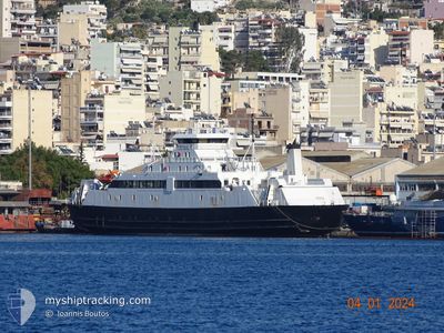
HERMES I
Ro-Ro/Passenger Ship
Current Trip
| Trip Time | 1 h, 12 mins |
|---|---|
| Trip Distance | 16.79 nm |
| AVG Speed | 13.4 Knop |
| MAX Speed | 14.4 Knop |
| Djupgående | 3.8 m |
| AVG Wind | 2.6 knots |
| MAX Wind | 3.8 knots |
| MIN Temp | 14.6°C / 58.28°F |
| MAX Temp | 14.8°C / 58.64°F |
| Position mottagen | 23 d sen |
Current Position
| Longitud | --- |
|---|---|
| Latitude | --- |
| Status | Under way using engine |
| Fart | 14 Knop |
| Kurs | 124.2° |
| Område | Ionian Sea |
| Station | T-AIS |
| Position mottagen | 23 d sen |
Info
Information
The current position of HERMES I is in Ionian Sea with coordinates 39.59003° / 20.00380° as reported on 2025-11-16 09:26 by AIS to our vessel tracker app. The vessel's current speed is 14 Knop and is currently inside the port of IGOUMENITSA.
The vessel HERMES I (IMO: 9035175, MMSI: 240581100) is a Ro-Ro/Passenger Ship that was built in 1993 ( 32 År gammal ). It's sailing under the flag of [GR] Greece.
In this page you can find informations about the vessels current position, last detected port calls, and current voyage information. If the vessels is not in coverage by AIS you will find the latest position.
The current position of HERMES I is detected by our AIS receivers and we are not responsible for the reliability of the data. The last position was recorded while the vessel was in Coverage by the Ais receivers of our vessel tracking app.
The current draught of HERMES I as reported by AIS is 3.8 meters
Weather
| Temperature | 14.6°C / 58.28°F |
|---|---|
| Wind Speed | 1 knots |
| Direction | 54° NE |
| Pressure | 1023.7 hPa |
| Humidity | 55.8 % |
| Cloud Coverage | 1 % |
Featured Company
Last Port Calls
| Port | Arrival | Departure | Time In Port |
|---|---|---|---|
| 2025-12-09 12:14 | |||
| 2025-12-08 22:23 | 2025-12-09 11:02 | 12 h | |
| 2025-12-08 18:51 | 2025-12-08 21:05 | 2 h | |
| 2025-12-08 16:24 | 2025-12-08 17:39 | 1 h | |
| 2025-12-08 12:15 | 2025-12-08 15:05 | 2 h | |
| 2025-12-07 22:44 | 2025-12-08 11:04 | 12 h | |
| 2025-12-07 18:47 | 2025-12-07 21:09 | 2 h | |
| 2025-12-07 16:22 | 2025-12-07 17:34 | 1 h | |
| 2025-12-07 12:20 | 2025-12-07 15:06 | 2 h | |
| 2025-12-06 22:38 | 2025-12-07 11:03 | 12 h |
Most Visited Ports (Last year)
| Port | Arrivals | |
|---|---|---|
| 347 | ||
| 330 | ||
| 11 | ||
| 1 |
Last Trips
| Origin | Departure | Destination | Arrival | Distance | |
|---|---|---|---|---|---|
| 2025-12-09 11:02 | 2025-12-09 12:14 | 16.79 nm | |||
| 2025-12-08 21:05 | 2025-12-08 22:23 | 10.02 nm | |||
| 2025-12-08 17:39 | 2025-12-08 18:51 | 17.09 nm | |||
| 2025-12-08 15:05 | 2025-12-08 16:24 | 16.34 nm | |||
| 2025-12-08 11:04 | 2025-12-08 12:15 | 10.96 nm | |||
| 2025-12-07 21:09 | 2025-12-07 22:44 | 11.97 nm | |||
| 2025-12-07 17:34 | 2025-12-07 18:47 | 16.14 nm | |||
| 2025-12-07 15:06 | 2025-12-07 16:22 | 11.87 nm | |||
| 2025-12-07 11:03 | 2025-12-07 12:20 | 10.76 nm | |||
| 2025-12-06 21:08 | 2025-12-06 22:38 | 8.13 nm |
Events
| Tid | Event | Detaljer | Position / Dest | Information |
|---|---|---|---|---|
| 2025-12-09 10:14 | ANLÄNDER HAMN |
|
39.49793 / 20.24031
[GR] IGOUMENITSA
|
Fart: 14 kn Kurs: 127° |
| 2025-12-09 09:08 | STARTAR förflyttning | 0.75 nm, East of AGIOS ISIDOROS |
39.62315 / 19.94356
CORFU
|
Fart: 14.6 kn Kurs: 122° |
| 2025-12-09 09:02 | AVGÅTT HAMN |
|
39.62315 / 19.94356
CORFU
|
Fart: Kurs: 318° |
| 2025-12-08 20:37 | STOPPAR förflyttning |
39.62667 / 19.91167
[GR] KERKYRA
|
Fart: Kurs: -1° |
|
| 2025-12-08 20:23 | ANLÄNDER HAMN |
|
39.62667 / 19.91167
[GR] KERKYRA
|
Fart: 14 kn Kurs: 304° |
| 2025-12-08 19:05 | AVGÅTT HAMN |
|
39.53833 / 20.09500
CORFU
|
Fart: Kurs: -1° |
| 2025-12-08 17:19 | STOPPAR förflyttning |
39.49667 / 20.26167
[GR] IGOUMENITSA
|
Fart: Kurs: -1° |
|
| 2025-12-08 16:51 | ANLÄNDER HAMN |
|
39.49667 / 20.26167
[GR] IGOUMENITSA
|
Fart: 14 kn Kurs: 109° |
| 2025-12-08 15:39 | AVGÅTT HAMN |
|
39.62593 / 19.94133
CORFU
|
Fart: 7.6 kn Kurs: 342° |
| 2025-12-08 14:24 | ANLÄNDER HAMN |
|
39.63034 / 19.91588
[GR] KERKYRA
|
Fart: 14.4 kn Kurs: 293° |