
HERMANN SCHULTE
Cargo
Current Trip
| Time Travelled | 10 days |
|---|---|
| Remaining Time | 4 h, 0 mins |
| Distance Travelled | 3846.00 nm |
| Remaining Distance | 66.20 nm |
| AVG Speed | 15.1 Knop |
| MAX Speed | 21.1 Knop |
| AVG Wind | 20.1 knots |
| MAX Wind | 31 knots |
| MIN Temp | 1°C / 33.8°F |
| MAX Temp | 15.4°C / 59.72°F |
| Djupgående | 11 m |
| Position mottagen | Nu |
Current Position
| Longitud | 2.82912° |
|---|---|
| Latitude | 51.42222° |
| Status | Under way using engine |
| Fart | 16.2 Knop |
| Kurs | 84.4° |
| Område | North Sea |
| Station | T-AIS |
| Position mottagen | Nu |
Info
Information
The current position of HERMANN SCHULTE is in North Sea with coordinates 51.42222° / 2.82912° as reported on 2024-04-16 22:59 by AIS to our vessel tracker app. The vessel's current speed is 16.2 Knop and is heading at the port of ANTWERP. The estimated time of arrival as calculated by MyShipTracking vessel tracking app is 2024-04-17 03:00 LT
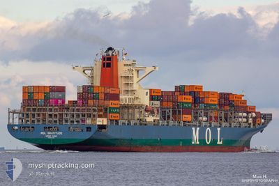
The vessel HERMANN SCHULTE (IMO: 9535187, MMSI: 477462400) is a Cargo It's sailing under the flag of [HK] Hong Kong.
In this page you can find informations about the vessels current position, last detected port calls, and current voyage information. If the vessels is not in coverage by AIS you will find the latest position.
The current position of HERMANN SCHULTE is detected by our AIS receivers and we are not responsible for the reliability of the data. The last position was recorded while the vessel was in Coverage by the Ais receivers of our vessel tracking app.
The current draught of HERMANN SCHULTE as reported by AIS is 11 meters
Weather
| Temperature | 8.8°C / 47.84°F |
|---|---|
| Wind Speed | 16 knots |
| Direction | 345° NNW |
| Pressure | 1013.6 hPa |
| Humidity | 73 % |
| Cloud Coverage | 80 % |
Featured Company
Last Port Calls
| Port | Arrival | Departure | Time In Port |
|---|---|---|---|
| 2024-04-05 18:29 | 2024-04-06 16:13 | 21 h | |
| 2024-04-01 12:31 | 2024-04-04 14:06 | 3 d | |
| 2024-03-27 01:55 | 2024-03-28 05:43 | 1 d | |
| 2024-03-23 16:20 | 2024-03-25 13:39 | 1 d | |
| 2024-03-19 19:25 | 2024-03-20 12:56 | 17 h | |
| 2024-03-13 19:47 | 2024-03-14 10:24 | 14 h | |
| 2024-03-10 20:11 | 2024-03-12 06:51 | 1 d | |
| 2024-02-26 19:34 | 2024-02-27 16:46 | 21 h | |
| 2024-02-25 07:49 | 2024-02-25 22:09 | 14 h | |
| 2024-02-23 08:01 | 2024-02-24 12:30 | 1 d |
Last Trips
| Origin | Departure | Destination | Arrival | Distance | |
|---|---|---|---|---|---|
| 2024-04-04 10:06 | 2024-04-05 14:29 | 403.68 nm | |||
| 2024-03-28 00:43 | 2024-04-01 08:31 | 956.99 nm | |||
| 2024-03-25 08:39 | 2024-03-26 20:55 | 317.39 nm | |||
| 2024-03-20 06:56 | 2024-03-23 11:20 | 689.28 nm | |||
| 2024-03-14 06:24 | 2024-03-19 13:25 | 1691.53 nm | |||
| 2024-03-12 02:51 | 2024-03-13 15:47 | 633.70 nm | |||
| 2024-02-27 17:46 | 2024-03-10 16:11 | 4193.73 nm | |||
| 2024-02-25 23:09 | 2024-02-26 20:34 | 286.19 nm | |||
| 2024-02-24 13:30 | 2024-02-25 08:49 | 123.72 nm | |||
| 2024-02-11 19:33 | 2024-02-23 09:01 | 4913.62 nm |
Events
| Tid | Event | Detaljer | Position / Dest | Information |
|---|---|---|---|---|
| 2024-04-16 21:28 | ETA ändrat | 2024/04/16 22:40 2024/04/16 17:30 |
51.43480 / 2.62531
BEANR
|
Fart: 6.8 kn Kurs: 282.5° |
| 2024-04-16 21:25 | STARTAR förflyttning | 17.09 nm, North West of OOSTENDE |
51.43362 / 2.63214
BEANR
|
Fart: 3.2 kn Kurs: 292° |
| 2024-04-16 21:22 | Status ändrad | Under way using engine At anchor |
51.43239 / 2.63321
BEANR
|
Fart: 0.2 kn Kurs: 343° |
| 2024-04-16 14:35 | STOPPAR förflyttning | 16.92 nm, North West of OOSTENDE |
51.43053 / 2.63348
BEANR
|
Fart: 0.2 kn Kurs: 357° |
| 2024-04-16 14:29 | Status ändrad | At anchor Under way using engine |
51.43136 / 2.63269
BEANR
|
Fart: 0.8 kn Kurs: 355° |
| 2024-04-16 13:20 | Byter havsområde | Belgian part of the North Sea French part of the North Sea |
51.33730 / 2.38034
North Sea
BEANR
|
Fart: 15 kn Kurs: 68.5° |
| 2024-04-16 11:59 | Status ändrad | Under way using engine Default |
51.16762 / 1.89175
BEANR
|
Fart: 10.2 kn Kurs: 58° |
| 2024-04-16 11:55 | Status ändrad | Default Under way using engine |
51.17360 / 1.90717
BEANR
|
Fart: 10.2 kn Kurs: 58° |
| 2024-04-16 10:23 | Byter havsområde | French part of the North Sea French part of the English Channel |
51.01495 / 1.58875
North Sea
BEANR
|
Fart: 9.9 kn Kurs: 50.7° |
| 2024-04-16 07:20 | Status ändrad | Under way using engine Default |
50.56370 / 1.12162
BEANR
|
Fart: 11.8 kn Kurs: 47° |