
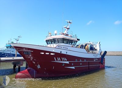
HENK SENIOR
Fishing
Current Trip
| Time Travelled | 2 days |
|---|---|
| Remaining Time | 14 h, 39 mins |
| Distance Travelled | 203.51 nm |
| Remaining Distance | 167.90 nm |
| AVG Speed | 8.3 Knop |
| MAX Speed | 12.6 Knop |
| AVG Wind | 15.4 knots |
| MAX Wind | 18 knots |
| MIN Temp | 7.3°C / 45.14°F |
| MAX Temp | 8.8°C / 47.84°F |
| Djupgående | 4 m |
| Position mottagen | 1 m sen |
Current Position
| Longitud | -0.02087° |
|---|---|
| Latitude | 50.32152° |
| Status | Moored |
| Fart | 11.5 Knop |
| Kurs | 71.4° |
| Område | English Channel |
| Station | T-AIS |
| Position mottagen | 1 m sen |
Info
Information
The current position of HENK SENIOR is in English Channel with coordinates 50.32152° / -0.02087° as reported on 2024-04-24 07:33 by AIS to our vessel tracker app. The vessel's current speed is 11.5 Knop and is heading at the port of VLISSINGEN. The estimated time of arrival as calculated by MyShipTracking vessel tracking app is 2024-04-24 22:14 LT
The vessel HENK SENIOR (IMO: 9795763, MMSI: 232006364) is a Fishing It's sailing under the flag of [GB] United Kingdom.
In this page you can find informations about the vessels current position, last detected port calls, and current voyage information. If the vessels is not in coverage by AIS you will find the latest position.
The current position of HENK SENIOR is detected by our AIS receivers and we are not responsible for the reliability of the data. The last position was recorded while the vessel was in Coverage by the Ais receivers of our vessel tracking app.
The current draught of HENK SENIOR as reported by AIS is 4 meters
Weather
| Temperature | 7.3°C / 45.14°F |
|---|---|
| Wind Speed | 15 knots |
| Direction | 352° N |
| Pressure | 1018.2 hPa |
| Humidity | 74.5 % |
| Cloud Coverage | 100 % |
Featured Company
Last Port Calls
| Port | Arrival | Departure | Time In Port |
|---|---|---|---|
| 2024-04-18 20:18 | 2024-04-22 00:28 | 3 d | |
| 2024-04-11 17:57 | 2024-04-15 00:33 | 3 d | |
| 2024-04-04 20:36 | 2024-04-08 00:30 | 3 d | |
| 2024-03-28 20:26 | 2024-04-01 16:57 | 3 d | |
| 2024-03-21 20:48 | 2024-03-25 01:32 | 3 d | |
| 2024-03-14 23:48 | 2024-03-18 01:30 | 3 d | |
| 2024-03-07 22:34 | 2024-03-11 01:30 | 3 d | |
| 2024-03-01 19:09 | 2024-03-04 01:32 | 2 d | |
| 2024-02-23 07:47 | 2024-02-26 01:29 | 2 d | |
| 2024-02-08 20:20 | 2024-02-19 01:52 | 10 d |
Most Visited Ports (Last year)
| Port | Arrivals | |
|---|---|---|
| 40 | ||
| 13 | ||
| 6 | ||
| 2 |
Last Trips
| Origin | Departure | Destination | Arrival | Distance | |
|---|---|---|---|---|---|
| 2024-04-15 02:33 | 2024-04-18 22:18 | 344.89 nm | |||
| 2024-04-08 02:30 | 2024-04-11 19:57 | 463.66 nm | |||
| 2024-04-01 18:57 | 2024-04-04 22:36 | 150.64 nm | |||
| 2024-03-25 02:32 | 2024-03-28 21:26 | 316.82 nm | |||
| 2024-03-18 02:30 | 2024-03-21 21:48 | 474.17 nm | |||
| 2024-03-11 02:30 | 2024-03-15 00:48 | 498.35 nm | |||
| 2024-03-04 02:32 | 2024-03-07 23:34 | 431.67 nm | |||
| 2024-02-26 02:29 | 2024-03-01 20:09 | 59.68 nm | |||
| 2024-02-19 02:52 | 2024-02-23 08:47 | 384.99 nm | |||
| 2024-02-05 02:34 | 2024-02-08 21:20 | 410.01 nm |
Events
| Tid | Event | Detaljer | Position / Dest | Information |
|---|---|---|---|---|
| 2024-04-23 23:00 | Byter havsområde | United Kingdom part of the English Channel United Kingdom part of the North Sea |
50.32123 / .35430
English Channel
|
Fart: 6.8 kn Kurs: 255° |
| 2024-04-23 23:00 | I täckningsområde |
50.32123 / .35430
English Channel
|
Fart: 6.8 kn Kurs: 255° |
|
| 2024-04-22 21:03 | UTANFÖR täckningsområde |
51.12147 / 1.59445
North Sea
|
Fart: 11.5 kn Kurs: 225.2° |
|
| 2024-04-22 19:55 | I täckningsområde |
51.30277 / 1.81850
North Sea
|
Fart: 12.6 kn Kurs: 212.4° |
|
| 2024-04-22 18:40 | UTANFÖR täckningsområde |
51.51882 / 2.04415
North Sea
|
Fart: 11.7 kn Kurs: 213.7° |
|
| 2024-04-22 18:40 | Upptäckt i hav | United Kingdom part of the North Sea |
51.51882 / 2.04415
North Sea
|
Fart: 11.7 kn Kurs: 213.7° |
| 2024-04-22 18:40 | I täckningsområde |
51.51882 / 2.04415
North Sea
|
Fart: 11.7 kn Kurs: 213.7° |
|
| 2024-04-22 05:23 | UTANFÖR täckningsområde |
51.63058 / 2.38775
North Sea
|
Fart: 10.4 kn Kurs: 296.2° |
|
| 2024-04-22 01:41 | Byter havsområde | Belgian part of the North Sea Dutch part of the North Sea |
51.41518 / 3.31833
North Sea
|
Fart: 9.5 kn Kurs: 268.7° |
| 2024-04-22 00:28 | AVGÅTT HAMN |
|
51.44127 / 3.59995
VLISSINGEN
|
Fart: 6.8 kn Kurs: 119° |