
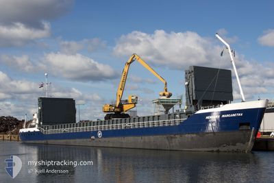
HENDRIKA MARGARETHA
General Cargo
Current Trip
| Time Travelled | 2 days |
|---|---|
| Remaining Time | 10 h, 57 mins |
| Distance Travelled | 400.54 nm |
| Remaining Distance | 65.33 nm |
| AVG Speed | 7.4 Knop |
| MAX Speed | 11 Knop |
| AVG Wind | 15.2 knots |
| MAX Wind | 27.4 knots |
| MIN Temp | 4.5°C / 40.1°F |
| MAX Temp | 9.1°C / 48.38°F |
| Djupgående | 4.9 m |
| Position mottagen | Nu |
Current Position
| Longitud | 10.33867° |
|---|---|
| Latitude | 54.47684° |
| Status | Under way using engine |
| Fart | 5.9 Knop |
| Kurs | 65.9° |
| Område | Baltic Sea |
| Station | T-AIS |
| Position mottagen | Nu |
Info
Information
The current position of HENDRIKA MARGARETHA is in Baltic Sea with coordinates 54.47684° / 10.33867° as reported on 2024-04-19 21:31 by AIS to our vessel tracker app. The vessel's current speed is 5.9 Knop and is heading at the port of ROSTOCK. The estimated time of arrival as calculated by MyShipTracking vessel tracking app is 2024-04-20 08:28 LT
The vessel HENDRIKA MARGARETHA (IMO: 9057238, MMSI: 244246000) is a General Cargo that was built in 1993 ( 31 År gammal ). It's sailing under the flag of [NL] Netherlands.
In this page you can find informations about the vessels current position, last detected port calls, and current voyage information. If the vessels is not in coverage by AIS you will find the latest position.
The current position of HENDRIKA MARGARETHA is detected by our AIS receivers and we are not responsible for the reliability of the data. The last position was recorded while the vessel was in Coverage by the Ais receivers of our vessel tracking app.
The current draught of HENDRIKA MARGARETHA as reported by AIS is 4.9 meters
Weather
| Temperature | 5.7°C / 42.26°F |
|---|---|
| Wind Speed | 20 knots |
| Direction | 31° NNE |
| Pressure | 1007.5 hPa |
| Humidity | 75.1 % |
| Cloud Coverage | 85 % |
Featured Company
Last Port Calls
| Port | Arrival | Departure | Time In Port |
|---|---|---|---|
| 2024-04-13 13:32 | 2024-04-17 16:06 | 4 d | |
| 2024-04-04 11:01 | 2024-04-09 15:22 | 5 d | |
| 2024-03-27 10:19 | 2024-04-03 13:39 | 7 d | |
| 2024-03-21 06:20 | 2024-03-21 23:17 | 16 h | |
| 2024-03-19 18:50 | 2024-03-20 14:25 | 19 h | |
| 2024-03-18 04:43 | 2024-03-18 13:45 | 9 h | |
| 2024-03-16 19:39 | |||
| 2024-03-15 08:07 | 2024-03-15 17:46 | 9 h | |
| 2024-03-13 09:18 | 2024-03-15 07:59 | 1 d | |
| 2024-03-09 13:19 | 2024-03-11 16:54 | 2 d |
Last Trips
| Origin | Departure | Destination | Arrival | Distance | |
|---|---|---|---|---|---|
| 2024-04-09 17:22 | 2024-04-13 15:32 | 670.34 nm | |||
| 2024-04-03 15:39 | 2024-04-04 13:01 | 155.16 nm | |||
| 2024-03-22 00:17 | 2024-03-27 11:19 | 782.83 nm | |||
| 2024-03-20 15:25 | 2024-03-21 07:20 | 116.16 nm | |||
| 2024-03-18 14:45 | 2024-03-19 19:50 | 267.38 nm | |||
| 2024-03-15 18:46 | 2024-03-18 05:43 | 246.61 nm | |||
| 2024-03-15 18:46 | 2024-03-16 20:39 | 242.50 nm | |||
| 2024-03-15 08:59 | 2024-03-15 09:07 | 1.27 nm | |||
| 2024-03-11 17:54 | 2024-03-13 10:18 | 303.05 nm | |||
| 2024-03-08 09:20 | 2024-03-09 14:19 | 197.49 nm |
Events
| Tid | Event | Detaljer | Position / Dest | Information |
|---|---|---|---|---|
| 2024-04-19 21:05 | Byter havsområde | German part of the Baltic Sea German part of the North Sea |
54.45647 / 10.27504
Baltic Sea
ROSTOCK
|
Fart: 5.7 kn Kurs: 54.2° |
| 2024-04-19 19:48 | ETA ändrat | 2024/04/20 09:00 2024/04/20 10:00 |
54.36443 / 10.15079
ROSTOCK
|
Fart: 5.1 kn Kurs: 99.4° |
| 2024-04-19 19:45 | STARTAR förflyttning | 1.33 nm, South West of STICKENHΟRN SPORT |
54.36511 / 10.14515
ROSTOCK
|
Fart: 3.8 kn Kurs: 102° |
| 2024-04-19 18:58 | STOPPAR förflyttning | 1.37 nm, South West of STICKENHΟRN SPORT |
54.36572 / 10.14205
ROSTOCK
|
Fart: 0.3 kn Kurs: 104° |
| 2024-04-19 11:43 | I täckningsområde |
53.97187 / 9.26459
North Sea
ROSTOCK
|
Fart: 6.7 kn Kurs: 38.5° |
|
| 2024-04-19 09:33 | UTANFÖR täckningsområde |
53.88535 / 9.12692
North Sea
ROSTOCK
|
Fart: 9.7 kn Kurs: 74.6° |
|
| 2024-04-19 07:33 | ETA ändrat | 2024/04/20 10:00 2024/04/20 04:00 |
53.92755 / 8.66027
ROSTOCK
|
Fart: 10.9 kn Kurs: 147.8° |
| 2024-04-19 04:29 | I täckningsområde |
53.94142 / 7.88304
North Sea
ROSTOCK
|
Fart: 8.7 kn Kurs: 77.3° |
|
| 2024-04-19 03:26 | UTANFÖR täckningsområde |
53.90777 / 7.61961
North Sea
ROSTOCK
|
Fart: 8.6 kn Kurs: 77.3° |
|
| 2024-04-18 21:20 | Byter havsområde | German part of the North Sea Dutch part of the North Sea |
53.73248 / 6.36755
North Sea
ROSTOCK
|
Fart: 6.6 kn Kurs: 68° |