
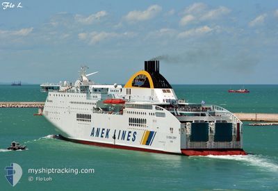
HELLENIC SPIRIT
Ro-Ro/Passenger Ship
Current Trip
| Time Travelled | 16 h, 21 mins |
|---|---|
| Remaining Time | 3 h, 8 mins |
| Distance Travelled | 425.17 nm |
| Remaining Distance | 84.85 nm |
| AVG Speed | 26.2 Knop |
| MAX Speed | 26.8 Knop |
| AVG Wind | 9.7 knots |
| MAX Wind | 21.8 knots |
| MIN Temp | 17.5°C / 63.5°F |
| MAX Temp | 19.8°C / 67.64°F |
| Djupgående | 6.5 m |
| Position mottagen | 1 m sen |
Current Position
| Longitud | 15.02150° |
|---|---|
| Latitude | 42.98926° |
| Status | Under way using engine |
| Fart | 26 Knop |
| Kurs | 305.1° |
| Område | Adriatic Sea |
| Station | T-AIS |
| Position mottagen | 1 m sen |
Info
Information
The current position of HELLENIC SPIRIT is in Adriatic Sea with coordinates 42.98926° / 15.02150° as reported on 2024-04-16 10:17 by AIS to our vessel tracker app. The vessel's current speed is 26 Knop and is heading at the port of ANCONA. The estimated time of arrival as calculated by MyShipTracking vessel tracking app is 2024-04-16 13:26 LT
The vessel HELLENIC SPIRIT (IMO: 9216030, MMSI: 239806000) is a Ro-Ro/Passenger Ship that was built in 2001 ( 23 År gammal ). It's sailing under the flag of [GR] Greece.
In this page you can find informations about the vessels current position, last detected port calls, and current voyage information. If the vessels is not in coverage by AIS you will find the latest position.
The current position of HELLENIC SPIRIT is detected by our AIS receivers and we are not responsible for the reliability of the data. The last position was recorded while the vessel was in Coverage by the Ais receivers of our vessel tracking app.
The current draught of HELLENIC SPIRIT as reported by AIS is 6.5 meters
Weather
| Temperature | 18.3°C / 64.94°F |
|---|---|
| Wind Speed | 12 knots |
| Direction | 188° S |
| Pressure | 1000.7 hPa |
| Humidity | 72.5 % |
| Cloud Coverage | 19 % |
Featured Company
Last Port Calls
| Port | Arrival | Departure | Time In Port |
|---|---|---|---|
| 2024-04-15 15:28 | 2024-04-15 17:57 | 2 h | |
| 2024-04-15 10:00 | 2024-04-15 10:35 | 34 m | |
| 2024-04-14 14:00 | 2024-04-14 17:56 | 3 h | |
| 2024-04-13 11:51 | 2024-04-13 15:59 | 4 h | |
| 2024-04-12 10:52 | 2024-04-12 14:40 | 3 h | |
| 2024-04-11 08:24 | 2024-04-11 18:36 | 10 h | |
| 2024-04-10 13:37 | 2024-04-10 16:45 | 3 h | |
| 2024-04-09 21:10 | 2024-04-09 21:45 | 34 m | |
| 2024-04-09 13:28 | 2024-04-09 16:07 | 2 h | |
| 2024-04-08 15:30 | 2024-04-08 18:16 | 2 h |
Last Trips
| Origin | Departure | Destination | Arrival | Distance | |
|---|---|---|---|---|---|
| 2024-04-15 13:35 | 2024-04-15 18:28 | 121.47 nm | |||
| 2024-04-14 19:56 | 2024-04-15 13:00 | 403.10 nm | |||
| 2024-04-13 18:59 | 2024-04-14 16:00 | 525.81 nm | |||
| 2024-04-12 16:40 | 2024-04-13 14:51 | 520.02 nm | |||
| 2024-04-11 21:36 | 2024-04-12 12:52 | 399.55 nm | |||
| 2024-04-10 18:45 | 2024-04-11 11:24 | 401.70 nm | |||
| 2024-04-10 00:45 | 2024-04-10 15:37 | 402.65 nm | |||
| 2024-04-09 19:07 | 2024-04-10 00:10 | 123.11 nm | |||
| 2024-04-08 20:16 | 2024-04-09 16:28 | 509.81 nm | |||
| 2024-04-08 02:19 | 2024-04-08 17:30 | 400.06 nm |
Events
| Tid | Event | Detaljer | Position / Dest | Information |
|---|---|---|---|---|
| 2024-04-16 07:23 | Byter havsområde | Croatian part of the Adriatic Sea Italian part of the Adriatic Sea |
42.18648 / 16.35143
Adriatic Sea
ITAOI
|
Fart: 26 kn Kurs: 317.8° |
| 2024-04-16 06:15 | Status ändrad | Under way using engine Default |
41.82772 / 16.80966
ITAOI
|
Fart: 26.1 kn Kurs: 316° |
| 2024-04-16 05:43 | Status ändrad | Default Under way using engine |
41.63779 / 17.05134
ITAOI
|
Fart: 26 kn Kurs: 316° |
| 2024-04-16 05:15 | Status ändrad | Under way using engine Default |
41.52005 / 17.21005
ITAOI
|
Fart: 26 kn Kurs: 317° |
| 2024-04-16 04:55 | Status ändrad | Default Under way using engine |
41.39888 / 17.37096
ITAOI
|
Fart: 26.1 kn Kurs: 315.2° |
| 2024-04-16 04:35 | Status ändrad | Under way using engine Default |
41.31167 / 17.48594
ITAOI
|
Fart: 26.1 kn Kurs: 311° |
| 2024-04-16 04:31 | Status ändrad | Default Under way using engine |
41.28131 / 17.52783
ITAOI
|
Fart: 26.1 kn Kurs: 311.3° |
| 2024-04-16 04:15 | Status ändrad | Under way using engine Default |
41.21370 / 17.62540
ITAOI
|
Fart: 26.1 kn Kurs: 313° |
| 2024-04-16 03:59 | Status ändrad | Default Under way using engine |
41.13367 / 17.73920
ITAOI
|
Fart: 25.9 kn Kurs: 319.7° |
| 2024-04-16 00:51 | Byter havsområde | Italian part of the Adriatic Sea Albanian part of the Adriatic Sea |
40.13374 / 18.97039
Adriatic Sea
ITAOI
|
Fart: 26.7 kn Kurs: 315.9° |