
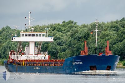
HAV DOLPHIN
General Cargo
Current Trip
| Time Travelled | 1 h, 29 mins |
|---|---|
| Remaining Time | 1 day |
| Distance Travelled | 13.22 nm |
| Remaining Distance | 323.21 nm |
| AVG Speed | 9.4 Knop |
| MAX Speed | 10.9 Knop |
| AVG Wind | 11.5 knots |
| MAX Wind | 14.6 knots |
| MIN Temp | 7°C / 44.6°F |
| MAX Temp | 8.8°C / 47.84°F |
| Djupgående | 2.8 m |
| Position mottagen | 1 m sen |
Current Position
| Longitud | 7.38668° |
|---|---|
| Latitude | 53.29618° |
| Status | Under way using engine |
| Fart | 10.8 Knop |
| Kurs | 292.8° |
| Område | North Sea |
| Station | T-AIS |
| Position mottagen | 1 m sen |
Info
Information
The current position of HAV DOLPHIN is in North Sea with coordinates 53.29618° / 7.38668° as reported on 2024-04-24 16:57 by AIS to our vessel tracker app. The vessel's current speed is 10.8 Knop and is heading at the port of GENT. The estimated time of arrival as calculated by MyShipTracking vessel tracking app is 2024-04-26 00:49 LT
The vessel HAV DOLPHIN (IMO: 9073854, MMSI: 304473000) is a General Cargo that was built in 1993 ( 31 År gammal ). It's sailing under the flag of [AG] Antigua Barbuda.
In this page you can find informations about the vessels current position, last detected port calls, and current voyage information. If the vessels is not in coverage by AIS you will find the latest position.
The current position of HAV DOLPHIN is detected by our AIS receivers and we are not responsible for the reliability of the data. The last position was recorded while the vessel was in Coverage by the Ais receivers of our vessel tracking app.
The current draught of HAV DOLPHIN as reported by AIS is 2.8 meters
Weather
| Temperature | 7.3°C / 45.14°F |
|---|---|
| Wind Speed | 11 knots |
| Direction | 11° N |
| Pressure | 1004.4 hPa |
| Humidity | 75.7 % |
| Cloud Coverage | 50 % |
Featured Company
Last Port Calls
| Port | Arrival | Departure | Time In Port |
|---|---|---|---|
| 2024-04-23 23:39 | 2024-04-24 15:29 | 15 h | |
| 2024-04-17 14:42 | 2024-04-18 16:57 | 1 d | |
| 2024-04-08 18:39 | 2024-04-09 03:34 | 8 h | |
| 2024-04-04 14:22 | 2024-04-06 07:03 | 1 d | |
| 2024-03-23 15:04 | 2024-03-25 16:30 | 2 d | |
| 2024-03-14 08:02 | 2024-03-15 18:30 | 1 d | |
| 2024-03-10 19:22 | 2024-03-12 08:24 | 1 d | |
| 2024-03-08 18:32 | 2024-03-08 19:11 | 39 m | |
| 2024-03-08 18:01 | 2024-03-08 18:14 | 12 m | |
| 2024-03-07 12:53 | 2024-03-08 17:24 | 1 d |
Most Visited Ports (Last year)
| Port | Arrivals | |
|---|---|---|
| 5 | ||
| 5 | ||
| 4 | ||
| 4 | ||
| 4 | ||
| 4 |
Last Trips
| Origin | Departure | Destination | Arrival | Distance | |
|---|---|---|---|---|---|
| 2024-04-18 18:57 | 2024-04-24 01:39 | 944.22 nm | |||
| 2024-04-09 03:34 | 2024-04-17 16:42 | 773.91 nm | |||
| 2024-04-06 08:03 | 2024-04-08 18:39 | 465.38 nm | |||
| 2024-03-25 17:30 | 2024-04-04 15:22 | 992.52 nm | |||
| 2024-03-15 18:30 | 2024-03-23 16:04 | 884.33 nm | |||
| 2024-03-12 08:24 | 2024-03-14 08:02 | 323.82 nm | |||
| 2024-03-08 19:11 | 2024-03-10 19:22 | 318.32 nm | |||
| 2024-03-08 18:14 | 2024-03-08 18:32 | 1.78 nm | |||
| 2024-03-08 17:24 | 2024-03-08 18:01 | 4.57 nm | |||
| 2024-03-07 12:05 | 2024-03-07 12:53 | 4.19 nm |
Events
| Tid | Event | Detaljer | Position / Dest | Information |
|---|---|---|---|---|
| 2024-04-24 16:34 | STARTAR förflyttning | 1.69 nm, South of JEMGUM |
53.23626 / 7.39840
BEGNE
|
Fart: 10.7 kn Kurs: 326.3° |
| 2024-04-24 16:34 | STOPPAR förflyttning | 1.78 nm, South of JEMGUM |
53.23492 / 7.40047
BEGNE
|
Fart: Kurs: 0° |
| 2024-04-24 16:11 | STARTAR förflyttning | 1.7 nm, North East of WEENER |
53.18664 / 7.40407
BEGNE
|
Fart: 9.9 kn Kurs: 54.2° |
| 2024-04-24 16:11 | STOPPAR förflyttning | 1.59 nm, North East of WEENER |
53.18576 / 7.40142
BEGNE
|
Fart: Kurs: 0° |
| 2024-04-24 15:44 | STARTAR förflyttning | 2.06 nm, South of WEENER |
53.13376 / 7.36536
BEGNE
|
Fart: 7.9 kn Kurs: 12.1° |
| 2024-04-24 15:43 | STOPPAR förflyttning | 2.18 nm, South of WEENER |
53.13183 / 7.36545
BEGNE
|
Fart: Kurs: 0° |
| 2024-04-24 15:32 | STARTAR förflyttning | 1.16 nm, North of PAPENBURG |
53.11008 / 7.36744
BEGNE
|
Fart: 8.2 kn Kurs: 45.9° |
| 2024-04-24 15:31 | STOPPAR förflyttning | 1.1 nm, North West of PAPENBURG |
53.10834 / 7.36501
BEGNE
|
Fart: Kurs: 0° |
| 2024-04-24 15:29 | AVGÅTT HAMN |
|
53.10511 / 7.36327
BEGNE
|
Fart: 2.7 kn Kurs: 359° |
| 2024-04-24 15:26 | STARTAR förflyttning |
53.10315 / 7.36420
[DE] PAPENBURG
|
Fart: 3.3 kn Kurs: 344° |