
GRINDELWALD
Cargo
Current Trip
BASELSEEHAFENBASEL
| Time Travelled | 18 h, 32 mins |
|---|---|
| Remaining Time | --- |
| Distance Travelled | 118.40 nm |
| Remaining Distance | --- |
| AVG Speed | 9.7 Knop |
| MAX Speed | 11 Knop |
| AVG Wind | 7.5 knots |
| MAX Wind | 12.8 knots |
| MIN Temp | 7.8°C / 46.04°F |
| MAX Temp | 11.5°C / 52.7°F |
| Djupgående | 2.2 m |
| Position mottagen | 1 m sen |
Current Position
| Longitud | --- |
|---|---|
| Latitude | --- |
| Status | Under way using engine |
| Fart | 9.6 Knop |
| Kurs | 43° |
| Område | North Sea |
| Station | T-AIS |
| Position mottagen | 1 m sen |
Info
Information
The current position of GRINDELWALD is in North Sea with coordinates 49.72313° / 8.44039° as reported on 2025-12-07 06:44 by AIS to our vessel tracker app. The vessel's current speed is 9.6 Knop
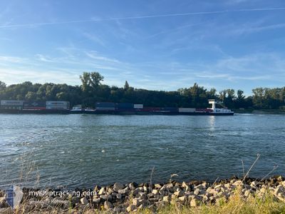
The vessel GRINDELWALD (MMSI: 244050638) is a Cargo It's sailing under the flag of [NL] Netherlands.
In this page you can find informations about the vessels current position, last detected port calls, and current voyage information. If the vessels is not in coverage by AIS you will find the latest position.
The current position of GRINDELWALD is detected by our AIS receivers and we are not responsible for the reliability of the data. The last position was recorded while the vessel was in Coverage by the Ais receivers of our vessel tracking app.
The current draught of GRINDELWALD as reported by AIS is 2.2 meters
Weather
| Temperature | 8.6°C / 47.48°F |
|---|---|
| Wind Speed | 7 knots |
| Direction | 196° SSW |
| Pressure | 1011.4 hPa |
| Humidity | 82.5 % |
| Cloud Coverage | 85 % |
Featured Company
Last Port Calls
| Port | Arrival | Departure | Time In Port |
|---|---|---|---|
| 2025-12-06 12:45 | 2025-12-06 13:13 | 28 m | |
| 2025-12-05 10:41 | 2025-12-05 17:05 | 6 h | |
| 2025-12-04 18:05 | 2025-12-05 10:04 | 15 h | |
| 2025-12-04 10:37 | 2025-12-04 17:50 | 7 h | |
| 2025-12-01 18:21 | 2025-12-01 19:09 | 48 m | |
| 2025-11-28 23:09 | 2025-11-30 00:20 | 1 d | |
| 2025-11-25 20:48 | 2025-11-28 18:49 | 2 d | |
| 2025-11-25 20:09 | 2025-11-25 20:41 | 31 m | |
| 2025-11-24 08:07 | 2025-11-25 10:40 | 1 d | |
| 2025-11-20 15:39 | 2025-11-20 16:49 | 1 h |
Most Visited Ports (Last year)
| Port | Arrivals | |
|---|---|---|
| 47 | ||
| 41 | ||
| 28 | ||
| 27 | ||
| 20 | ||
| 15 |
Last Trips
| Origin | Departure | Destination | Arrival | Distance | |
|---|---|---|---|---|---|
| 2025-12-05 17:05 | 2025-12-06 12:45 | 21.19 nm | |||
| 2025-12-05 10:04 | 2025-12-05 10:41 | 2.45 nm | |||
| 2025-12-04 17:50 | 2025-12-04 18:05 | 0.91 nm | |||
| 2025-12-01 19:09 | 2025-12-04 10:37 | 265.70 nm | |||
| 2025-11-30 00:20 | 2025-12-01 18:21 | 179.95 nm | |||
| 2025-11-28 18:49 | 2025-11-28 23:09 | 30.02 nm | |||
| 2025-11-25 20:41 | 2025-11-25 20:48 | 0.28 nm | |||
| 2025-11-25 10:40 | 2025-11-25 20:09 | 38.41 nm | |||
| 2025-11-20 16:49 | 2025-11-24 08:07 | 424.70 nm | |||
| 2025-11-20 11:14 | 2025-11-20 15:39 | 27.34 nm |
Events
| Tid | Event | Detaljer | Position / Dest | Information |
|---|---|---|---|---|
| 2025-12-07 06:20 | Status ändrad | Under way using engine Default |
49.69306 / 8.35680
BASELSEEHAFENBASEL
|
Fart: 10 kn Kurs: 337° |
| 2025-12-07 06:12 | Status ändrad | Default Under way using engine |
49.67333 / 8.35833
BASELSEEHAFENBASEL
|
Fart: 9.4 kn Kurs: 326° |
| 2025-12-07 06:08 | Status ändrad | Under way using engine Default |
49.66371 / 8.36610
BASELSEEHAFENBASEL
|
Fart: 10 kn Kurs: 356° |
| 2025-12-07 05:24 | Status ändrad | Default Under way using engine |
49.55667 / 8.41333
BASELSEEHAFENBASEL
|
Fart: 9.6 kn Kurs: 337° |
| 2025-12-07 03:15 | Status ändrad | Under way using engine Default |
49.28583 / 8.47865
BASELSEEHAFENBASEL
|
Fart: 11 kn Kurs: 39° |
| 2025-12-07 03:15 | I täckningsområde |
49.28583 / 8.47865
North Sea
|
Fart: 10.3 kn Kurs: 75° |
|
| 2025-12-07 00:17 | STARTAR förflyttning | 3.99 nm, South of MUNCHHAUSEN |
48.85500 / 8.11667
BASELSEEHAFENBASEL
|
Fart: 10 kn Kurs: 10° |
| 2025-12-06 22:50 | STOPPAR förflyttning | 5.05 nm, South of MUNCHHAUSEN |
48.83667 / 8.11500
BASELSEEHAFENBASEL
|
Fart: Kurs: -1° |
| 2025-12-06 13:57 | STARTAR förflyttning | 7.27 nm, North of BREISACH |
48.15333 / 7.59167
BASELSEEHAFENBASEL
|
Fart: 6 kn Kurs: 23° |
| 2025-12-06 13:18 | STOPPAR förflyttning | 6.85 nm, North of BREISACH |
48.14667 / 7.58667
BASELSEEHAFENBASEL
|
Fart: Kurs: -1° |