
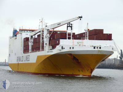
GRANDE ANGOLA
Ro-Ro Cargo
Current Trip
| Time Travelled | 23 h, 13 mins |
|---|---|
| Remaining Time | 2 days |
| Distance Travelled | 350.01 nm |
| Remaining Distance | 1004.55 nm |
| AVG Speed | 16.9 Knop |
| MAX Speed | 17.7 Knop |
| AVG Wind | 10.3 knots |
| MAX Wind | 22 knots |
| MIN Temp | 13.5°C / 56.3°F |
| MAX Temp | 19.7°C / 67.46°F |
| Djupgående | 8.8 m |
| Position mottagen | 2 h, 36 m sen |
Current Position
| Longitud | -12.43064° |
|---|---|
| Latitude | 29.90771° |
| Status | Under way using engine |
| Fart | 16.9 Knop |
| Kurs | 222.3° |
| Område | North Atlantic Ocean |
| Station | T-AIS |
| Position mottagen | 2 h, 36 m sen |
Info
Information
The current position of GRANDE ANGOLA is in North Atlantic Ocean with coordinates 29.90771° / -12.43064° as reported on 2024-04-24 00:39 by AIS to our vessel tracker app. The vessel's current speed is 16.9 Knop and is heading at the port of DAKAR. The estimated time of arrival as calculated by MyShipTracking vessel tracking app is 2024-04-26 11:26 LT
The vessel GRANDE ANGOLA (IMO: 9343156, MMSI: 247233800) is a Ro-Ro Cargo that was built in 2008 ( 16 År gammal ). It's sailing under the flag of [IT] Italy.
In this page you can find informations about the vessels current position, last detected port calls, and current voyage information. If the vessels is not in coverage by AIS you will find the latest position.
The current position of GRANDE ANGOLA is detected by our AIS receivers and we are not responsible for the reliability of the data. The last position was recorded while the vessel was in Coverage by the Ais receivers of our vessel tracking app.
The current draught of GRANDE ANGOLA as reported by AIS is 8.8 meters
Weather
| Temperature | 19.7°C / 67.46°F |
|---|---|
| Wind Speed | 18 knots |
| Direction | 15° NNE |
| Pressure | 1013.5 hPa |
| Humidity | 79.1 % |
| Cloud Coverage | 3 % |
Featured Company
Last Port Calls
| Port | Arrival | Departure | Time In Port |
|---|---|---|---|
| 2024-04-22 10:25 | 2024-04-23 04:03 | 17 h | |
| 2024-04-14 20:17 | 2024-04-15 16:55 | 20 h | |
| 2024-04-09 21:53 | 2024-04-10 10:04 | 12 h | |
| 2024-04-07 13:29 | 2024-04-08 21:20 | 1 d | |
| 2024-04-05 15:44 | 2024-04-07 07:07 | 1 d | |
| 2024-04-03 21:57 | 2024-04-04 23:31 | 1 d | |
| 2024-04-01 16:46 | 2024-04-02 23:48 | 1 d | |
| 2024-03-21 22:48 | 2024-03-25 04:11 | 3 d | |
| 2024-03-13 21:08 | |||
| 2024-03-11 08:56 | 2024-03-12 07:24 | 22 h |
Last Trips
| Origin | Departure | Destination | Arrival | Distance | |
|---|---|---|---|---|---|
| 2024-04-15 18:55 | 2024-04-22 11:25 | 1242.50 nm | |||
| 2024-04-10 12:04 | 2024-04-14 22:17 | 309.58 nm | |||
| 2024-04-08 23:20 | 2024-04-09 23:53 | 392.46 nm | |||
| 2024-04-07 09:07 | 2024-04-07 15:29 | 84.40 nm | |||
| 2024-04-05 01:31 | 2024-04-05 17:44 | 259.90 nm | |||
| 2024-04-03 01:48 | 2024-04-03 23:57 | 350.72 nm | |||
| 2024-03-25 04:11 | 2024-04-01 18:46 | 2093.01 nm | |||
| 2024-03-12 08:24 | 2024-03-13 22:08 | 512.51 nm | |||
| 2024-03-09 18:01 | 2024-03-11 09:56 | 534.18 nm | |||
| 2024-02-29 19:02 | 2024-03-04 01:04 | 1366.00 nm |
Events
| Tid | Event | Detaljer | Position / Dest | Information |
|---|---|---|---|---|
| 2024-04-24 00:55 | Status ändrad | Default Under way using engine |
29.85383 / -12.48610
MACAS>SNDKR
|
Fart: 16.9 kn Kurs: 222.3° |
| 2024-04-24 00:39 | UTANFÖR täckningsområde |
29.90771 / -12.43064
North Atlantic Ocean
MACAS>SNDKR
|
Fart: 16.9 kn Kurs: 222.3° |
|
| 2024-04-24 00:05 | Status ändrad | Under way using engine Default |
30.02688 / -12.30806
MACAS>SNDKR
|
Fart: 17.1 kn Kurs: 222° |
| 2024-04-24 00:02 | Status ändrad | Default Under way using engine |
30.03911 / -12.29526
MACAS>SNDKR
|
Fart: 17.2 kn Kurs: 222.3° |
| 2024-04-23 22:50 | Destination ändrad | MACAS>SNDKR SNDKR |
30.29229 / -12.02924
MACAS>SNDKR
|
Fart: 16.9 kn Kurs: 222.1° |
| 2024-04-23 22:39 | Byter havsområde | Spanish (Canary Islands) part of the North Atlantic Ocean Moroccan part of the North Atlantic Ocean |
30.32915 / -11.99102
North Atlantic Ocean
SNDKR
|
Fart: 16.7 kn Kurs: 222.8° |
| 2024-04-23 22:39 | Status ändrad | Under way using engine Default |
30.32915 / -11.99102
SNDKR
|
Fart: 17 kn Kurs: 223° |
| 2024-04-23 22:27 | I täckningsområde |
30.32915 / -11.99102
North Atlantic Ocean
SNDKR
|
Fart: 16.7 kn Kurs: 222.8° |
|
| 2024-04-23 20:45 | Status ändrad | Default Under way using engine |
30.72552 / -11.57224
SNDKR
|
Fart: 17.3 kn Kurs: 222.2° |
| 2024-04-23 20:39 | UTANFÖR täckningsområde |
30.75038 / -11.54644
North Atlantic Ocean
SNDKR
|
Fart: 17.3 kn Kurs: 222.2° |