
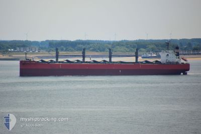
GLOBAL LAGUNA
Bulk Carrier
Current Trip
| Time Travelled | 2 days |
|---|---|
| Remaining Time | --- |
| Distance Travelled | 373.86 nm |
| Remaining Distance | --- |
| AVG Speed | 10 Knop |
| MAX Speed | 14 Knop |
| AVG Wind | 8.4 knots |
| MAX Wind | 15 knots |
| MIN Temp | 12.2°C / 53.96°F |
| MAX Temp | 20.6°C / 69.08°F |
| Djupgående | 10.4 m |
| Position mottagen | 1 m sen |
Current Position
| Longitud | -54.89753° |
|---|---|
| Latitude | -35.07608° |
| Status | Under way using engine |
| Fart | 10.9 Knop |
| Kurs | 86° |
| Område | South Atlantic Ocean |
| Station | T-AIS |
| Position mottagen | 1 m sen |
Info
Information
The current position of GLOBAL LAGUNA is in South Atlantic Ocean with coordinates -35.07608° / -54.89753° as reported on 2024-04-25 16:18 by AIS to our vessel tracker app. The vessel's current speed is 10.9 Knop and is heading at the port of GIBRALTAR. The estimated time of arrival as calculated by MyShipTracking vessel tracking app is 2024-05-15 01:00 LT
The vessel GLOBAL LAGUNA (IMO: 9626730, MMSI: 373102000) is a Bulk Carrier that was built in 2012 ( 12 År gammal ). It's sailing under the flag of [PA] Panama.
In this page you can find informations about the vessels current position, last detected port calls, and current voyage information. If the vessels is not in coverage by AIS you will find the latest position.
The current position of GLOBAL LAGUNA is detected by our AIS receivers and we are not responsible for the reliability of the data. The last position was recorded while the vessel was in Coverage by the Ais receivers of our vessel tracking app.
The current draught of GLOBAL LAGUNA as reported by AIS is 10.4 meters
Weather
| Temperature | 17.8°C / 64.04°F |
|---|---|
| Wind Speed | 6 knots |
| Direction | 12° NNE |
| Pressure | 1017.1 hPa |
| Humidity | 57 % |
| Cloud Coverage | 91 % |
Featured Company
Last Port Calls
| Port | Arrival | Departure | Time In Port |
|---|---|---|---|
| 2024-04-18 21:28 | 2024-04-23 03:09 | 4 d | |
| 2024-03-13 16:23 | 2024-03-29 00:05 | 15 d | |
| 2024-02-20 09:33 | |||
| 2024-02-15 19:43 |
Most Visited Ports (Last year)
| Port | Arrivals | |
|---|---|---|
| 3 | ||
| 1 | ||
| 1 | ||
| 1 | ||
| 1 | ||
| 1 |
Events
| Tid | Event | Detaljer | Position / Dest | Information |
|---|---|---|---|---|
| 2024-04-25 15:40 | Status ändrad | Under way using engine Default |
-35.06768 / -55.04052
GI GIB
|
Fart: 10 kn Kurs: 99° |
| 2024-04-25 15:33 | Status ändrad | Default Under way using engine |
-35.06500 / -55.06500
GI GIB
|
Fart: 10.6 kn Kurs: 92.8° |
| 2024-04-25 15:26 | Byter havsområde | Uruguayan part of the South Atlantic Ocean Uruguayan part of the Rio de La Plata |
-35.06362 / -55.08974
South Atlantic Ocean
GI GIB
|
Fart: 10.7 kn Kurs: 95.6° |
| 2024-04-25 14:45 | Status ändrad | Under way using engine Default |
-35.05271 / -55.23568
GI GIB
|
Fart: 10.6 kn Kurs: 91° |
| 2024-04-25 14:40 | Status ändrad | Default Under way using engine |
-35.05196 / -55.25552
GI GIB
|
Fart: 10.6 kn Kurs: 92.2° |
| 2024-04-25 14:35 | Status ändrad | Under way using engine Default |
-35.05148 / -55.27357
GI GIB
|
Fart: 10.6 kn Kurs: 94° |
| 2024-04-25 14:15 | Status ändrad | Default Under way using engine |
-35.04887 / -55.34424
GI GIB
|
Fart: 10.7 kn Kurs: 92.6° |
| 2024-04-25 14:01 | Byter havsområde | Uruguayan part of the Rio de La Plata Argentinean part of the Rio de La Plata |
-35.04886 / -55.39845
Rio de La Plata
GI GIB
|
Fart: 10.7 kn Kurs: 90.8° |
| 2024-04-25 14:00 | Status ändrad | Under way using engine Default |
-35.04885 / -55.39906
GI GIB
|
Fart: 10 kn Kurs: 88° |
| 2024-04-25 14:00 | Djupgående ändrat | 10.4 10.3 |
-35.04833 / -55.41167
GI GIB
|
Fart: 10 kn Kurs: 88° |