
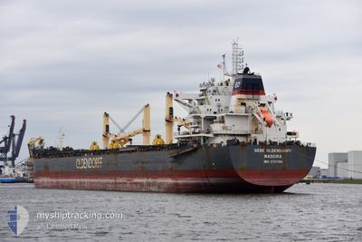
GEBE OLDENDORFF
Cargo
Current Trip
| Trip Time | 13 days |
|---|---|
| Trip Distance | 4121.78 nm |
| AVG Speed | 12 Knop |
| MAX Speed | 16.6 Knop |
| Djupgående | 11.4 m |
| AVG Wind | 10.2 knots |
| MAX Wind | 34.5 knots |
| MIN Temp | -0.2°C / 31.64°F |
| MAX Temp | 19.6°C / 67.28°F |
| Position mottagen | 1 m sen |
Current Position
| Longitud | 17.20593° |
|---|---|
| Latitude | 40.47496° |
| Status | Moored |
| Fart | |
| Kurs | 343° |
| Område | Ionian Sea |
| Station | T-AIS |
| Position mottagen | 1 m sen |
Info
Information
The current position of GEBE OLDENDORFF is in Ionian Sea with coordinates 40.47496° / 17.20593° as reported on 2024-04-20 05:21 by AIS to our vessel tracker app. The vessel's current speed is 0 Knop and is currently inside the port of TARANTO.
The vessel GEBE OLDENDORFF (IMO: 9727596, MMSI: 255805774) is a Cargo It's sailing under the flag of [PT] Portugal.
In this page you can find informations about the vessels current position, last detected port calls, and current voyage information. If the vessels is not in coverage by AIS you will find the latest position.
The current position of GEBE OLDENDORFF is detected by our AIS receivers and we are not responsible for the reliability of the data. The last position was recorded while the vessel was in Coverage by the Ais receivers of our vessel tracking app.
The current draught of GEBE OLDENDORFF as reported by AIS is 11.4 meters
Weather
| Temperature | 8.2°C / 46.76°F |
|---|---|
| Wind Speed | 4 knots |
| Direction | 312° NW |
| Pressure | 1010.4 hPa |
| Humidity | 49.3 % |
| Cloud Coverage | --- |
Featured Company
Last Port Calls
| Port | Arrival | Departure | Time In Port |
|---|---|---|---|
| 2024-04-19 19:50 | |||
| 2024-04-01 18:30 | 2024-04-05 20:52 | 4 d | |
| 2024-03-26 23:15 | 2024-03-28 19:52 | 1 d | |
| 2024-02-22 13:18 | 2024-02-28 15:41 | 6 d |
Most Visited Ports (Last year)
| Port | Arrivals | |
|---|---|---|
| 12 | ||
| 1 | ||
| 1 | ||
| 1 | ||
| 1 | ||
| 1 |
Last Trips
| Origin | Departure | Destination | Arrival | Distance | |
|---|---|---|---|---|---|
| 2024-04-05 23:52 | 2024-04-19 21:50 | 4121.78 nm | |||
| 2024-03-28 20:52 | 2024-04-01 21:30 | 1303.75 nm | |||
| 2024-02-28 16:41 | 2024-03-27 00:15 | 2297.97 nm | |||
| 2024-01-23 13:45 | 2024-02-22 14:18 | 6062.11 nm |
Events
| Tid | Event | Detaljer | Position / Dest | Information |
|---|---|---|---|---|
| 2024-04-19 20:09 | Status ändrad | Moored Under way using engine |
40.47495 / 17.20595
[IT] TARANTO
|
Fart: Kurs: 343° |
| 2024-04-19 20:03 | STOPPAR förflyttning |
40.47471 / 17.20617
[IT] TARANTO
|
Fart: 0.3 kn Kurs: 341° |
|
| 2024-04-19 19:50 | ANLÄNDER HAMN |
|
40.47050 / 17.20913
[IT] TARANTO
|
Fart: 2.4 kn Kurs: 339° |
| 2024-04-19 19:29 | STARTAR förflyttning | 2.66 nm, South East of TARANTO |
40.45147 / 17.21381
ITTAR
|
Fart: 3.1 kn Kurs: 2° |
| 2024-04-19 19:21 | Status ändrad | Under way using engine At anchor |
40.44831 / 17.21423
ITTAR
|
Fart: 0.1 kn Kurs: 342° |
| 2024-04-19 15:02 | Status ändrad | At anchor Under way using engine |
40.44787 / 17.21315
ITTAR
|
Fart: 0.3 kn Kurs: 348° |
| 2024-04-19 14:54 | STOPPAR förflyttning | 2.76 nm, South East of TARANTO |
40.44859 / 17.21298
ITTAR
|
Fart: 0.3 kn Kurs: 5° |
| 2024-04-19 13:08 | Djupgående ändrat | 11.4 11.7 |
40.24139 / 17.16281
ITTAR
|
Fart: 11.6 kn Kurs: 0° |
| 2024-04-19 13:08 | ETA ändrat | 2024/04/19 14:30 2024/04/19 16:00 |
40.24139 / 17.16281
ITTAR
|
Fart: 11.6 kn Kurs: 0° |
| 2024-04-19 12:24 | I täckningsområde |
40.10253 / 17.16457
Ionian Sea
ITTAR
|
Fart: 11.7 kn Kurs: 345.7° |