
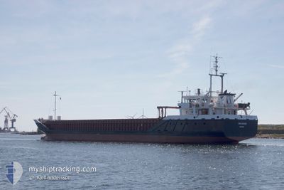
FRI RIVER
General Cargo
Current Trip
| Time Travelled | 16 h, 41 mins |
|---|---|
| Remaining Time | --- |
| Distance Travelled | 144.21 nm |
| Remaining Distance | --- |
| AVG Speed | 8.8 Knop |
| MAX Speed | 12.3 Knop |
| AVG Wind | 14.7 knots |
| MAX Wind | 18 knots |
| MIN Temp | 8.3°C / 46.94°F |
| MAX Temp | 9.1°C / 48.38°F |
| Djupgående | 3.5 m |
| Position mottagen | 9 h, 53 m sen |
Current Position
| Longitud | -4.83808° |
|---|---|
| Latitude | 53.44555° |
| Status | Under way using engine |
| Fart | 12.1 Knop |
| Kurs | 215° |
| Område | Irish Sea and St. George's Channel |
| Station | T-AIS |
| Position mottagen | 9 h, 53 m sen |
Info
Information
The current position of FRI RIVER is in Irish Sea and St. George's Channel with coordinates 53.44555° / -4.83808° as reported on 2024-04-17 23:03 by AIS to our vessel tracker app. The vessel's current speed is 12.1 Knop and is heading at the port of TONNAY CHARENTE. The estimated time of arrival as calculated by MyShipTracking vessel tracking app is 2024-04-20 05:00 LT
The vessel FRI RIVER (IMO: 9224104, MMSI: 311000758) is a General Cargo that was built in 2000 ( 24 År gammal ). It's sailing under the flag of [BS] Bahamas.
In this page you can find informations about the vessels current position, last detected port calls, and current voyage information. If the vessels is not in coverage by AIS you will find the latest position.
The current position of FRI RIVER is detected by our AIS receivers and we are not responsible for the reliability of the data. The last position was recorded while the vessel was in Coverage by the Ais receivers of our vessel tracking app.
The current draught of FRI RIVER as reported by AIS is 3.5 meters
Weather
| Temperature | 9°C / 48.2°F |
|---|---|
| Wind Speed | 1 knots |
| Direction | 318° NW |
| Pressure | 1025.7 hPa |
| Humidity | 69.8 % |
| Cloud Coverage | 18 % |
Featured Company
Last Port Calls
| Port | Arrival | Departure | Time In Port |
|---|---|---|---|
| 2024-04-14 22:31 | 2024-04-17 16:15 | 2 d | |
| 2024-04-05 15:13 | 2024-04-08 16:52 | 3 d | |
| 2024-03-27 18:27 | 2024-04-03 16:34 | 6 d | |
| 2024-03-21 00:52 | 2024-03-22 00:37 | 23 h | |
| 2024-03-16 14:20 | 2024-03-18 19:12 | 2 d | |
| 2024-03-09 19:46 | 2024-03-11 19:48 | 2 d | |
| 2024-02-29 22:29 | 2024-03-06 10:53 | 5 d | |
| 2024-02-27 01:47 | 2024-02-28 14:52 | 1 d | |
| 2024-02-20 07:39 | 2024-02-21 11:49 | 1 d | |
| 2024-02-16 07:09 | 2024-02-19 14:23 | 3 d |
Most Visited Ports (Last year)
| Port | Arrivals | |
|---|---|---|
| 4 | ||
| 4 | ||
| 2 | ||
| 2 | ||
| 2 | ||
| 2 |
Last Trips
| Origin | Departure | Destination | Arrival | Distance | |
|---|---|---|---|---|---|
| 2024-04-08 18:52 | 2024-04-14 23:31 | 662.45 nm | |||
| 2024-04-03 18:34 | 2024-04-05 17:13 | 202.32 nm | |||
| 2024-03-22 01:37 | 2024-03-27 19:27 | 1047.38 nm | |||
| 2024-03-18 20:12 | 2024-03-21 01:52 | 374.01 nm | |||
| 2024-03-11 19:48 | 2024-03-16 15:20 | 928.39 nm | |||
| 2024-03-06 11:53 | 2024-03-09 19:46 | 850.74 nm | |||
| 2024-02-28 15:52 | 2024-02-29 23:29 | 341.35 nm | |||
| 2024-02-21 11:49 | 2024-02-27 02:47 | 1009.76 nm | |||
| 2024-02-19 14:23 | 2024-02-20 07:39 | 153.84 nm | |||
| 2024-02-06 17:12 | 2024-02-16 07:09 | 1288.48 nm |
Events
| Tid | Event | Detaljer | Position / Dest | Information |
|---|---|---|---|---|
| 2024-04-17 23:11 | Status ändrad | Default Under way using engine |
53.42382 / -4.86405
FRTON
|
Fart: 12.1 kn Kurs: 215° |
| 2024-04-17 23:03 | Status ändrad | Under way using engine Default |
53.44555 / -4.83808
FRTON
|
Fart: 12.2 kn Kurs: 215° |
| 2024-04-17 23:03 | UTANFÖR täckningsområde |
53.44555 / -4.83808
Irish Sea and St. George's Channel
FRTON
|
Fart: 12.1 kn Kurs: 215° |
|
| 2024-04-17 22:51 | I täckningsområde |
53.44555 / -4.83808
Irish Sea and St. George's Channel
FRTON
|
Fart: 12.1 kn Kurs: 215° |
|
| 2024-04-17 19:31 | Status ändrad | Default Under way using engine |
53.55241 / -3.78803
FRTON
|
Fart: 10.5 kn Kurs: 270.4° |
| 2024-04-17 19:26 | UTANFÖR täckningsområde |
53.55235 / -3.76184
Irish Sea and St. George's Channel
FRTON
|
Fart: 10.5 kn Kurs: 270.4° |
|
| 2024-04-17 18:20 | ETA ändrat | 2024/04/20 05:00 2024/04/20 03:00 |
53.55064 / -3.44636
FRTON
|
Fart: 10.1 kn Kurs: 270.4° |
| 2024-04-17 16:15 | AVGÅTT HAMN |
|
53.46443 / -3.04791
FRTON
|
Fart: 8 kn Kurs: 318° |
| 2024-04-17 16:01 | STARTAR förflyttning |
53.44935 / -3.01752
[GB] LIVERPOOL
|
Fart: 3.2 kn Kurs: 181° |
|
| 2024-04-17 13:47 | Status ändrad | Under way using engine Moored |
53.45859 / -3.02104
[GB] LIVERPOOL
|
Fart: Kurs: 70° |