
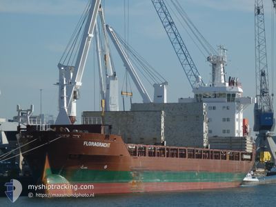
FLORAGRACHT
General Cargo
Current Trip
| Time Travelled | 8 days |
|---|---|
| Remaining Time | --- |
| Distance Travelled | 2739.25 nm |
| Remaining Distance | 1249.12 nm |
| AVG Speed | 12.6 Knop |
| MAX Speed | 15 Knop |
| AVG Wind | 13.1 knots |
| MAX Wind | 26 knots |
| MIN Temp | 9.8°C / 49.64°F |
| MAX Temp | 19.4°C / 66.92°F |
| Djupgående | 6.4 m |
| Position mottagen | 4 d sen |
Current Position
| Longitud | -30.76886° |
|---|---|
| Latitude | 38.92029° |
| Status | Under way using engine |
| Fart | 13.9 Knop |
| Kurs | 262.4° |
| Område | North Atlantic Ocean |
| Station | T-AIS |
| Position mottagen | 4 d sen |
Info
Information
The current position of FLORAGRACHT is in North Atlantic Ocean with coordinates 38.92029° / -30.76886° as reported on 2024-04-21 00:28 by AIS to our vessel tracker app. The vessel's current speed is 13.9 Knop and is heading at the port of WILMINGTON. The estimated time of arrival as calculated by MyShipTracking vessel tracking app is 2024-04-28 12:00 LT
The vessel FLORAGRACHT (IMO: 9509968, MMSI: 246619000) is a General Cargo that was built in 2011 ( 13 År gammal ). It's sailing under the flag of [NL] Netherlands.
In this page you can find informations about the vessels current position, last detected port calls, and current voyage information. If the vessels is not in coverage by AIS you will find the latest position.
The current position of FLORAGRACHT is detected by our AIS receivers and we are not responsible for the reliability of the data. The last position was recorded while the vessel was in Coverage by the Ais receivers of our vessel tracking app.
The current draught of FLORAGRACHT as reported by AIS is 6.4 meters
Weather
| Temperature | 18.6°C / 65.48°F |
|---|---|
| Wind Speed | 11 knots |
| Direction | 265° W |
| Pressure | 1021.5 hPa |
| Humidity | 78 % |
| Cloud Coverage | 36 % |
Featured Company
Last Port Calls
| Port | Arrival | Departure | Time In Port |
|---|---|---|---|
| 2024-04-16 08:21 | 2024-04-16 13:29 | 5 h | |
| 2024-04-12 09:43 | 2024-04-13 10:16 | 1 d | |
| 2024-04-11 06:07 | 2024-04-11 15:55 | 9 h | |
| 2024-04-09 04:24 | 2024-04-09 10:49 | 6 h | |
| 2024-03-08 22:45 | 2024-03-10 04:28 | 1 d | |
| 2024-03-05 10:09 | 2024-03-08 12:28 | 3 d | |
| 2024-03-04 10:07 | 2024-03-04 17:40 | 7 h | |
| 2024-02-12 15:25 | 2024-02-19 19:24 | 7 d |
Last Trips
| Origin | Departure | Destination | Arrival | Distance | |
|---|---|---|---|---|---|
| 2024-04-13 12:16 | 2024-04-16 09:21 | 301.75 nm | |||
| 2024-04-11 17:55 | 2024-04-12 11:43 | 215.74 nm | |||
| 2024-04-09 12:49 | 2024-04-11 08:07 | 429.55 nm | |||
| 2024-03-10 00:28 | 2024-04-09 06:24 | 6039.18 nm | |||
| 2024-03-08 08:28 | 2024-03-08 18:45 | 109.53 nm | |||
| 2024-03-04 13:40 | 2024-03-05 06:09 | 43.33 nm | |||
| 2024-02-19 20:24 | 2024-03-04 06:07 | 4075.12 nm | |||
| 2024-01-25 13:25 | 2024-02-12 16:25 | 849.44 nm |
Events
| Tid | Event | Detaljer | Position / Dest | Information |
|---|---|---|---|---|
| 2024-04-23 11:22 | STARTAR förflyttning |
37.16259 / -47.24903
US ILM
|
Fart: 7.6 kn Kurs: 264° |
|
| 2024-04-23 10:49 | STOPPAR förflyttning |
37.16000 / -47.24166
US ILM
|
Fart: Kurs: -1° |
|
| 2024-04-21 00:43 | Status ändrad | Default Under way using engine |
38.91333 / -30.83667
US ILM
|
Fart: 13.9 kn Kurs: 262.4° |
| 2024-04-21 00:28 | UTANFÖR täckningsområde |
38.92029 / -30.76886
North Atlantic Ocean
US ILM
|
Fart: 13.9 kn Kurs: 262.4° |
|
| 2024-04-20 13:16 | Upptäckt i hav | Portuguese (Azores) part of the North Atlantic Ocean |
39.78229 / -27.84557
North Atlantic Ocean
US ILM
|
Fart: 13 kn Kurs: 246.7° |
| 2024-04-20 13:15 | Status ändrad | Under way using engine Default |
39.78322 / -27.84268
US ILM
|
Fart: 13 kn Kurs: 245° |
| 2024-04-20 13:15 | I täckningsområde |
39.78229 / -27.84557
North Atlantic Ocean
US ILM
|
Fart: 13 kn Kurs: 246.7° |
|
| 2024-04-16 22:30 | Status ändrad | Default Under way using engine |
49.64762 / -4.43949
US ILM
|
Fart: 10.6 kn Kurs: 237.8° |
| 2024-04-16 22:24 | UTANFÖR täckningsområde |
49.65678 / -4.41725
English Channel
US ILM
|
Fart: 10.6 kn Kurs: 237.8° |
|
| 2024-04-16 18:22 | Status ändrad | Under way using engine Default |
50.08367 / -3.41650
US ILM
|
Fart: 12 kn Kurs: 242° |