
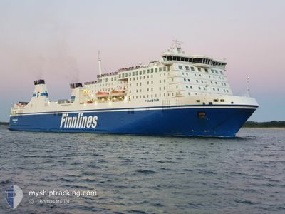
FINNSTAR
Ro-Ro/Passenger Ship
Current Trip
| Time Travelled | 20 h, 20 mins |
|---|---|
| Remaining Time | 7 h, 21 mins |
| Distance Travelled | 425.58 nm |
| Remaining Distance | 185.88 nm |
| AVG Speed | 21.5 Knop |
| MAX Speed | 22.8 Knop |
| AVG Wind | 11.6 knots |
| MAX Wind | 17.6 knots |
| MIN Temp | 2.8°C / 37.04°F |
| MAX Temp | 5.4°C / 41.72°F |
| Djupgående | 7.1 m |
| Position mottagen | 7 h, 38 m sen |
Current Position
| Longitud | 17.42416° |
|---|---|
| Latitude | 56.36850° |
| Status | Under way using engine |
| Fart | 22.5 Knop |
| Kurs | 52.2° |
| Område | Baltic Sea |
| Station | T-AIS |
| Position mottagen | 7 h, 38 m sen |
Info
Information
The current position of FINNSTAR is in Baltic Sea with coordinates 56.36850° / 17.42416° as reported on 2024-04-24 14:42 by AIS to our vessel tracker app. The vessel's current speed is 22.5 Knop and is heading at the port of HELSINKI. The estimated time of arrival as calculated by MyShipTracking vessel tracking app is 2024-04-25 05:42 LT
The vessel FINNSTAR (IMO: 9319442, MMSI: 230981000) is a Ro-Ro/Passenger Ship that was built in 2006 ( 18 År gammal ). It's sailing under the flag of [FI] Finland.
In this page you can find informations about the vessels current position, last detected port calls, and current voyage information. If the vessels is not in coverage by AIS you will find the latest position.
The current position of FINNSTAR is detected by our AIS receivers and we are not responsible for the reliability of the data. The last position was recorded while the vessel was in Coverage by the Ais receivers of our vessel tracking app.
The current draught of FINNSTAR as reported by AIS is 7.1 meters
Weather
| Temperature | 2.9°C / 37.22°F |
|---|---|
| Wind Speed | 11 knots |
| Direction | 60° ENE |
| Pressure | 1008.5 hPa |
| Humidity | 97.5 % |
| Cloud Coverage | 100 % |
Featured Company
Last Port Calls
| Port | Arrival | Departure | Time In Port |
|---|---|---|---|
| 2024-04-23 19:52 | 2024-04-24 02:01 | 6 h | |
| 2024-04-22 08:27 | 2024-04-22 15:31 | 7 h | |
| 2024-04-20 18:43 | 2024-04-21 03:04 | 8 h | |
| 2024-04-19 06:50 | 2024-04-19 13:06 | 6 h | |
| 2024-04-17 18:24 | 2024-04-18 01:58 | 7 h | |
| 2024-04-16 06:50 | 2024-04-16 12:14 | 5 h | |
| 2024-04-14 18:28 | 2024-04-15 01:25 | 6 h | |
| 2024-04-13 06:50 | 2024-04-13 12:58 | 6 h | |
| 2024-04-11 18:29 | 2024-04-12 01:38 | 7 h | |
| 2024-04-10 06:48 | 2024-04-10 12:22 | 5 h |
Most Visited Ports (Last year)
| Port | Arrivals | |
|---|---|---|
| 110 | ||
| 107 | ||
| 1 | ||
| 1 |
Last Trips
| Origin | Departure | Destination | Arrival | Distance | |
|---|---|---|---|---|---|
| 2024-04-22 18:31 | 2024-04-23 21:52 | 619.03 nm | |||
| 2024-04-21 05:04 | 2024-04-22 11:27 | 617.75 nm | |||
| 2024-04-19 16:06 | 2024-04-20 20:43 | 618.42 nm | |||
| 2024-04-18 03:58 | 2024-04-19 09:50 | 614.94 nm | |||
| 2024-04-16 15:14 | 2024-04-17 20:24 | 618.12 nm | |||
| 2024-04-15 03:25 | 2024-04-16 09:50 | 618.19 nm | |||
| 2024-04-13 15:58 | 2024-04-14 20:28 | 618.58 nm | |||
| 2024-04-12 03:38 | 2024-04-13 09:50 | 617.81 nm | |||
| 2024-04-10 15:22 | 2024-04-11 20:29 | 618.43 nm | |||
| 2024-04-09 02:44 | 2024-04-10 09:48 | 618.41 nm |
Events
| Tid | Event | Detaljer | Position / Dest | Information |
|---|---|---|---|---|
| 2024-04-24 14:48 | Status ändrad | Default Under way using engine |
56.39157 / 17.47733
FIHEL
|
Fart: 22.5 kn Kurs: 52.2° |
| 2024-04-24 14:42 | UTANFÖR täckningsområde |
56.36850 / 17.42416
Baltic Sea
FIHEL
|
Fart: 22.5 kn Kurs: 52.2° |
|
| 2024-04-24 14:12 | Status ändrad | Under way using engine Default |
56.25041 / 17.15216
FIHEL
|
Fart: 22.3 kn Kurs: 52° |
| 2024-04-24 13:56 | Status ändrad | Default Under way using engine |
56.19257 / 17.01926
FIHEL
|
Fart: 21.9 kn Kurs: 52.2° |
| 2024-04-24 11:02 | Byter havsområde | Swedish part of the Baltic Sea Danish part of the Kattegat |
55.62292 / 15.38158
Baltic Sea
FIHEL
|
Fart: 22.3 kn Kurs: 59.5° |
| 2024-04-24 08:26 | Byter havsområde | Danish part of the Kattegat Swedish part of the Baltic Sea |
55.01885 / 14.07081
Kattegat
FIHEL
|
Fart: 22 kn Kurs: 63° |
| 2024-04-24 08:11 | Byter havsområde | Swedish part of the Baltic Sea German part of the Baltic Sea |
54.98403 / 13.92309
Baltic Sea
FIHEL
|
Fart: 22.2 kn Kurs: 67.6° |
| 2024-04-24 05:20 | Byter havsområde | German part of the Baltic Sea Danish part of the Baltic Sea |
54.59132 / 12.33650
Baltic Sea
FIHEL
|
Fart: 19.6 kn Kurs: 61° |
| 2024-04-24 05:05 | Byter havsområde | Danish part of the Baltic Sea German part of the Baltic Sea |
54.52584 / 12.24836
Baltic Sea
FIHEL
|
Fart: 20.8 kn Kurs: 28.9° |
| 2024-04-24 02:01 | AVGÅTT HAMN |
|
53.96101 / 10.88885
FIHEL
|
Fart: 7.4 kn Kurs: 66° |