
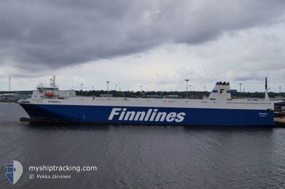
FINNMILL
Ro-Ro Cargo
Current Trip
| Time Travelled | 9 h, 31 mins |
|---|---|
| Remaining Time | 6 h, 17 mins |
| Distance Travelled | 95.20 nm |
| Remaining Distance | 66.58 nm |
| AVG Speed | 10 Knop |
| MAX Speed | 10.7 Knop |
| AVG Wind | 13.1 knots |
| MAX Wind | 17 knots |
| MIN Temp | 7°C / 44.6°F |
| MAX Temp | 8.6°C / 47.48°F |
| Djupgående | 6 m |
| Position mottagen | 1 m sen |
Current Position
| Longitud | --- |
|---|---|
| Latitude | --- |
| Status | Under way using engine |
| Fart | 10.3 Knop |
| Kurs | 336.8° |
| Område | Kattegat |
| Station | T-AIS |
| Position mottagen | 1 m sen |
Info
Information
The current position of FINNMILL is in Kattegat with coordinates 55.24209° / 11.09673° as reported on 2025-12-07 22:39 by AIS to our vessel tracker app. The vessel's current speed is 10.3 Knop and is heading at the port of AARHUS. The estimated time of arrival as calculated by MyShipTracking vessel tracking app is 2025-12-08 05:57 LT
The vessel FINNMILL (IMO: 9212656, MMSI: 230642000) is a Ro-Ro Cargo that was built in 2002 ( 23 År gammal ). It's sailing under the flag of [FI] Finland.
In this page you can find informations about the vessels current position, last detected port calls, and current voyage information. If the vessels is not in coverage by AIS you will find the latest position.
The current position of FINNMILL is detected by our AIS receivers and we are not responsible for the reliability of the data. The last position was recorded while the vessel was in Coverage by the Ais receivers of our vessel tracking app.
The current draught of FINNMILL as reported by AIS is 6 meters
Weather
| Temperature | 7°C / 44.6°F |
|---|---|
| Wind Speed | 16 knots |
| Direction | 150° SSE |
| Pressure | 1005.1 hPa |
| Humidity | 93 % |
| Cloud Coverage | 100 % |
Featured Company
Last Port Calls
| Port | Arrival | Departure | Time In Port |
|---|---|---|---|
| 2025-12-07 09:21 | 2025-12-07 14:09 | 4 h | |
| 2025-12-05 06:09 | 2025-12-05 20:14 | 14 h | |
| 2025-12-03 08:21 | 2025-12-03 16:37 | 8 h | |
| 2025-12-01 06:16 | 2025-12-02 17:47 | 1 d | |
| 2025-11-30 09:21 | 2025-11-30 14:25 | 5 h | |
| 2025-11-28 06:07 | 2025-11-28 20:19 | 14 h | |
| 2025-11-26 08:21 | 2025-11-26 16:13 | 7 h | |
| 2025-11-24 06:14 | 2025-11-25 18:26 | 1 d | |
| 2025-11-23 09:19 | 2025-11-23 13:29 | 4 h | |
| 2025-11-21 06:30 | 2025-11-21 20:40 | 14 h |
Last Trips
| Origin | Departure | Destination | Arrival | Distance | |
|---|---|---|---|---|---|
| 2025-12-05 20:14 | 2025-12-07 09:21 | 638.05 nm | |||
| 2025-12-03 16:37 | 2025-12-05 06:09 | 630.74 nm | |||
| 2025-12-02 17:47 | 2025-12-03 08:21 | 158.83 nm | |||
| 2025-11-30 14:25 | 2025-12-01 06:16 | 160.96 nm | |||
| 2025-11-28 20:19 | 2025-11-30 09:21 | 638.43 nm | |||
| 2025-11-26 16:13 | 2025-11-28 06:07 | 630.91 nm | |||
| 2025-11-25 18:26 | 2025-11-26 08:21 | 158.27 nm | |||
| 2025-11-23 13:29 | 2025-11-24 06:14 | 161.09 nm | |||
| 2025-11-21 20:40 | 2025-11-23 09:19 | 633.49 nm | |||
| 2025-11-19 16:25 | 2025-11-21 06:30 | 631.87 nm |
Events
| Tid | Event | Detaljer | Position / Dest | Information |
|---|---|---|---|---|
| 2025-12-07 19:28 | Byter havsområde | Danish part of the Kattegat Danish part of the Baltic Sea |
54.75013 / 10.87935
Kattegat
AARHUS
|
Fart: 10.3 kn Kurs: 358.3° |
| 2025-12-07 18:25 | Upptäckt i hav | Danish part of the Baltic Sea |
54.63594 / 11.08563
Baltic Sea
AARHUS
|
Fart: 9.8 kn Kurs: 299.2° |
| 2025-12-07 17:45 | STARTAR förflyttning | 5.03 nm, North of PUTTGARDEN |
54.58612 / 11.25605
AARHUS
|
Fart: 10.1 kn Kurs: 295° |
| 2025-12-07 17:44 | STOPPAR förflyttning | 5 nm, North of PUTTGARDEN |
54.58523 / 11.25935
AARHUS
|
Fart: Kurs: 292° |
| 2025-12-07 17:22 | Byter havsområde | German part of the Baltic Sea Danish part of the Baltic Sea |
54.55202 / 11.34921
Baltic Sea
AARHUS
|
Fart: 10.1 kn Kurs: 299.3° |
| 2025-12-07 17:13 | Byter havsområde | Danish part of the Baltic Sea German part of the Baltic Sea |
54.53706 / 11.38335
Baltic Sea
AARHUS
|
Fart: 10.1 kn Kurs: 332.3° |
| 2025-12-07 13:36 | Djupgående ändrat | 6 6.7 |
54.01635 / 10.99083
AARHUS
|
Fart: 10.1 kn Kurs: 49.4° |
| 2025-12-07 13:36 | Destination ändrad | AARHUS TRAVEMUNDE |
54.01635 / 10.99083
AARHUS
|
Fart: 10.1 kn Kurs: 49.4° |
| 2025-12-07 13:36 | ETA ändrat | 2025/12/08 06:00 2025/12/07 09:00 |
54.01635 / 10.99083
AARHUS
|
Fart: 10.1 kn Kurs: 49.4° |
| 2025-12-07 13:33 | Status ändrad | Under way using engine Default |
54.01036 / 10.97867
TRAVEMUNDE
|
Fart: 9.9 kn Kurs: 50° |