
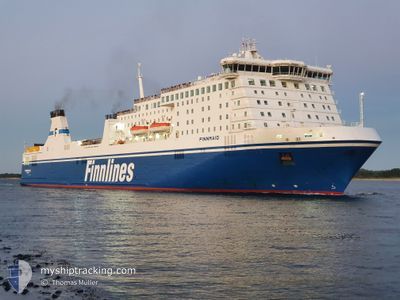
FINNMAID
Ro-Ro/Passenger Ship
Current Trip
| Time Travelled | 14 h, 4 mins |
|---|---|
| Remaining Time | 13 h, 52 mins |
| Distance Travelled | 304.18 nm |
| Remaining Distance | 320.26 nm |
| AVG Speed | 21.7 Knop |
| MAX Speed | 23 Knop |
| AVG Wind | 10 knots |
| MAX Wind | 20 knots |
| MIN Temp | 1.5°C / 34.7°F |
| MAX Temp | 4.4°C / 39.92°F |
| Djupgående | 7.1 m |
| Position mottagen | 1 h, 56 m sen |
Current Position
| Longitud | 17.00626° |
|---|---|
| Latitude | 56.34723° |
| Status | Under way using engine |
| Fart | 22.9 Knop |
| Kurs | 22.4° |
| Område | Baltic Sea |
| Station | T-AIS |
| Position mottagen | 1 h, 56 m sen |
Info
Information
The current position of FINNMAID is in Baltic Sea with coordinates 56.34723° / 17.00626° as reported on 2024-04-23 13:09 by AIS to our vessel tracker app. The vessel's current speed is 22.9 Knop and is heading at the port of VUOSAARI. The estimated time of arrival as calculated by MyShipTracking vessel tracking app is 2024-04-24 04:58 LT
The vessel FINNMAID (IMO: 9319466, MMSI: 230982000) is a Ro-Ro/Passenger Ship that was built in 2006 ( 18 År gammal ). It's sailing under the flag of [FI] Finland.
In this page you can find informations about the vessels current position, last detected port calls, and current voyage information. If the vessels is not in coverage by AIS you will find the latest position.
The current position of FINNMAID is detected by our AIS receivers and we are not responsible for the reliability of the data. The last position was recorded while the vessel was in Coverage by the Ais receivers of our vessel tracking app.
The current draught of FINNMAID as reported by AIS is 7.1 meters
Weather
| Temperature | 3.3°C / 37.94°F |
|---|---|
| Wind Speed | 20 knots |
| Direction | 208° SSW |
| Pressure | 1012.9 hPa |
| Humidity | 76.8 % |
| Cloud Coverage | 100 % |
Featured Company
Last Port Calls
| Port | Arrival | Departure | Time In Port |
|---|---|---|---|
| 2024-04-22 18:13 | 2024-04-23 01:02 | 6 h | |
| 2024-04-21 06:30 | 2024-04-21 13:14 | 6 h | |
| 2024-04-19 18:22 | 2024-04-20 02:04 | 7 h | |
| 2024-04-18 07:51 | 2024-04-18 14:16 | 6 h | |
| 2024-04-16 21:04 | 2024-04-17 04:10 | 7 h | |
| 2024-04-15 10:34 | 2024-04-15 17:36 | 7 h | |
| 2024-04-13 18:13 | 2024-04-14 07:05 | 12 h | |
| 2024-04-12 06:43 | 2024-04-12 12:37 | 5 h | |
| 2024-04-10 18:16 | 2024-04-11 01:25 | 7 h | |
| 2024-04-09 06:31 | 2024-04-09 12:22 | 5 h |
Most Visited Ports (Last year)
| Port | Arrivals | |
|---|---|---|
| 109 | ||
| 108 | ||
| 1 |
Last Trips
| Origin | Departure | Destination | Arrival | Distance | |
|---|---|---|---|---|---|
| 2024-04-21 16:14 | 2024-04-22 20:13 | 620.71 nm | |||
| 2024-04-20 04:04 | 2024-04-21 09:30 | 622.79 nm | |||
| 2024-04-18 17:16 | 2024-04-19 20:22 | 616.74 nm | |||
| 2024-04-17 06:10 | 2024-04-18 10:51 | 623.07 nm | |||
| 2024-04-15 20:36 | 2024-04-16 23:04 | 620.04 nm | |||
| 2024-04-14 09:05 | 2024-04-15 13:34 | 623.01 nm | |||
| 2024-04-12 15:37 | 2024-04-13 20:13 | 620.97 nm | |||
| 2024-04-11 03:25 | 2024-04-12 09:43 | 617.80 nm | |||
| 2024-04-09 15:22 | 2024-04-10 20:16 | 620.38 nm | |||
| 2024-04-08 02:13 | 2024-04-09 09:31 | 617.34 nm |
Events
| Tid | Event | Detaljer | Position / Dest | Information |
|---|---|---|---|---|
| 2024-04-23 13:16 | Status ändrad | Default Under way using engine |
56.39006 / 17.03797
FI HELSINKI
|
Fart: 22.9 kn Kurs: 22.4° |
| 2024-04-23 13:09 | UTANFÖR täckningsområde |
56.34723 / 17.00626
Baltic Sea
|
Fart: 22.9 kn Kurs: 22.4° |
|
| 2024-04-23 12:56 | Status ändrad | Under way using engine Default |
56.27186 / 16.95062
FI HELSINKI
|
Fart: 22.7 kn Kurs: 22° |
| 2024-04-23 12:28 | Status ändrad | Default Under way using engine |
56.11101 / 16.83316
FI HELSINKI
|
Fart: 22.3 kn Kurs: 41.2° |
| 2024-04-23 09:56 | Byter havsområde | Swedish part of the Baltic Sea Danish part of the Kattegat |
55.62410 / 15.39651
Baltic Sea
FI HELSINKI
|
Fart: 22.5 kn Kurs: 57.4° |
| 2024-04-23 07:14 | Byter havsområde | Danish part of the Kattegat Swedish part of the Baltic Sea |
54.99031 / 14.03921
Kattegat
FI HELSINKI
|
Fart: 22.5 kn Kurs: 56.8° |
| 2024-04-23 07:08 | Byter havsområde | Swedish part of the Baltic Sea German part of the Baltic Sea |
54.97510 / 13.97804
Baltic Sea
FI HELSINKI
|
Fart: 22.7 kn Kurs: 68.7° |
| 2024-04-23 01:02 | AVGÅTT HAMN |
|
53.96117 / 10.88908
FI HELSINKI
|
Fart: 7.2 kn Kurs: 61° |
| 2024-04-23 00:48 | STARTAR förflyttning |
53.94498 / 10.86195
[DE] TRAVEMUNDE
|
Fart: 3.5 kn Kurs: 354° |
|
| 2024-04-23 00:43 | Destination ändrad | FI HELSINKI DE TRAVEMUNDE |
53.94312 / 10.86150
[DE] TRAVEMUNDE
|
Fart: Kurs: 18° |