
FILIA
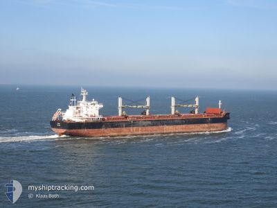
Bulk Carrier
Current Trip
| Time Travelled | 17 days |
|---|---|
| Remaining Time | --- |
| Distance Travelled | 4849.20 nm |
| Remaining Distance | --- |
| AVG Speed | 11.1 Knop |
| MAX Speed | 13.7 Knop |
| AVG Wind | 17.1 knots |
| MAX Wind | 30 knots |
| MIN Temp | 2.1°C / 35.78°F |
| MAX Temp | 26.2°C / 79.16°F |
| Djupgående | 11.1 m |
| Position mottagen | 7 d sen |
Current Position
| Longitud | -15.24773° |
|---|---|
| Latitude | 36.80943° |
| Status | Under way using engine |
| Fart | 12.2 Knop |
| Kurs | 207° |
| Område | North Atlantic Ocean |
| Station | T-AIS |
| Position mottagen | 7 d sen |
Info
Information
The current position of FILIA is in North Atlantic Ocean with coordinates 36.80943° / -15.24773° as reported on 2024-04-17 22:50 by AIS to our vessel tracker app. The vessel's current speed is 12.2 Knop and is heading at the port of ITAQUI. The estimated time of arrival as calculated by MyShipTracking vessel tracking app is 2024-04-27 20:00 LT
The vessel FILIA (IMO: 9490868, MMSI: 229396000) is a Bulk Carrier that was built in 2011 ( 13 År gammal ). It's sailing under the flag of [MT] Malta.
In this page you can find informations about the vessels current position, last detected port calls, and current voyage information. If the vessels is not in coverage by AIS you will find the latest position.
The current position of FILIA is detected by our AIS receivers and we are not responsible for the reliability of the data. The last position was recorded while the vessel was in Coverage by the Ais receivers of our vessel tracking app.
The current draught of FILIA as reported by AIS is 11.1 meters
Weather
| Temperature | 25.8°C / 78.44°F |
|---|---|
| Wind Speed | 12 knots |
| Direction | 48° NE |
| Pressure | 1011.4 hPa |
| Humidity | 74.6 % |
| Cloud Coverage | 100 % |
Featured Company
Last Port Calls
| Port | Arrival | Departure | Time In Port |
|---|---|---|---|
| 2024-03-30 03:04 | 2024-04-07 20:15 | 8 d | |
| 2024-03-22 06:44 | 2024-03-23 20:25 | 1 d | |
| 2024-03-14 23:59 | 2024-03-21 19:36 | 6 d |
Most Visited Ports (Last year)
| Port | Arrivals | |
|---|---|---|
| 3 | ||
| 2 | ||
| 2 | ||
| 1 | ||
| 1 | ||
| 1 |
Events
| Tid | Event | Detaljer | Position / Dest | Information |
|---|---|---|---|---|
| 2024-04-17 22:57 | Status ändrad | Default Under way using engine |
36.78756 / -15.26207
BR ITQ
|
Fart: 12.2 kn Kurs: 207° |
| 2024-04-17 22:50 | UTANFÖR täckningsområde |
36.80943 / -15.24773
North Atlantic Ocean
BR ITQ
|
Fart: 12.2 kn Kurs: 207° |
|
| 2024-04-17 22:47 | Status ändrad | Under way using engine Default |
36.81792 / -15.24220
BR ITQ
|
Fart: 11.9 kn Kurs: 207° |
| 2024-04-17 22:39 | I täckningsområde |
36.81145 / -15.24640
North Atlantic Ocean
BR ITQ
|
Fart: 12.2 kn Kurs: 207° |
|
| 2024-04-17 19:29 | Status ändrad | Default Under way using engine |
37.41340 / -14.86937
BR ITQ
|
Fart: 12 kn Kurs: 207° |
| 2024-04-17 19:26 | Status ändrad | Under way using engine Default |
37.42322 / -14.86313
BR ITQ
|
Fart: 11.9 kn Kurs: 206° |
| 2024-04-17 19:26 | UTANFÖR täckningsområde |
37.42322 / -14.86313
North Atlantic Ocean
BR ITQ
|
Fart: 12 kn Kurs: 207° |
|
| 2024-04-17 19:10 | Status ändrad | Default Under way using engine |
37.47010 / -14.83317
BR ITQ
|
Fart: 11.7 kn Kurs: 207° |
| 2024-04-17 18:57 | Status ändrad | Under way using engine Default |
37.50843 / -14.80832
BR ITQ
|
Fart: 11.7 kn Kurs: 208° |
| 2024-04-17 18:51 | Status ändrad | Default Under way using engine |
37.52483 / -14.79748
BR ITQ
|
Fart: 11.6 kn Kurs: 207° |