
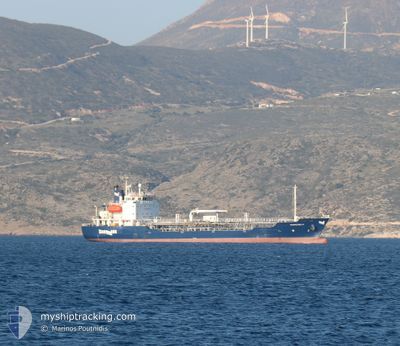
EVIAPETROL IV
Oil/Chemical Tanker
Current Trip
| Time Travelled | 2 days |
|---|---|
| Remaining Time | 6 h, 22 mins |
| Distance Travelled | 338.90 nm |
| Remaining Distance | 152.31 nm |
| AVG Speed | 12 Knop |
| MAX Speed | 13.6 Knop |
| AVG Wind | 9.7 knots |
| MAX Wind | 21 knots |
| MIN Temp | 11.3°C / 52.34°F |
| MAX Temp | 20.3°C / 68.54°F |
| Djupgående | 5 m |
| Position mottagen | 3 m sen |
Current Position
| Longitud | 26.09479° |
|---|---|
| Latitude | 38.56811° |
| Status | At anchor |
| Fart | 0.8 Knop |
| Kurs | 59° |
| Område | Aegean Sea |
| Station | T-AIS |
| Position mottagen | 3 m sen |
Info
Information
The current position of EVIAPETROL IV is in Aegean Sea with coordinates 38.56811° / 26.09479° as reported on 2024-04-20 02:37 by AIS to our vessel tracker app. The vessel's current speed is 0.8 Knop and is heading at the port of SANTORINI. The estimated time of arrival as calculated by MyShipTracking vessel tracking app is 2024-04-20 09:03 LT
The vessel EVIAPETROL IV (IMO: 9301689, MMSI: 241262000) is a Oil/Chemical Tanker that was built in 2005 ( 19 År gammal ). It's sailing under the flag of [GR] Greece.
In this page you can find informations about the vessels current position, last detected port calls, and current voyage information. If the vessels is not in coverage by AIS you will find the latest position.
The current position of EVIAPETROL IV is detected by our AIS receivers and we are not responsible for the reliability of the data. The last position was recorded while the vessel was in Coverage by the Ais receivers of our vessel tracking app.
The current draught of EVIAPETROL IV as reported by AIS is 5 meters
Weather
| Temperature | 11.8°C / 53.24°F |
|---|---|
| Wind Speed | 18 knots |
| Direction | 238° WSW |
| Pressure | 999.1 hPa |
| Humidity | 76.3 % |
| Cloud Coverage | 100 % |
Featured Company
Last Port Calls
| Port | Arrival | Departure | Time In Port |
|---|---|---|---|
| 2024-04-17 04:33 | 2024-04-17 16:25 | 11 h | |
| 2024-04-15 04:06 | 2024-04-15 11:07 | 7 h | |
| 2024-04-09 05:46 | 2024-04-09 14:15 | 8 h | |
| 2024-04-01 05:31 | 2024-04-02 05:35 | 1 d | |
| 2024-03-31 04:18 | 2024-03-31 14:10 | 9 h | |
| 2024-03-19 05:16 | 2024-03-19 13:45 | 8 h | |
| 2024-03-05 05:16 | 2024-03-05 14:04 | 8 h | |
| 2024-03-03 05:26 | 2024-03-04 09:07 | 1 d | |
| 2024-02-28 05:19 | 2024-02-28 14:09 | 8 h | |
| 2024-02-20 06:16 | 2024-02-20 15:52 | 9 h |
Last Trips
| Origin | Departure | Destination | Arrival | Distance | |
|---|---|---|---|---|---|
| 2024-04-15 14:07 | 2024-04-17 07:33 | 66.10 nm | |||
| 2024-04-09 17:15 | 2024-04-15 07:06 | 395.45 nm | |||
| 2024-04-02 08:35 | 2024-04-09 08:46 | 167.29 nm | |||
| 2024-03-31 17:10 | 2024-04-01 08:31 | 165.39 nm | |||
| 2024-03-19 15:45 | 2024-03-31 07:18 | 375.79 nm | |||
| 2024-03-05 16:04 | 2024-03-19 07:16 | 406.25 nm | |||
| 2024-03-04 11:07 | 2024-03-05 07:16 | 154.77 nm | |||
| 2024-02-28 16:09 | 2024-03-03 07:26 | 158.72 nm | |||
| 2024-02-20 17:52 | 2024-02-28 07:19 | 369.37 nm | |||
| 2024-02-03 08:16 | 2024-02-20 08:16 | 459.35 nm |
Events
| Tid | Event | Detaljer | Position / Dest | Information |
|---|---|---|---|---|
| 2024-04-20 02:37 | Status ändrad | At anchor Default |
38.56811 / 26.09479
THIRA
|
Fart: 0.2 kn Kurs: 116° |
| 2024-04-20 01:57 | Status ändrad | Default At anchor |
38.56926 / 26.09467
THIRA
|
Fart: 0.2 kn Kurs: 106° |
| 2024-04-20 01:19 | Status ändrad | At anchor Default |
38.56808 / 26.09490
THIRA
|
Fart: 0.1 kn Kurs: 32° |
| 2024-04-20 01:11 | Status ändrad | Default At anchor |
38.56792 / 26.09506
THIRA
|
Fart: 0.1 kn Kurs: 45° |
| 2024-04-20 00:43 | Status ändrad | At anchor Default |
38.56866 / 26.09447
THIRA
|
Fart: 0.5 kn Kurs: 44° |
| 2024-04-20 00:35 | I täckningsområde |
38.56866 / 26.09447
Aegean Sea
THIRA
|
Fart: 0.2 kn Kurs: 94° |
|
| 2024-04-19 21:27 | STOPPAR förflyttning | 1.55 nm, North West of KARDAMYLA |
38.56841 / 26.09663
THIRA
|
Fart: 0.2 kn Kurs: 332° |
| 2024-04-19 20:50 | Status ändrad | Default Under way using engine |
38.59481 / 26.09739
THIRA
|
Fart: 10.7 kn Kurs: 144.2° |
| 2024-04-19 20:37 | UTANFÖR täckningsområde |
38.62165 / 26.07655
Aegean Sea
THIRA
|
Fart: 10.7 kn Kurs: 144.2° |
|
| 2024-04-19 20:23 | Status ändrad | Under way using engine Default |
38.65323 / 26.04632
THIRA
|
Fart: 10.5 kn Kurs: 140° |