
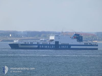
EUROCARGO BARI
Ro-Ro Cargo
Current Trip
| Time Travelled | 5 days |
|---|---|
| Remaining Time | --- |
| Distance Travelled | 2003.21 nm |
| Remaining Distance | 6.08 nm |
| AVG Speed | 19 Knop |
| MAX Speed | 22.6 Knop |
| AVG Wind | 13.4 knots |
| MAX Wind | 23 knots |
| MIN Temp | 9.6°C / 49.28°F |
| MAX Temp | 25.9°C / 78.62°F |
| Djupgående | 6.6 m |
| Position mottagen | 1 m sen |
Current Position
| Longitud | -97.81107° |
|---|---|
| Latitude | 22.56278° |
| Status | At anchor |
| Fart | 0.1 Knop |
| Kurs | 103° |
| Område | Gulf of Mexico |
| Station | T-AIS |
| Position mottagen | 1 m sen |
Info
Information
The current position of EUROCARGO BARI is in Gulf of Mexico with coordinates 22.56278° / -97.81107° as reported on 2024-04-18 23:59 by AIS to our vessel tracker app. The vessel's current speed is 0.1 Knop and is heading at the port of ALTAMIRA. The estimated time of arrival as calculated by MyShipTracking vessel tracking app is 2024-04-17 23:00 LT
The vessel EUROCARGO BARI (IMO: 9471082, MMSI: 247320400) is a Ro-Ro Cargo that was built in 2012 ( 12 År gammal ). It's sailing under the flag of [IT] Italy.
In this page you can find informations about the vessels current position, last detected port calls, and current voyage information. If the vessels is not in coverage by AIS you will find the latest position.
The current position of EUROCARGO BARI is detected by our AIS receivers and we are not responsible for the reliability of the data. The last position was recorded while the vessel was in Coverage by the Ais receivers of our vessel tracking app.
The current draught of EUROCARGO BARI as reported by AIS is 6.6 meters
Weather
| Temperature | 25.2°C / 77.36°F |
|---|---|
| Wind Speed | 11 knots |
| Direction | 119° ESE |
| Pressure | 1008.6 hPa |
| Humidity | 89.4 % |
| Cloud Coverage | 72 % |
Featured Company
Last Port Calls
| Port | Arrival | Departure | Time In Port |
|---|---|---|---|
| 2024-04-13 15:53 | 2024-04-13 23:29 | 7 h | |
| 2024-04-12 01:22 | 2024-04-12 23:09 | 21 h | |
| 2024-04-05 23:35 | 2024-04-06 10:42 | 11 h | |
| 2024-03-27 14:21 | 2024-03-28 12:20 | 21 h | |
| 2024-03-26 10:33 | 2024-03-26 19:16 | 8 h | |
| 2024-03-21 00:12 | 2024-03-21 10:46 | 10 h | |
| 2024-03-15 11:12 | 2024-03-15 19:38 | 8 h | |
| 2024-03-14 09:36 | 2024-03-14 22:00 | 12 h | |
| 2024-03-07 22:40 | 2024-03-08 18:41 | 20 h | |
| 2024-02-29 21:59 | 2024-03-01 21:20 | 23 h |
Most Visited Ports (Last year)
| Port | Arrivals | |
|---|---|---|
| 21 | ||
| 20 | ||
| 20 | ||
| 1 | ||
| 1 |
Last Trips
| Origin | Departure | Destination | Arrival | Distance | |
|---|---|---|---|---|---|
| 2024-04-12 19:09 | 2024-04-13 11:53 | 162.59 nm | |||
| 2024-04-06 04:42 | 2024-04-11 21:22 | 2107.68 nm | |||
| 2024-03-28 08:20 | 2024-04-05 17:35 | 2025.04 nm | |||
| 2024-03-26 15:16 | 2024-03-27 10:21 | 163.45 nm | |||
| 2024-03-21 04:46 | 2024-03-26 06:33 | 2166.80 nm | |||
| 2024-03-15 15:38 | 2024-03-20 18:12 | 1997.37 nm | |||
| 2024-03-14 18:00 | 2024-03-15 07:12 | 162.23 nm | |||
| 2024-03-08 12:41 | 2024-03-14 05:36 | 2168.88 nm | |||
| 2024-03-01 16:20 | 2024-03-07 16:40 | 2111.55 nm | |||
| 2024-02-27 19:27 | 2024-02-29 16:59 | 179.56 nm |
Events
| Tid | Event | Detaljer | Position / Dest | Information |
|---|---|---|---|---|
| 2024-04-18 01:58 | STOPPAR förflyttning | 5.99 nm, North East of ALTAMIRA |
22.56324 / -97.81076
US NYC > MX ATM
|
Fart: 0.1 kn Kurs: 124° |
| 2024-04-18 01:38 | Status ändrad | At anchor Under way using engine |
22.56153 / -97.80848
US NYC > MX ATM
|
Fart: 0.6 kn Kurs: 280° |
| 2024-04-18 00:17 | Byter havsområde | Mexican part of the Gulf of Mexico United States part of the North Atlantic Ocean |
22.53873 / -97.46896
Gulf of Mexico
US NYC > MX ATM
|
Fart: 20.4 kn Kurs: 259.8° |
| 2024-04-18 00:15 | Status ändrad | Under way using engine Default |
22.54065 / -97.45741
US NYC > MX ATM
|
Fart: 20 kn Kurs: 262° |
| 2024-04-18 00:07 | I täckningsområde |
22.53873 / -97.46896
Gulf of Mexico
US NYC > MX ATM
|
Fart: 20.4 kn Kurs: 259.8° |
|
| 2024-04-16 02:40 | Status ändrad | Default Under way using engine |
25.25500 / -80.07667
US NYC > MX ATM
|
Fart: 18 kn Kurs: 202.9° |
| 2024-04-16 02:36 | UTANFÖR täckningsområde |
25.27426 / -80.06911
North Atlantic Ocean
US NYC > MX ATM
|
Fart: 18 kn Kurs: 202.9° |
|
| 2024-04-16 02:32 | Status ändrad | Under way using engine Default |
25.28963 / -80.06215
US NYC > MX ATM
|
Fart: 17 kn Kurs: 199° |
| 2024-04-16 02:28 | Status ändrad | Default Under way using engine |
25.31167 / -80.05334
US NYC > MX ATM
|
Fart: 17.8 kn Kurs: 199.8° |
| 2024-04-15 20:51 | Status ändrad | Under way using engine Default |
27.06676 / -79.85600
US NYC > MX ATM
|
Fart: 18 kn Kurs: 205° |