
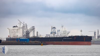
ESTEEM EXPLORER
Tanker
Current Trip
| Time Travelled | 16 days |
|---|---|
| Remaining Time | --- |
| Distance Travelled | 4246.76 nm |
| Remaining Distance | --- |
| AVG Speed | 12.7 Knop |
| MAX Speed | 16.3 Knop |
| AVG Wind | 13.5 knots |
| MAX Wind | 30 knots |
| MIN Temp | 16.4°C / 61.52°F |
| MAX Temp | 25.1°C / 77.18°F |
| Djupgående | 19.6 m |
| Position mottagen | 6 h, 57 m sen |
Current Position
| Longitud | -25.78169° |
|---|---|
| Latitude | 38.44602° |
| Status | Under way using engine |
| Fart | 12.8 Knop |
| Kurs | 49° |
| Område | North Atlantic Ocean |
| Station | T-AIS |
| Position mottagen | 6 h, 57 m sen |
Info
Information
The current position of ESTEEM EXPLORER is in North Atlantic Ocean with coordinates 38.44602° / -25.78169° as reported on 2024-04-18 22:10 by AIS to our vessel tracker app. The vessel's current speed is 12.8 Knop and is heading at the port of ROTTERDAM. The estimated time of arrival as calculated by MyShipTracking vessel tracking app is 2024-04-23 19:00 LT
The vessel ESTEEM EXPLORER (IMO: 9855484, MMSI: 355051000) is a Tanker It's sailing under the flag of [PA] Panama.
In this page you can find informations about the vessels current position, last detected port calls, and current voyage information. If the vessels is not in coverage by AIS you will find the latest position.
The current position of ESTEEM EXPLORER is detected by our AIS receivers and we are not responsible for the reliability of the data. The last position was recorded while the vessel was in Coverage by the Ais receivers of our vessel tracking app.
The current draught of ESTEEM EXPLORER as reported by AIS is 19.6 meters
Weather
| Temperature | 16.4°C / 61.52°F |
|---|---|
| Wind Speed | 7 knots |
| Direction | 210° SSW |
| Pressure | 1013.7 hPa |
| Humidity | 87.8 % |
| Cloud Coverage | 9 % |
Featured Company
Last Port Calls
| Port | Arrival | Departure | Time In Port |
|---|---|---|---|
| 2024-03-31 18:26 | 2024-04-02 14:19 | 1 d | |
| 2024-02-23 09:46 | 2024-02-25 01:16 | 1 d | |
| 2024-02-18 12:20 | 2024-02-19 19:10 | 1 d |
Most Visited Ports (Last year)
| Port | Arrivals | |
|---|---|---|
| 2 | ||
| 1 | ||
| 1 |
Last Trips
| Origin | Departure | Destination | Arrival | Distance | |
|---|---|---|---|---|---|
| 2024-02-25 02:16 | 2024-03-31 13:26 | 5889.77 nm | |||
| 2024-02-19 20:10 | 2024-02-23 10:46 | 376.09 nm | |||
| 2024-01-22 09:19 | 2024-02-18 13:20 | 5976.83 nm |
Events
| Tid | Event | Detaljer | Position / Dest | Information |
|---|---|---|---|---|
| 2024-04-18 22:36 | Status ändrad | Default Under way using engine |
38.51091 / -25.69089
NL RTM
|
Fart: 12.8 kn Kurs: 49° |
| 2024-04-18 22:10 | UTANFÖR täckningsområde |
38.44602 / -25.78169
North Atlantic Ocean
NL RTM
|
Fart: 12.8 kn Kurs: 49° |
|
| 2024-04-18 19:42 | Status ändrad | Under way using engine Default |
38.10356 / -26.29600
NL RTM
|
Fart: 13.3 kn Kurs: 68° |
| 2024-04-18 19:42 | I täckningsområde |
38.10382 / -26.29530
North Atlantic Ocean
NL RTM
|
Fart: 12.9 kn Kurs: 66.4° |
|
| 2024-04-18 17:34 | Status ändrad | Default Under way using engine |
37.93100 / -26.84275
NL RTM
|
Fart: 13.2 kn Kurs: 68.5° |
| 2024-04-18 17:21 | UTANFÖR täckningsområde |
37.91401 / -26.89864
North Atlantic Ocean
NL RTM
|
Fart: 13.2 kn Kurs: 68.5° |
|
| 2024-04-18 08:37 | ETA ändrat | 2024/04/23 19:00 2024/04/23 21:00 |
37.19911 / -29.23739
NL RTM
|
Fart: 13.7 kn Kurs: 68.8° |
| 2024-04-18 08:03 | Status ändrad | Under way using engine Default |
37.14963 / -29.38256
NL RTM
|
Fart: 13.4 kn Kurs: 71° |
| 2024-04-18 07:44 | Status ändrad | Default Under way using engine |
37.12217 / -29.46687
NL RTM
|
Fart: 13.4 kn Kurs: 70.9° |
| 2024-04-18 07:40 | Status ändrad | Under way using engine Default |
37.11738 / -29.48385
NL RTM
|
Fart: 13.4 kn Kurs: 71° |