
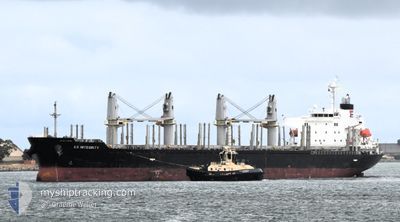
ES INTEGRITY
Cargo
Current Trip
| Time Travelled | 13 days |
|---|---|
| Remaining Time | --- |
| Distance Travelled | 3215.10 nm |
| Remaining Distance | --- |
| AVG Speed | 10.1 Knop |
| MAX Speed | 16.7 Knop |
| AVG Wind | 12.5 knots |
| MAX Wind | 26.1 knots |
| MIN Temp | -3.5°C / 25.7°F |
| MAX Temp | 18.3°C / 64.94°F |
| Djupgående | 9.8 m |
| Position mottagen | 1 m sen |
Current Position
| Longitud | -5.35996° |
|---|---|
| Latitude | 36.11134° |
| Status | Under way using engine |
| Fart | 5.2 Knop |
| Kurs | 178.2° |
| Område | Strait of Gibraltar |
| Station | T-AIS |
| Position mottagen | 1 m sen |
Info
Information
The current position of ES INTEGRITY is in Strait of Gibraltar with coordinates 36.11134° / -5.35996° as reported on 2024-04-23 08:56 by AIS to our vessel tracker app. The vessel's current speed is 5.2 Knop
The vessel ES INTEGRITY (IMO: 9736963, MMSI: 371608000) is a Cargo It's sailing under the flag of [PA] Panama.
In this page you can find informations about the vessels current position, last detected port calls, and current voyage information. If the vessels is not in coverage by AIS you will find the latest position.
The current position of ES INTEGRITY is detected by our AIS receivers and we are not responsible for the reliability of the data. The last position was recorded while the vessel was in Coverage by the Ais receivers of our vessel tracking app.
The current draught of ES INTEGRITY as reported by AIS is 9.8 meters
Weather
| Temperature | 16.6°C / 61.88°F |
|---|---|
| Wind Speed | 10 knots |
| Direction | 88° E |
| Pressure | 1015.5 hPa |
| Humidity | 83.4 % |
| Cloud Coverage | 12 % |
Featured Company
Most Visited Ports (Last year)
| Port | Arrivals | |
|---|---|---|
| 2 | ||
| 1 | ||
| 1 | ||
| 1 | ||
| 1 | ||
| 1 |
Events
| Tid | Event | Detaljer | Position / Dest | Information |
|---|---|---|---|---|
| 2024-04-23 08:50 | STARTAR förflyttning | 1.71 nm, South of GIBRALTAR |
36.11908 / -5.36019
CASABLANCA
|
Fart: 3.1 kn Kurs: 180° |
| 2024-04-23 08:45 | Destination ändrad | CASABLANCA GIBRALTAR |
36.12176 / -5.36045
CASABLANCA
|
Fart: 1.2 kn Kurs: 172° |
| 2024-04-23 08:45 | ETA ändrat | 2024/04/24 19:00 2024/04/22 23:00 |
36.12176 / -5.36045
CASABLANCA
|
Fart: 1.2 kn Kurs: 172° |
| 2024-04-23 08:40 | Status ändrad | Under way using engine At anchor |
36.12190 / -5.36126
GIBRALTAR
|
Fart: 0.3 kn Kurs: 147° |
| 2024-04-22 21:46 | STOPPAR förflyttning | 1.47 nm, South of GIBRALTAR |
36.12299 / -5.36185
GIBRALTAR
|
Fart: 0.3 kn Kurs: 153° |
| 2024-04-22 21:37 | Status ändrad | At anchor Under way using engine |
36.12189 / -5.36247
GIBRALTAR
|
Fart: 0.9 kn Kurs: 90° |
| 2024-04-22 20:38 | Byter havsområde | Gibraltarian part of the Strait of Gibraltar Spanish part of the Strait of Gibraltar |
36.05296 / -5.35580
Strait of Gibraltar
GIBRALTAR
|
Fart: 7 kn Kurs: 356.2° |
| 2024-04-22 20:05 | Byter havsområde | Spanish part of the Strait of Gibraltar Moroccan part of the Strait of Gibraltar |
35.99081 / -5.37346
Strait of Gibraltar
GIBRALTAR
|
Fart: 7.2 kn Kurs: 54.6° |
| 2024-04-22 18:41 | Status ändrad | Under way using engine Default |
35.90779 / -5.69538
GIBRALTAR
|
Fart: 12.8 kn Kurs: 85° |
| 2024-04-22 18:34 | Status ändrad | Default Under way using engine |
35.90585 / -5.72454
GIBRALTAR
|
Fart: 12.3 kn Kurs: 85° |