
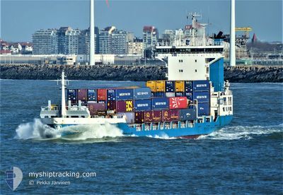
ELISABETH
Container Ship
Current Trip
| Time Travelled | 12 h, 1 mins |
|---|---|
| Remaining Time | 10 h, 59 mins |
| Distance Travelled | 153.50 nm |
| Remaining Distance | 165.57 nm |
| AVG Speed | 13.2 Knop |
| MAX Speed | 15.1 Knop |
| AVG Wind | 9.3 knots |
| MAX Wind | 13.8 knots |
| MIN Temp | -0.1°C / 31.82°F |
| MAX Temp | 6.3°C / 43.34°F |
| Djupgående | 7.2 m |
| Position mottagen | Nu |
Current Position
| Longitud | 11.95138° |
|---|---|
| Latitude | 54.44342° |
| Status | Under way using engine |
| Fart | 14.2 Knop |
| Kurs | 269.5° |
| Område | Baltic Sea |
| Station | T-AIS |
| Position mottagen | Nu |
Info
Information
The current position of ELISABETH is in Baltic Sea with coordinates 54.44342° / 11.95138° as reported on 2024-04-24 12:29 by AIS to our vessel tracker app. The vessel's current speed is 14.2 Knop and is heading at the port of HAMBURG. The estimated time of arrival as calculated by MyShipTracking vessel tracking app is 2024-04-24 23:29 LT
The vessel ELISABETH (IMO: 9219862, MMSI: 246497000) is a Container Ship that was built in 2000 ( 24 År gammal ). It's sailing under the flag of [NL] Netherlands.
In this page you can find informations about the vessels current position, last detected port calls, and current voyage information. If the vessels is not in coverage by AIS you will find the latest position.
The current position of ELISABETH is detected by our AIS receivers and we are not responsible for the reliability of the data. The last position was recorded while the vessel was in Coverage by the Ais receivers of our vessel tracking app.
The current draught of ELISABETH as reported by AIS is 7.2 meters
Weather
| Temperature | 4.8°C / 40.64°F |
|---|---|
| Wind Speed | 10 knots |
| Direction | 136° SE |
| Pressure | 1006.4 hPa |
| Humidity | 90.2 % |
| Cloud Coverage | 100 % |
Featured Company
Last Port Calls
| Port | Arrival | Departure | Time In Port |
|---|---|---|---|
| 2024-04-23 09:20 | 2024-04-24 00:29 | 15 h | |
| 2024-04-22 03:38 | 2024-04-22 19:06 | 15 h | |
| 2024-04-20 18:29 | 2024-04-21 12:21 | 17 h | |
| 2024-04-18 11:37 | 2024-04-19 09:51 | 22 h | |
| 2024-04-17 17:28 | 2024-04-18 01:52 | 8 h | |
| 2024-04-15 23:52 | 2024-04-16 13:07 | 13 h | |
| 2024-04-14 06:47 | 2024-04-15 01:56 | 19 h | |
| 2024-04-12 01:45 | 2024-04-13 00:36 | 22 h | |
| 2024-04-11 05:52 | 2024-04-11 17:47 | 11 h | |
| 2024-04-10 14:05 | 2024-04-10 14:43 | 37 m |
Most Visited Ports (Last year)
| Port | Arrivals | |
|---|---|---|
| 57 | ||
| 36 | ||
| 29 | ||
| 29 | ||
| 28 | ||
| 28 |
Last Trips
| Origin | Departure | Destination | Arrival | Distance | |
|---|---|---|---|---|---|
| 2024-04-22 21:06 | 2024-04-23 11:20 | 183.70 nm | |||
| 2024-04-21 14:21 | 2024-04-22 05:38 | 180.31 nm | |||
| 2024-04-19 11:51 | 2024-04-20 20:29 | 305.14 nm | |||
| 2024-04-18 03:52 | 2024-04-18 13:37 | 114.14 nm | |||
| 2024-04-16 15:07 | 2024-04-17 19:28 | 312.81 nm | |||
| 2024-04-15 03:56 | 2024-04-16 01:52 | 180.13 nm | |||
| 2024-04-13 02:36 | 2024-04-14 08:47 | 311.44 nm | |||
| 2024-04-11 19:47 | 2024-04-12 03:45 | 113.10 nm | |||
| 2024-04-10 16:43 | 2024-04-11 07:52 | 131.11 nm | |||
| 2024-04-09 21:52 | 2024-04-10 16:05 | 224.15 nm |
Events
| Tid | Event | Detaljer | Position / Dest | Information |
|---|---|---|---|---|
| 2024-04-24 10:46 | Byter havsområde | Danish part of the Baltic Sea German part of the Baltic Sea |
54.67816 / 12.42906
Baltic Sea
DEHAM
|
Fart: 13.9 kn Kurs: 234.8° |
| 2024-04-24 10:41 | Upptäckt i hav | German part of the Baltic Sea |
54.69115 / 12.46067
Baltic Sea
DEHAM
|
Fart: 13.9 kn Kurs: 235.2° |
| 2024-04-24 09:44 | Byter havsområde | Danish part of the Baltic Sea German part of the Baltic Sea |
54.78465 / 12.79593
Baltic Sea
DEHAM
|
Fart: 14.4 kn Kurs: 273.1° |
| 2024-04-24 08:42 | Status ändrad | Under way using engine Default |
54.77196 / 13.23176
DEHAM
|
Fart: 15.2 kn Kurs: 272° |
| 2024-04-24 08:25 | I täckningsområde |
54.77215 / 13.22447
Baltic Sea
DEHAM
|
Fart: 15.2 kn Kurs: 272.5° |
|
| 2024-04-24 07:06 | Status ändrad | Default Under way using engine |
54.58963 / 13.73366
DEHAM
|
Fart: 14.6 kn Kurs: 330.9° |
| 2024-04-24 06:58 | Status ändrad | Under way using engine Default |
54.56304 / 13.75898
DEHAM
|
Fart: 14.6 kn Kurs: 332° |
| 2024-04-24 06:58 | UTANFÖR täckningsområde |
54.56304 / 13.75898
Baltic Sea
DEHAM
|
Fart: 14.6 kn Kurs: 330.9° |
|
| 2024-04-24 06:11 | Status ändrad | Default Under way using engine |
54.39582 / 13.91860
DEHAM
|
Fart: 14.6 kn Kurs: 331° |
| 2024-04-24 06:06 | Status ändrad | Under way using engine Default |
54.37587 / 13.93775
DEHAM
|
Fart: 14 kn Kurs: 309° |