
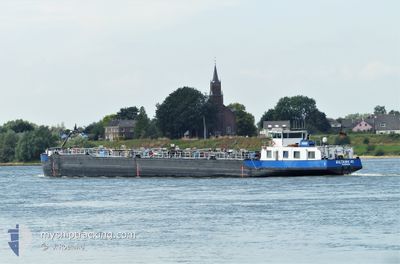
EILTANK45
Wing in ground
Current Trip
| Trip Time | 2 days |
|---|---|
| Trip Distance | 228.90 nm |
| AVG Speed | 5.2 Knop |
| MAX Speed | 6.8 Knop |
| Djupgående | 1.9 m |
| AVG Wind | 6 knots |
| MAX Wind | 12 knots |
| MIN Temp | -2°C / 28.4°F |
| MAX Temp | 11.1°C / 51.98°F |
| Position mottagen | 2 m sen |
Current Position
| Longitud | 8.33892° |
|---|---|
| Latitude | 49.07397° |
| Status | Under way using engine |
| Fart | |
| Kurs | --- |
| Område | North Sea |
| Station | T-AIS |
| Position mottagen | 2 m sen |
Info
Information
The current position of EILTANK45 is in North Sea with coordinates 49.07397° / 8.33892° as reported on 2024-04-23 07:16 by AIS to our vessel tracker app. The vessel's current speed is 0 Knop and is currently inside the port of KARLSRUHE.
The vessel EILTANK45 (MMSI: 211496390) is a Wing in ground It's sailing under the flag of [DE] Germany.
In this page you can find informations about the vessels current position, last detected port calls, and current voyage information. If the vessels is not in coverage by AIS you will find the latest position.
The current position of EILTANK45 is detected by our AIS receivers and we are not responsible for the reliability of the data. The last position was recorded while the vessel was in Coverage by the Ais receivers of our vessel tracking app.
The current draught of EILTANK45 as reported by AIS is 1.9 meters
Weather
| Temperature | 3.9°C / 39.02°F |
|---|---|
| Wind Speed | 7 knots |
| Direction | 43° NE |
| Pressure | 1019.8 hPa |
| Humidity | 61.4 % |
| Cloud Coverage | 6 % |
Featured Company
Last Port Calls
| Port | Arrival | Departure | Time In Port |
|---|---|---|---|
| 2024-04-23 05:11 | |||
| 2024-04-21 02:35 | 2024-04-21 03:28 | 53 m | |
| 2024-04-18 19:59 | 2024-04-20 17:00 | 1 d | |
| 2024-04-18 19:19 | 2024-04-18 19:53 | 34 m | |
| 2024-04-14 13:40 | 2024-04-18 06:44 | 3 d | |
| 2024-04-11 17:19 | 2024-04-12 03:17 | 9 h | |
| 2024-04-10 16:56 | 2024-04-11 16:08 | 23 h | |
| 2024-04-04 07:15 | 2024-04-07 06:51 | 2 d | |
| 2024-04-02 12:27 | 2024-04-03 00:44 | 12 h | |
| 2024-03-30 11:17 | 2024-03-30 11:45 | 27 m |
Last Trips
| Origin | Departure | Destination | Arrival | Distance | |
|---|---|---|---|---|---|
| 2024-04-21 05:28 | 2024-04-23 07:11 | 228.90 nm | |||
| 2024-04-20 19:00 | 2024-04-21 04:35 | 71.55 nm | |||
| 2024-04-18 21:53 | 2024-04-18 21:59 | 0.60 nm | |||
| 2024-04-18 08:44 | 2024-04-18 21:19 | 96.38 nm | |||
| 2024-04-12 05:17 | 2024-04-14 15:40 | 289.36 nm | |||
| 2024-04-11 18:08 | 2024-04-11 19:19 | 3.68 nm | |||
| 2024-04-07 08:51 | 2024-04-10 18:56 | 296.35 nm | |||
| 2024-04-03 02:44 | 2024-04-04 09:15 | 125.74 nm | |||
| 2024-03-30 12:45 | 2024-04-02 14:27 | 130.56 nm | |||
| 2024-03-30 08:15 | 2024-03-30 12:17 | 45.49 nm |
Events
| Tid | Event | Detaljer | Position / Dest | Information |
|---|---|---|---|---|
| 2024-04-23 05:17 | STOPPAR förflyttning |
49.07389 / 8.33927
[DE] KARLSRUHE
|
Fart: 0.3 kn Kurs: 511° |
|
| 2024-04-23 05:11 | ANLÄNDER HAMN |
|
49.07814 / 8.34031
[DE] KARLSRUHE
|
Fart: 4.5 kn Kurs: 184.9° |
| 2024-04-23 02:39 | I täckningsområde |
49.25544 / 8.42786
North Sea
|
Fart: 5.1 kn Kurs: 236.8° |
|
| 2024-04-23 01:06 | UTANFÖR täckningsområde |
49.34671 / 8.48191
North Sea
|
Fart: 5.4 kn Kurs: 215.4° |
|
| 2024-04-22 22:36 | I täckningsområde |
49.53313 / 8.42664
North Sea
|
Fart: 6.2 kn Kurs: 163.2° |
|
| 2024-04-22 19:56 | UTANFÖR täckningsområde |
49.73844 / 8.45171
North Sea
|
Fart: 5.7 kn Kurs: 198.1° |
|
| 2024-04-22 19:21 | I täckningsområde |
49.76741 / 8.45484
North Sea
|
Fart: 5.8 kn Kurs: 76.3° |
|
| 2024-04-22 16:48 | UTANFÖR täckningsområde |
49.97924 / 8.31394
North Sea
|
Fart: 6.4 kn Kurs: 137.1° |
|
| 2024-04-22 15:27 | I täckningsområde |
50.02350 / 8.13105
North Sea
|
Fart: 6.1 kn Kurs: 78.7° |
|
| 2024-04-22 03:35 | UTANFÖR täckningsområde |
50.50171 / 7.31273
North Sea
|
Fart: 5.4 kn Kurs: 142.5° |