
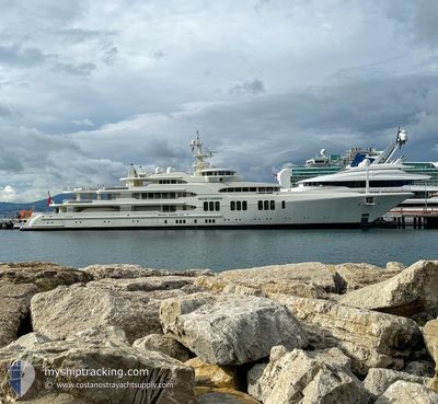
ECSTASEA
Yacht
Current Trip
LAST UPDATE TIME
| Time Travelled | 3 days |
|---|---|
| Remaining Time | --- |
| Distance Travelled | 6.35 nm |
| Remaining Distance | --- |
| AVG Speed | 16.8 Knop |
| MAX Speed | 16.8 Knop |
| AVG Wind | 2.1 knots |
| MAX Wind | 2.4 knots |
| MIN Temp | 25°C / 77°F |
| MAX Temp | 25.1°C / 77.18°F |
| Djupgående | 3.8 m |
| Position mottagen | 3 d sen |
Current Position
| Longitud | -79.93717° |
|---|---|
| Latitude | 26.84611° |
| Status | Under way using engine |
| Fart | 16.8 Knop |
| Kurs | 47° |
| Område | North Atlantic Ocean |
| Station | T-AIS |
| Position mottagen | 3 d sen |
Info
Information
The current position of ECSTASEA is in North Atlantic Ocean with coordinates 26.84611° / -79.93717° as reported on 2024-04-12 23:20 by AIS to our vessel tracker app. The vessel's current speed is 16.8 Knop
The vessel ECSTASEA (IMO: 1008102, MMSI: 319009900) is a Yacht that was built in 2004 ( 20 År gammal ). It's sailing under the flag of [KY] Cayman Is.
In this page you can find informations about the vessels current position, last detected port calls, and current voyage information. If the vessels is not in coverage by AIS you will find the latest position.
The current position of ECSTASEA is detected by our AIS receivers and we are not responsible for the reliability of the data. The last position was recorded while the vessel was in Coverage by the Ais receivers of our vessel tracking app.
The current draught of ECSTASEA as reported by AIS is 3.8 meters
Weather
| Temperature | 25°C / 77°F |
|---|---|
| Wind Speed | 1 knots |
| Direction | 349° N |
| Pressure | 1019.6 hPa |
| Humidity | 37.9 % |
| Cloud Coverage | 8 % |
Featured Company
Last Port Calls
| Port | Arrival | Departure | Time In Port |
|---|---|---|---|
| 2024-04-10 16:31 | 2024-04-12 22:57 | 2 d |
Most Visited Ports (Last year)
| Port | Arrivals | |
|---|---|---|
| 10 | ||
| 2 | ||
| 2 | ||
| 1 | ||
| 1 | ||
| 1 |
Last Trips
| Origin | Departure | Destination | Arrival | Distance |
|---|
Events
| Tid | Event | Detaljer | Position / Dest | Information |
|---|---|---|---|---|
| 2024-04-12 23:20 | UTANFÖR täckningsområde |
26.84611 / -79.93717
North Atlantic Ocean
|
Fart: 16.8 kn Kurs: 47° |
|
| 2024-04-12 22:57 | AVGÅTT HAMN |
|
26.76710 / -80.01441
LAST UPDATE TIME
|
Fart: 9.4 kn Kurs: 66° |
| 2024-04-12 22:44 | STARTAR förflyttning |
26.76904 / -80.04772
[US] PALM BEACH
|
Fart: 5.1 kn Kurs: 89° |
|
| 2024-04-12 22:42 | Status ändrad | Under way using engine Moored |
26.76975 / -80.05068
[US] PALM BEACH
|
Fart: Kurs: 105° |
| 2024-04-12 16:24 | I täckningsområde |
26.77040 / -80.05266
North Atlantic Ocean
[US] PALM BEACH
|
Fart: Kurs: 212.3° |
|
| 2024-04-12 09:15 | UTANFÖR täckningsområde |
26.77083 / -80.05113
North Atlantic Ocean
[US] PALM BEACH
|
Fart: Kurs: 332.3° |
|
| 2024-04-12 07:51 | I täckningsområde |
26.77083 / -80.05114
North Atlantic Ocean
[US] PALM BEACH
|
Fart: Kurs: 358.3° |
|
| 2024-04-12 06:21 | UTANFÖR täckningsområde |
26.77083 / -80.05115
North Atlantic Ocean
[US] PALM BEACH
|
Fart: Kurs: 315.1° |
|
| 2024-04-12 04:51 | I täckningsområde |
26.77083 / -80.05115
North Atlantic Ocean
[US] PALM BEACH
|
Fart: Kurs: 8.8° |
|
| 2024-04-12 03:27 | UTANFÖR täckningsområde |
26.77083 / -80.05114
North Atlantic Ocean
[US] PALM BEACH
|
Fart: Kurs: 293.4° |