
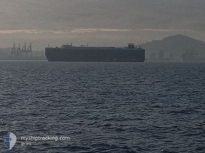
CRYSTAL RAY
Ro-Ro/Passenger Ship
Current Trip
LK HBA
| Time Travelled | 22 days |
|---|---|
| Remaining Time | --- |
| Distance Travelled | 8033.70 nm |
| Remaining Distance | --- |
| AVG Speed | 14.7 Knop |
| MAX Speed | 18.1 Knop |
| AVG Wind | 10.1 knots |
| MAX Wind | 28 knots |
| MIN Temp | 16.5°C / 61.7°F |
| MAX Temp | 29.9°C / 85.82°F |
| Djupgående | 9.2 m |
| Position mottagen | 9 d sen |
Current Position
| Longitud | 17.54473° |
|---|---|
| Latitude | -33.87587° |
| Status | Under way using engine |
| Fart | 15.1 Knop |
| Kurs | 322.4° |
| Område | South Atlantic Ocean |
| Station | T-AIS |
| Position mottagen | 9 d sen |
Info
Information
The current position of CRYSTAL RAY is in South Atlantic Ocean with coordinates -33.87587° / 17.54473° as reported on 2024-04-15 11:05 by AIS to our vessel tracker app. The vessel's current speed is 15.1 Knop
The vessel CRYSTAL RAY (IMO: 9210440, MMSI: 311039000) is a Ro-Ro/Passenger Ship that was built in 2000 ( 24 År gammal ). It's sailing under the flag of [BS] Bahamas.
In this page you can find informations about the vessels current position, last detected port calls, and current voyage information. If the vessels is not in coverage by AIS you will find the latest position.
The current position of CRYSTAL RAY is detected by our AIS receivers and we are not responsible for the reliability of the data. The last position was recorded while the vessel was in Coverage by the Ais receivers of our vessel tracking app.
The current draught of CRYSTAL RAY as reported by AIS is 9.2 meters
Weather
| Temperature | 22.8°C / 73.04°F |
|---|---|
| Wind Speed | 15 knots |
| Direction | 342° NNW |
| Pressure | 1011.2 hPa |
| Humidity | 83.5 % |
| Cloud Coverage | 27 % |
Featured Company
Last Port Calls
| Port | Arrival | Departure | Time In Port |
|---|---|---|---|
| 2024-04-02 02:24 | 2024-04-02 11:25 | 9 h | |
| 2024-03-27 23:22 | 2024-03-28 19:59 | 20 h | |
| 2024-03-19 08:41 | 2024-03-19 08:45 | 3 m | |
| 2024-03-13 21:58 | 2024-03-16 04:33 | 2 d | |
| 2024-02-05 01:27 | |||
| 2024-02-01 18:06 | 2024-02-02 08:57 | 14 h |
Most Visited Ports (Last year)
| Port | Arrivals | |
|---|---|---|
| 4 | ||
| 3 | ||
| 3 | ||
| 3 | ||
| 2 | ||
| 2 |
Last Trips
| Origin | Departure | Destination | Arrival | Distance | |
|---|---|---|---|---|---|
| 2024-03-29 03:59 | 2024-04-02 07:54 | 1472.41 nm | |||
| 2024-03-19 17:45 | 2024-03-28 07:22 | 2764.98 nm | |||
| 2024-03-16 13:33 | 2024-03-19 17:41 | 493.11 nm | |||
| 2024-02-04 20:27 | 2024-03-14 06:58 | 10710.41 nm | |||
| 2024-01-04 23:00 | 2024-02-01 13:06 | 10696.17 nm |
Events
| Tid | Event | Detaljer | Position / Dest | Information |
|---|---|---|---|---|
| 2024-04-15 11:10 | Status ändrad | Default Under way using engine |
-33.85768 / 17.52793
LK HBA
|
Fart: 15.1 kn Kurs: 322.4° |
| 2024-04-15 11:05 | I täckningsområde |
-33.87587 / 17.54473
South Atlantic Ocean
|
Fart: 15.1 kn Kurs: 322.4° |
|
| 2024-04-15 11:05 | UTANFÖR täckningsområde |
-33.87587 / 17.54473
South Atlantic Ocean
|
Fart: 15.1 kn Kurs: 322.4° |
|
| 2024-04-15 11:02 | Status ändrad | Under way using engine Default |
-33.88566 / 17.55369
LK HBA
|
Fart: 15 kn Kurs: 323° |
| 2024-04-15 08:52 | Status ändrad | Default Under way using engine |
-34.31695 / 17.94477
LK HBA
|
Fart: 15.3 kn Kurs: 324.5° |
| 2024-04-15 08:46 | UTANFÖR täckningsområde |
-34.33899 / 17.96394
South Atlantic Ocean
|
Fart: 15.3 kn Kurs: 324.5° |
|
| 2024-04-15 08:46 | Status ändrad | Under way using engine Default |
-34.33968 / 17.96455
LK HBA
|
Fart: 15.1 kn Kurs: 325° |
| 2024-04-15 08:46 | I täckningsområde |
-34.33899 / 17.96394
South Atlantic Ocean
|
Fart: 15.3 kn Kurs: 324.5° |
|
| 2024-04-15 07:44 | Status ändrad | Default Under way using engine |
-34.54681 / 18.18453
LK HBA
|
Fart: 16.6 kn Kurs: 294° |
| 2024-04-15 07:39 | UTANFÖR täckningsområde |
-34.55541 / 18.20766
South Atlantic Ocean
|
Fart: 16.6 kn Kurs: 294° |