
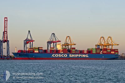
COSCO SHIPPING ANDES
Cargo A
Current Trip
| Time Travelled | 6 days |
|---|---|
| Remaining Time | --- |
| Distance Travelled | 2689.18 nm |
| Remaining Distance | --- |
| AVG Speed | 17.1 Knop |
| MAX Speed | 18.8 Knop |
| AVG Wind | 11.4 knots |
| MAX Wind | 20 knots |
| MIN Temp | 14.4°C / 57.92°F |
| MAX Temp | 24.2°C / 75.56°F |
| Djupgående | 12.4 m |
| Position mottagen | 40 m sen |
Current Position
| Longitud | -17.51308° |
|---|---|
| Latitude | 11.92697° |
| Status | Under way using engine |
| Fart | 17.7 Knop |
| Kurs | 170.4° |
| Område | North Atlantic Ocean |
| Station | T-AIS |
| Position mottagen | 40 m sen |
Info
Information
The current position of COSCO SHIPPING ANDES is in North Atlantic Ocean with coordinates 11.92697° / -17.51308° as reported on 2024-04-19 03:25 by AIS to our vessel tracker app. The vessel's current speed is 17.7 Knop and is heading at the port of PORT KLANG. The estimated time of arrival as calculated by MyShipTracking vessel tracking app is 2024-05-10 22:00 LT
The vessel COSCO SHIPPING ANDES (IMO: 9757888, MMSI: 477194600) is a Cargo A It's sailing under the flag of [HK] Hong Kong.
In this page you can find informations about the vessels current position, last detected port calls, and current voyage information. If the vessels is not in coverage by AIS you will find the latest position.
The current position of COSCO SHIPPING ANDES is detected by our AIS receivers and we are not responsible for the reliability of the data. The last position was recorded while the vessel was in Coverage by the Ais receivers of our vessel tracking app.
The current draught of COSCO SHIPPING ANDES as reported by AIS is 12.4 meters
Weather
| Temperature | 23.7°C / 74.66°F |
|---|---|
| Wind Speed | 11 knots |
| Direction | 328° NNW |
| Pressure | 1008.1 hPa |
| Humidity | 78.6 % |
| Cloud Coverage | 74 % |
Featured Company
Last Port Calls
| Port | Arrival | Departure | Time In Port |
|---|---|---|---|
| 2024-04-10 10:46 | 2024-04-12 16:44 | 2 d | |
| 2024-04-06 13:43 | 2024-04-08 17:40 | 2 d | |
| 2024-04-04 05:43 | 2024-04-05 17:31 | 1 d | |
| 2024-04-01 23:52 | 2024-04-03 03:25 | 1 d | |
| 2024-03-29 20:03 | 2024-03-31 06:02 | 1 d | |
| 2024-03-01 09:11 | 2024-03-02 05:23 | 20 h | |
| 2024-02-25 16:42 | 2024-02-26 03:27 | 10 h | |
| 2024-02-24 14:50 | 2024-02-25 04:56 | 14 h | |
| 2024-02-20 02:49 | 2024-02-20 17:59 | 15 h | |
| 2024-02-16 07:02 | 2024-02-17 10:39 | 1 d |
Most Visited Ports (Last year)
| Port | Arrivals | |
|---|---|---|
| 5 | ||
| 5 | ||
| 5 | ||
| 3 | ||
| 3 | ||
| 3 |
Last Trips
| Origin | Departure | Destination | Arrival | Distance | |
|---|---|---|---|---|---|
| 2024-04-08 19:40 | 2024-04-10 12:46 | 628.15 nm | |||
| 2024-04-05 19:31 | 2024-04-06 15:43 | 219.40 nm | |||
| 2024-04-03 05:25 | 2024-04-04 07:43 | 201.69 nm | |||
| 2024-03-31 08:02 | 2024-04-02 01:52 | 220.49 nm | |||
| 2024-03-02 13:23 | 2024-03-29 21:03 | 11144.18 nm | |||
| 2024-02-26 11:27 | 2024-03-01 17:11 | 1469.56 nm | |||
| 2024-02-25 12:56 | 2024-02-26 00:42 | 114.26 nm | |||
| 2024-02-21 01:59 | 2024-02-24 22:50 | 1018.81 nm | |||
| 2024-02-17 19:39 | 2024-02-20 10:49 | 493.32 nm | |||
| 2024-02-13 02:30 | 2024-02-16 16:02 | 530.64 nm |
Events
| Tid | Event | Detaljer | Position / Dest | Information |
|---|---|---|---|---|
| 2024-04-19 03:23 | Status ändrad | Under way using engine Default |
11.93372 / -17.51424
MY PKG
|
Fart: 17.7 kn Kurs: 171° |
| 2024-04-19 03:20 | Status ändrad | Default Under way using engine |
11.95136 / -17.51728
MY PKG
|
Fart: 17.6 kn Kurs: 169.9° |
| 2024-04-19 02:00 | Status ändrad | Under way using engine Default |
12.33771 / -17.58472
MY PKG
|
Fart: 17.4 kn Kurs: 172° |
| 2024-04-19 01:57 | Status ändrad | Default Under way using engine |
12.34974 / -17.58663
MY PKG
|
Fart: 17.3 kn Kurs: 170.4° |
| 2024-04-18 23:32 | Byter havsområde | Senegalese part of the North Atlantic Ocean Gambian part of the North Atlantic Ocean |
13.05585 / -17.70101
North Atlantic Ocean
MY PKG
|
Fart: 17.9 kn Kurs: 171.5° |
| 2024-04-18 23:18 | Status ändrad | Under way using engine Default |
13.12475 / -17.71012
MY PKG
|
Fart: 18 kn Kurs: 173° |
| 2024-04-18 23:11 | Status ändrad | Default Under way using engine |
13.15971 / -17.71429
MY PKG
|
Fart: 18 kn Kurs: 169.2° |
| 2024-04-18 22:49 | Status ändrad | Under way using engine Default |
13.26712 / -17.72952
MY PKG
|
Fart: 17.9 kn Kurs: 170° |
| 2024-04-18 22:41 | Status ändrad | Default Under way using engine |
13.30728 / -17.73612
MY PKG
|
Fart: 17.9 kn Kurs: 171.8° |
| 2024-04-18 21:43 | Byter havsområde | Gambian part of the North Atlantic Ocean Senegalese part of the North Atlantic Ocean |
13.59111 / -17.77907
North Atlantic Ocean
MY PKG
|
Fart: 17.7 kn Kurs: 171.6° |