
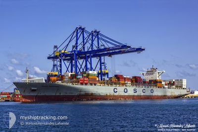
COSCO PHILIPPINES
Container Ship
Current Trip
| Time Travelled | 7 days |
|---|---|
| Remaining Time | 6 days |
| Distance Travelled | 3024.88 nm |
| Remaining Distance | 2743.65 nm |
| AVG Speed | 17.9 Knop |
| MAX Speed | 21.4 Knop |
| AVG Wind | 11.8 knots |
| MAX Wind | 25 knots |
| MIN Temp | 2.3°C / 36.14°F |
| MAX Temp | 19.2°C / 66.56°F |
| Djupgående | 13.2 m |
| Position mottagen | 4 d sen |
Current Position
| Longitud | 144.19968° |
|---|---|
| Latitude | 41.80586° |
| Status | Under way using engine |
| Fart | 17.9 Knop |
| Kurs | 66.9° |
| Område | North Pacific Ocean |
| Station | T-AIS |
| Position mottagen | 4 d sen |
Info
Information
The current position of COSCO PHILIPPINES is in North Pacific Ocean with coordinates 41.80586° / 144.19968° as reported on 2024-04-15 23:37 by AIS to our vessel tracker app. The vessel's current speed is 17.9 Knop and is heading at the port of LOS ANGELES. The estimated time of arrival as calculated by MyShipTracking vessel tracking app is 2024-04-26 08:05 LT
The vessel COSCO PHILIPPINES (IMO: 9448762, MMSI: 477738200) is a Container Ship that was built in 2010 ( 14 År gammal ). It's sailing under the flag of [HK] Hong Kong.
In this page you can find informations about the vessels current position, last detected port calls, and current voyage information. If the vessels is not in coverage by AIS you will find the latest position.
The current position of COSCO PHILIPPINES is detected by our AIS receivers and we are not responsible for the reliability of the data. The last position was recorded while the vessel was in Coverage by the Ais receivers of our vessel tracking app.
The current draught of COSCO PHILIPPINES as reported by AIS is 13.2 meters
Weather
| Temperature | 3.9°C / 39.02°F |
|---|---|
| Wind Speed | 13 knots |
| Direction | 134° SE |
| Pressure | 1017.1 hPa |
| Humidity | 93.6 % |
| Cloud Coverage | 100 % |
Featured Company
Last Port Calls
| Port | Arrival | Departure | Time In Port |
|---|---|---|---|
| 2024-04-12 07:54 | 2024-04-12 23:06 | 15 h | |
| 2024-04-09 10:17 | 2024-04-10 10:14 | 23 h | |
| 2024-04-06 23:40 | 2024-04-08 01:09 | 1 d | |
| 2024-04-03 22:13 | 2024-04-05 02:08 | 1 d | |
| 2024-03-07 21:17 | 2024-03-09 15:16 | 1 d | |
| 2024-03-06 03:37 | 2024-03-06 22:58 | 19 h | |
| 2024-02-29 15:35 | 2024-03-03 16:30 | 3 d | |
| 2024-02-01 09:56 | 2024-02-02 06:28 | 20 h |
Last Trips
| Origin | Departure | Destination | Arrival | Distance | |
|---|---|---|---|---|---|
| 2024-04-10 18:14 | 2024-04-12 15:54 | 479.78 nm | |||
| 2024-04-08 09:09 | 2024-04-09 18:17 | 449.46 nm | |||
| 2024-04-05 10:08 | 2024-04-07 07:40 | 761.35 nm | |||
| 2024-03-09 10:16 | 2024-04-04 06:13 | 10243.89 nm | |||
| 2024-03-06 16:58 | 2024-03-07 16:17 | 375.79 nm | |||
| 2024-03-03 10:30 | 2024-03-05 21:37 | 487.50 nm | |||
| 2024-02-02 14:28 | 2024-02-29 09:35 | 10511.07 nm | |||
| 2024-01-24 21:04 | 2024-02-01 17:56 | 1003.66 nm |
Events
| Tid | Event | Detaljer | Position / Dest | Information |
|---|---|---|---|---|
| 2024-04-15 23:42 | Status ändrad | Default Under way using engine |
41.81575 / 144.22998
LONG BEACH
|
Fart: 17.9 kn Kurs: 66.9° |
| 2024-04-15 23:37 | Status ändrad | Under way using engine Default |
41.80586 / 144.19968
LONG BEACH
|
Fart: 18.1 kn Kurs: 66° |
| 2024-04-15 23:37 | UTANFÖR täckningsområde |
41.80586 / 144.19968
North Pacific Ocean
LONG BEACH
|
Fart: 17.9 kn Kurs: 66.9° |
|
| 2024-04-15 23:19 | Status ändrad | Default Under way using engine |
41.76883 / 144.08945
LONG BEACH
|
Fart: 18.3 kn Kurs: 64.1° |
| 2024-04-15 22:15 | Status ändrad | Under way using engine Default |
41.62852 / 143.70137
LONG BEACH
|
Fart: 18 kn Kurs: 88° |
| 2024-04-15 21:59 | I täckningsområde |
41.62856 / 143.71465
North Pacific Ocean
LONG BEACH
|
Fart: 17.9 kn Kurs: 87.8° |
|
| 2024-04-15 17:43 | Status ändrad | Default Under way using engine |
41.62506 / 141.89710
LONG BEACH
|
Fart: 17.9 kn Kurs: 90.2° |
| 2024-04-15 17:38 | UTANFÖR täckningsområde |
41.62468 / 141.86382
North Pacific Ocean
LONG BEACH
|
Fart: 17.9 kn Kurs: 90.2° |
|
| 2024-04-15 16:20 | Byter havsområde | Japanese part of the North Pacific Ocean Japanese part of the Japan Sea |
41.61597 / 141.31272
North Pacific Ocean
LONG BEACH
|
Fart: 17.8 kn Kurs: 83.4° |
| 2024-04-15 15:55 | Status ändrad | Under way using engine Default |
41.60518 / 141.14881
LONG BEACH
|
Fart: 18.9 kn Kurs: 95° |