
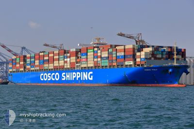
COSCO ITALY
Container Ship
Current Trip
| Time Travelled | 10 days |
|---|---|
| Remaining Time | 1 day |
| Distance Travelled | 4723.95 nm |
| Remaining Distance | 597.87 nm |
| AVG Speed | 18 Knop |
| MAX Speed | 20.7 Knop |
| AVG Wind | 14.8 knots |
| MAX Wind | 29 knots |
| MIN Temp | 2.3°C / 36.14°F |
| MAX Temp | 16.9°C / 62.42°F |
| Djupgående | 13.5 m |
| Position mottagen | 4 h, 29 m sen |
Current Position
| Longitud | -130.49711° |
|---|---|
| Latitude | 37.67303° |
| Status | Under way using engine |
| Fart | 17.9 Knop |
| Kurs | 123.3° |
| Område | North Pacific Ocean |
| Station | T-AIS |
| Position mottagen | 4 h, 29 m sen |
Info
Information
The current position of COSCO ITALY is in North Pacific Ocean with coordinates 37.67303° / -130.49711° as reported on 2024-04-18 21:20 by AIS to our vessel tracker app. The vessel's current speed is 17.9 Knop and is heading at the port of LOS ANGELES. The estimated time of arrival as calculated by MyShipTracking vessel tracking app is 2024-04-20 10:34 LT
The vessel COSCO ITALY (IMO: 9516454, MMSI: 477845600) is a Container Ship that was built in 2014 ( 10 År gammal ). It's sailing under the flag of [HK] Hong Kong.
In this page you can find informations about the vessels current position, last detected port calls, and current voyage information. If the vessels is not in coverage by AIS you will find the latest position.
The current position of COSCO ITALY is detected by our AIS receivers and we are not responsible for the reliability of the data. The last position was recorded while the vessel was in Coverage by the Ais receivers of our vessel tracking app.
The current draught of COSCO ITALY as reported by AIS is 13.5 meters
Weather
| Temperature | 12.6°C / 54.68°F |
|---|---|
| Wind Speed | 12 knots |
| Direction | 337° NNW |
| Pressure | 1020.1 hPa |
| Humidity | 73.4 % |
| Cloud Coverage | 72 % |
Featured Company
Last Port Calls
| Port | Arrival | Departure | Time In Port |
|---|---|---|---|
| 2024-04-07 10:49 | 2024-04-08 05:30 | 18 h | |
| 2024-03-17 18:44 | 2024-03-18 13:31 | 18 h | |
| 2024-02-22 13:11 | 2024-02-26 13:25 | 4 d | |
| 2024-02-08 19:30 | 2024-02-09 16:44 | 21 h | |
| 2024-02-01 01:39 |
Most Visited Ports (Last year)
| Port | Arrivals | |
|---|---|---|
| 7 | ||
| 6 | ||
| 6 | ||
| 5 | ||
| 3 | ||
| 3 |
Last Trips
| Origin | Departure | Destination | Arrival | Distance | |
|---|---|---|---|---|---|
| 2024-03-18 22:31 | 2024-04-07 19:49 | 1255.30 nm | |||
| 2024-02-26 05:25 | 2024-03-18 03:44 | 5943.85 nm | |||
| 2024-02-10 01:44 | 2024-02-22 05:11 | 5415.10 nm | |||
| 2024-02-01 10:39 | 2024-02-09 04:30 | 1219.58 nm |
Events
| Tid | Event | Detaljer | Position / Dest | Information |
|---|---|---|---|---|
| 2024-04-18 21:24 | Status ändrad | Default Under way using engine |
37.66103 / -130.47389
LONG BEACH
|
Fart: 17.9 kn Kurs: 123.3° |
| 2024-04-18 21:20 | UTANFÖR täckningsområde |
37.67303 / -130.49711
North Pacific Ocean
LONG BEACH
|
Fart: 17.9 kn Kurs: 123.3° |
|
| 2024-04-18 19:58 | ETA ändrat | 2024/04/20 21:00 2024/04/20 11:30 |
37.89457 / -130.92495
LONG BEACH
|
Fart: 17.9 kn Kurs: 122.9° |
| 2024-04-18 19:42 | Status ändrad | Under way using engine Default |
37.93902 / -131.01186
LONG BEACH
|
Fart: 17.8 kn Kurs: 122° |
| 2024-04-18 19:42 | I täckningsområde |
37.93902 / -131.01186
North Pacific Ocean
LONG BEACH
|
Fart: 17.7 kn Kurs: 121.8° |
|
| 2024-04-18 11:27 | Status ändrad | Default Under way using engine |
39.22984 / -133.67868
LONG BEACH
|
Fart: 18.4 kn Kurs: 119.9° |
| 2024-04-18 11:13 | UTANFÖR täckningsområde |
39.26565 / -133.75723
North Pacific Ocean
LONG BEACH
|
Fart: 18.4 kn Kurs: 119.9° |
|
| 2024-04-18 11:11 | Byter havsområde | High seas of the North Pacific Ocean Japanese part of the North Pacific Ocean |
39.27031 / -133.76750
North Pacific Ocean
LONG BEACH
|
Fart: 18.4 kn Kurs: 120.6° |
| 2024-04-18 11:11 | Status ändrad | Under way using engine Default |
39.27031 / -133.76750
LONG BEACH
|
Fart: 18 kn Kurs: 121° |
| 2024-04-18 11:05 | I täckningsområde |
39.27031 / -133.76750
North Pacific Ocean
LONG BEACH
|
Fart: 18.4 kn Kurs: 120.6° |