
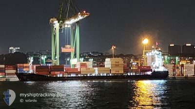
CONTSHIP ERA
General Cargo
Current Trip
| Time Travelled | 2 days |
|---|---|
| Remaining Time | --- |
| Distance Travelled | 457.15 nm |
| Remaining Distance | 8.88 nm |
| AVG Speed | 12 Knop |
| MAX Speed | 14.5 Knop |
| AVG Wind | 3.6 knots |
| MAX Wind | 7 knots |
| MIN Temp | 22.8°C / 73.04°F |
| MAX Temp | 30.1°C / 86.18°F |
| Djupgående | 7.3 m |
| Position mottagen | 2 d sen |
Current Position
| Longitud | 104.33619° |
|---|---|
| Latitude | 1.28459° |
| Status | Under way using engine |
| Fart | 13.7 Knop |
| Kurs | 59.8° |
| Område | Singapore Strait |
| Station | T-AIS |
| Position mottagen | 2 d sen |
Info
Information
The current position of CONTSHIP ERA is in Singapore Strait with coordinates 1.28459° / 104.33619° as reported on 2024-04-22 15:24 by AIS to our vessel tracker app. The vessel's current speed is 13.7 Knop and is heading at the port of KUCHING. The estimated time of arrival as calculated by MyShipTracking vessel tracking app is 2024-04-23 21:00 LT
The vessel CONTSHIP ERA (IMO: 9507702, MMSI: 209459000) is a General Cargo that was built in 2009 ( 15 År gammal ). It's sailing under the flag of [CY] Cyprus.
In this page you can find informations about the vessels current position, last detected port calls, and current voyage information. If the vessels is not in coverage by AIS you will find the latest position.
The current position of CONTSHIP ERA is detected by our AIS receivers and we are not responsible for the reliability of the data. The last position was recorded while the vessel was in Coverage by the Ais receivers of our vessel tracking app.
The current draught of CONTSHIP ERA as reported by AIS is 7.3 meters
Weather
| Temperature | 29.1°C / 84.38°F |
|---|---|
| Wind Speed | 5 knots |
| Direction | 348° NNW |
| Pressure | 1005.8 hPa |
| Humidity | 76.5 % |
| Cloud Coverage | 31 % |
Featured Company
Last Port Calls
| Port | Arrival | Departure | Time In Port |
|---|---|---|---|
| 2024-04-22 02:26 | 2024-04-22 12:50 | 10 h | |
| 2024-04-20 06:04 | 2024-04-21 02:56 | 20 h | |
| 2024-04-18 12:01 | 2024-04-18 21:02 | 9 h | |
| 2024-04-13 10:30 | 2024-04-13 18:59 | 8 h | |
| 2024-04-11 09:54 | 2024-04-12 15:18 | 1 d | |
| 2024-04-04 03:41 | 2024-04-04 12:41 | 9 h | |
| 2024-04-02 01:17 | 2024-04-03 08:45 | 1 d | |
| 2024-03-25 03:09 | 2024-03-26 07:45 | 1 d | |
| 2024-03-12 19:41 | 2024-03-13 03:55 | 8 h | |
| 2024-03-11 09:04 | 2024-03-12 01:14 | 16 h |
Most Visited Ports (Last year)
| Port | Arrivals | |
|---|---|---|
| 18 | ||
| 14 | ||
| 14 | ||
| 10 | ||
| 10 | ||
| 2 |
Last Trips
| Origin | Departure | Destination | Arrival | Distance | |
|---|---|---|---|---|---|
| 2024-04-21 10:56 | 2024-04-22 10:26 | 238.99 nm | |||
| 2024-04-19 05:02 | 2024-04-20 14:04 | 232.12 nm | |||
| 2024-04-14 02:59 | 2024-04-18 20:01 | 861.83 nm | |||
| 2024-04-12 23:18 | 2024-04-13 18:30 | 241.87 nm | |||
| 2024-04-04 20:41 | 2024-04-11 17:54 | 1069.29 nm | |||
| 2024-04-03 16:45 | 2024-04-04 11:41 | 244.14 nm | |||
| 2024-03-26 15:45 | 2024-04-02 09:17 | 1270.77 nm | |||
| 2024-03-13 11:55 | 2024-03-25 11:09 | 1059.79 nm | |||
| 2024-03-12 09:14 | 2024-03-13 03:41 | 241.01 nm | |||
| 2024-03-04 10:59 | 2024-03-11 17:04 | 1038.57 nm |
Events
| Tid | Event | Detaljer | Position / Dest | Information |
|---|---|---|---|---|
| 2024-04-25 09:17 | STARTAR förflyttning | 5.07 nm, North East of KUCHING |
1.62667 / 110.46000
MY KCH
|
Fart: 8 kn Kurs: 49° |
| 2024-04-24 08:26 | STOPPAR förflyttning | 4.14 nm, North East of KUCHING |
1.61333 / 110.45167
MY KCH
|
Fart: Kurs: -1° |
| 2024-04-24 06:44 | STARTAR förflyttning | 13.56 nm, North East of KUCHING |
1.75167 / 110.52834
MY KCH
|
Fart: 4 kn Kurs: -1° |
| 2024-04-23 21:17 | STOPPAR förflyttning | 13.59 nm, North East of KUCHING |
1.75333 / 110.52666
MY KCH
|
Fart: Kurs: -1° |
| 2024-04-22 15:28 | Status ändrad | Default Under way using engine |
1.29557 / 104.35027
MY KCH
|
Fart: 13.7 kn Kurs: 59.8° |
| 2024-04-22 15:24 | UTANFÖR täckningsområde |
1.28459 / 104.33619
Singapore Strait
MY KCH
|
Fart: 13.7 kn Kurs: 59.8° |
|
| 2024-04-22 15:20 | Status ändrad | Under way using engine Default |
1.27817 / 104.32237
MY KCH
|
Fart: 13.6 kn Kurs: 78° |
| 2024-04-22 15:00 | Status ändrad | Default Under way using engine |
1.26859 / 104.24869
MY KCH
|
Fart: 13.8 kn Kurs: 89.1° |
| 2024-04-22 13:53 | Byter havsområde | Malaysian part of the Singapore Strait Singaporean part of the Singapore Strait |
1.35027 / 104.05490
Singapore Strait
MY KCH
|
Fart: 10.6 kn Kurs: 131.2° |
| 2024-04-22 13:10 | ETA ändrat | 2024/04/23 21:00 2024/04/23 20:30 |
1.39959 / 103.94259
MY KCH
|
Fart: 11.9 kn Kurs: 131.9° |