
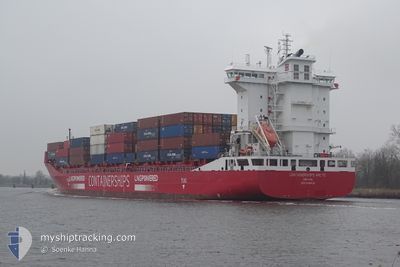
CONTAINERSHIPSARCTIC
Cargo
Current Trip
| Time Travelled | 1 day |
|---|---|
| Remaining Time | 1 day |
| Distance Travelled | 653.55 nm |
| Remaining Distance | 331.56 nm |
| AVG Speed | 14.2 Knop |
| MAX Speed | 15.5 Knop |
| AVG Wind | 9.3 knots |
| MAX Wind | 24.9 knots |
| MIN Temp | 3.6°C / 38.48°F |
| MAX Temp | 8.7°C / 47.66°F |
| Djupgående | 9 m |
| Position mottagen | Nu |
Current Position
| Longitud | 7.52498° |
|---|---|
| Latitude | 57.21957° |
| Status | Under way using engine |
| Fart | 13.3 Knop |
| Kurs | 241.1° |
| Område | North Sea |
| Station | T-AIS |
| Position mottagen | Nu |
Info
Information
The current position of CONTAINERSHIPSARCTIC is in North Sea with coordinates 57.21957° / 7.52498° as reported on 2024-04-19 13:10 by AIS to our vessel tracker app. The vessel's current speed is 13.3 Knop and is heading at the port of TEES. The estimated time of arrival as calculated by MyShipTracking vessel tracking app is 2024-04-20 14:31 LT
The vessel CONTAINERSHIPSARCTIC (IMO: 9818400, MMSI: 209717000) is a Cargo It's sailing under the flag of [CY] Cyprus.
In this page you can find informations about the vessels current position, last detected port calls, and current voyage information. If the vessels is not in coverage by AIS you will find the latest position.
The current position of CONTAINERSHIPSARCTIC is detected by our AIS receivers and we are not responsible for the reliability of the data. The last position was recorded while the vessel was in Coverage by the Ais receivers of our vessel tracking app.
The current draught of CONTAINERSHIPSARCTIC as reported by AIS is 9 meters
Weather
| Temperature | 4.9°C / 40.82°F |
|---|---|
| Wind Speed | 21 knots |
| Direction | 59° ENE |
| Pressure | 1007.3 hPa |
| Humidity | 68.1 % |
| Cloud Coverage | 21 % |
Featured Company
Last Port Calls
| Port | Arrival | Departure | Time In Port |
|---|---|---|---|
| 2024-04-17 02:27 | 2024-04-17 14:43 | 12 h | |
| 2024-04-15 19:21 | 2024-04-16 17:30 | 22 h | |
| 2024-04-11 18:31 | 2024-04-13 05:41 | 1 d | |
| 2024-04-10 19:25 | 2024-04-11 16:48 | 21 h | |
| 2024-04-09 23:39 | 2024-04-10 18:57 | 19 h | |
| 2024-04-07 14:42 | 2024-04-07 22:28 | 7 h | |
| 2024-04-04 06:45 | 2024-04-04 20:53 | 14 h | |
| 2024-04-02 08:09 | 2024-04-03 04:08 | 19 h | |
| 2024-04-01 14:29 | 2024-04-01 23:55 | 9 h | |
| 2024-03-31 11:52 | 2024-03-31 11:57 | 5 m |
Last Trips
| Origin | Departure | Destination | Arrival | Distance | |
|---|---|---|---|---|---|
| 2024-04-16 20:30 | 2024-04-17 04:27 | 122.47 nm | |||
| 2024-04-13 07:41 | 2024-04-15 22:21 | 726.43 nm | |||
| 2024-04-11 18:48 | 2024-04-11 20:31 | 17.19 nm | |||
| 2024-04-10 20:57 | 2024-04-10 21:25 | 1.77 nm | |||
| 2024-04-08 00:28 | 2024-04-10 01:39 | 606.82 nm | |||
| 2024-04-04 23:53 | 2024-04-07 16:42 | 682.23 nm | |||
| 2024-04-03 06:08 | 2024-04-04 09:45 | 330.98 nm | |||
| 2024-04-02 02:55 | 2024-04-02 10:09 | 121.47 nm | |||
| 2024-03-31 13:57 | 2024-04-01 17:29 | 408.22 nm | |||
| 2024-03-29 23:57 | 2024-03-31 13:52 | 435.47 nm |
Events
| Tid | Event | Detaljer | Position / Dest | Information |
|---|---|---|---|---|
| 2024-04-19 11:31 | Upptäckt i hav | Danish part of the North Sea |
57.38815 / 8.11832
North Sea
GBTEE
|
Fart: 13.1 kn Kurs: 241.4° |
| 2024-04-19 07:53 | ETA ändrat | 2024/04/20 16:00 2024/04/20 14:00 |
57.75682 / 9.43871
GBTEE
|
Fart: 13.3 kn Kurs: 244.3° |
| 2024-04-19 04:16 | Byter havsområde | Danish part of the Skaggerak Danish part of the Kattegat |
57.80353 / 10.92404
Skaggerak
GBTEE
|
Fart: 14 kn Kurs: 309.5° |
| 2024-04-19 03:16 | Byter havsområde | Danish part of the Kattegat Swedish part of the Kattegat |
57.63382 / 11.21937
Kattegat
GBTEE
|
Fart: 14.1 kn Kurs: 317.1° |
| 2024-04-18 23:59 | Byter havsområde | Swedish part of the Kattegat Danish part of the Kattegat |
56.93925 / 11.80611
Kattegat
GBTEE
|
Fart: 14.5 kn Kurs: 343.5° |
| 2024-04-18 13:41 | Byter havsområde | Danish part of the Kattegat Danish part of the Baltic Sea |
54.75643 / 10.87778
Kattegat
GBTEE
|
Fart: 14.9 kn Kurs: 355.5° |
| 2024-04-18 12:59 | Byter havsområde | Danish part of the Baltic Sea German part of the Baltic Sea |
54.64227 / 11.05671
Baltic Sea
GBTEE
|
Fart: 14.9 kn Kurs: 292.2° |
| 2024-04-18 12:38 | Byter havsområde | German part of the Baltic Sea Danish part of the Baltic Sea |
54.61126 / 11.19414
Baltic Sea
GBTEE
|
Fart: 15 kn Kurs: 290.9° |
| 2024-04-18 10:17 | Byter havsområde | Danish part of the Baltic Sea German part of the Baltic Sea |
54.44528 / 12.14809
Baltic Sea
GBTEE
|
Fart: 14.1 kn Kurs: 264.6° |
| 2024-04-18 10:02 | Byter havsområde | German part of the Baltic Sea Danish part of the Baltic Sea |
54.48710 / 12.20872
Baltic Sea
GBTEE
|
Fart: 15.2 kn Kurs: 194° |