
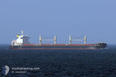
CMB CHIKAKO
Cargo
Current Trip
| Time Travelled | 8 days |
|---|---|
| Remaining Time | --- |
| Distance Travelled | 2211.86 nm |
| Remaining Distance | --- |
| AVG Speed | 10.7 Knop |
| MAX Speed | 13.2 Knop |
| AVG Wind | 12.6 knots |
| MAX Wind | 23.9 knots |
| MIN Temp | 20.6°C / 69.08°F |
| MAX Temp | 28.8°C / 83.84°F |
| Djupgående | 7.2 m |
| Position mottagen | 7 d sen |
Current Position
| Longitud | 114.49334° |
|---|---|
| Latitude | 22.05158° |
| Status | Under way using engine |
| Fart | 10.9 Knop |
| Kurs | 113.9° |
| Område | South China Sea |
| Station | T-AIS |
| Position mottagen | 7 d sen |
Info
Information
The current position of CMB CHIKAKO is in South China Sea with coordinates 22.05158° / 114.49334° as reported on 2024-04-10 11:00 by AIS to our vessel tracker app. The vessel's current speed is 10.9 Knop and is heading at the port of HONG KONG. The estimated time of arrival as calculated by MyShipTracking vessel tracking app is 2024-04-10 07:00 LT
The vessel CMB CHIKAKO (IMO: 9701190, MMSI: 357320000) is a Cargo It's sailing under the flag of [PA] Panama.
In this page you can find informations about the vessels current position, last detected port calls, and current voyage information. If the vessels is not in coverage by AIS you will find the latest position.
The current position of CMB CHIKAKO is detected by our AIS receivers and we are not responsible for the reliability of the data. The last position was recorded while the vessel was in Coverage by the Ais receivers of our vessel tracking app.
The current draught of CMB CHIKAKO as reported by AIS is 7.2 meters
Weather
| Temperature | 28.2°C / 82.76°F |
|---|---|
| Wind Speed | 3 knots |
| Direction | 322° NW |
| Pressure | 1007.1 hPa |
| Humidity | 75.1 % |
| Cloud Coverage | 94 % |
Featured Company
Most Visited Ports (Last year)
| Port | Arrivals | |
|---|---|---|
| 2 | ||
| 1 | ||
| 1 | ||
| 1 | ||
| 1 | ||
| 1 |
Last Trips
Events
| Tid | Event | Detaljer | Position / Dest | Information |
|---|---|---|---|---|
| 2024-04-10 11:06 | Status ändrad | Default Under way using engine |
22.04481 / 114.50973
HONGKONG
|
Fart: 10.9 kn Kurs: 113.9° |
| 2024-04-10 11:00 | UTANFÖR täckningsområde |
22.05158 / 114.49334
South China Sea
|
Fart: 10.9 kn Kurs: 113.9° |
|
| 2024-04-10 08:55 | Status ändrad | Under way using engine Default |
22.15978 / 114.15999
HONGKONG
|
Fart: 0.5 kn Kurs: 76° |
| 2024-04-10 08:55 | STARTAR förflyttning | 7.89 nm, South of HONG KONG |
22.15978 / 114.15999
HONGKONG
|
Fart: 3.3 kn Kurs: 124° |
| 2024-04-10 08:47 | I täckningsområde |
22.15978 / 114.15999
South China Sea
HONGKONG
|
Fart: 3.3 kn Kurs: 129.8° |
|
| 2024-04-09 23:32 | Status ändrad | Default At anchor |
22.16038 / 114.15571
HONGKONG
|
Fart: 0.4 kn Kurs: 96° |
| 2024-04-09 23:29 | Status ändrad | At anchor Default |
22.16074 / 114.15570
HONGKONG
|
Fart: 0.4 kn Kurs: 75° |
| 2024-04-09 23:29 | UTANFÖR täckningsområde |
22.16074 / 114.15570
South China Sea
HONGKONG
|
Fart: 0.4 kn Kurs: 165.3° |
|
| 2024-04-09 22:59 | Status ändrad | Default At anchor |
22.16056 / 114.15572
HONGKONG
|
Fart: 0.4 kn Kurs: 105° |
| 2024-04-09 22:56 | Status ändrad | At anchor Default |
22.16102 / 114.15569
HONGKONG
|
Fart: 0.4 kn Kurs: 89° |