
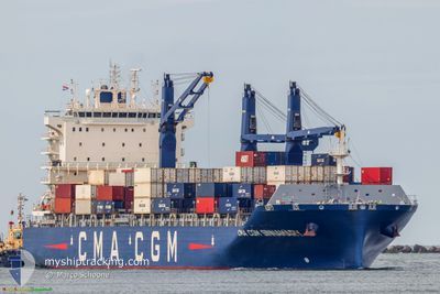
CMA CGM SINNAMARY
Cargo A
Current Trip
| Time Travelled | 1 day |
|---|---|
| Remaining Time | 23 h, 38 mins |
| Distance Travelled | 252.94 nm |
| Remaining Distance | 212.26 nm |
| AVG Speed | 9.4 Knop |
| MAX Speed | 11.4 Knop |
| AVG Wind | 11.6 knots |
| MAX Wind | 15 knots |
| MIN Temp | 26.7°C / 80.06°F |
| MAX Temp | 27.9°C / 82.22°F |
| Djupgående | 8.6 m |
| Position mottagen | 15 h, 10 m sen |
Current Position
| Longitud | -62.83335° |
|---|---|
| Latitude | 16.03710° |
| Status | Under way using engine |
| Fart | 9 Knop |
| Kurs | 169.4° |
| Område | Caribbean Sea |
| Station | T-AIS |
| Position mottagen | 15 h, 10 m sen |
Info
Information
The current position of CMA CGM SINNAMARY is in Caribbean Sea with coordinates 16.03710° / -62.83335° as reported on 2024-04-24 15:26 by AIS to our vessel tracker app. The vessel's current speed is 9 Knop and is heading at the port of PORT OF SPAIN. The estimated time of arrival as calculated by MyShipTracking vessel tracking app is 2024-04-26 06:14 LT
The vessel CMA CGM SINNAMARY (IMO: 9845673, MMSI: 228403700) is a Cargo A It's sailing under the flag of [FR] France.
In this page you can find informations about the vessels current position, last detected port calls, and current voyage information. If the vessels is not in coverage by AIS you will find the latest position.
The current position of CMA CGM SINNAMARY is detected by our AIS receivers and we are not responsible for the reliability of the data. The last position was recorded while the vessel was in Coverage by the Ais receivers of our vessel tracking app.
The current draught of CMA CGM SINNAMARY as reported by AIS is 8.6 meters
Weather
| Temperature | 27.2°C / 80.96°F |
|---|---|
| Wind Speed | 12 knots |
| Direction | 93° E |
| Pressure | 1013.1 hPa |
| Humidity | 76.8 % |
| Cloud Coverage | 3 % |
Featured Company
Last Port Calls
| Port | Arrival | Departure | Time In Port |
|---|---|---|---|
| 2024-04-23 17:15 | 2024-04-24 03:43 | 10 h | |
| 2024-04-10 22:58 | 2024-04-12 13:36 | 1 d | |
| 2024-04-10 00:15 | 2024-04-10 10:18 | 10 h | |
| 2024-04-07 12:14 | 2024-04-08 07:06 | 18 h | |
| 2024-04-04 17:24 | 2024-04-05 03:01 | 9 h | |
| 2024-03-23 14:10 | 2024-03-26 17:44 | 3 d | |
| 2024-03-18 18:39 | 2024-03-19 03:57 | 9 h | |
| 2024-03-15 00:19 | |||
| 2024-03-11 15:29 | 2024-03-13 03:38 | 1 d | |
| 2024-03-05 11:54 | 2024-03-05 23:51 | 11 h |
Most Visited Ports (Last year)
| Port | Arrivals | |
|---|---|---|
| 8 | ||
| 8 | ||
| 8 | ||
| 7 | ||
| 7 | ||
| 7 |
Last Trips
| Origin | Departure | Destination | Arrival | Distance | |
|---|---|---|---|---|---|
| 2024-04-12 15:36 | 2024-04-23 13:15 | 3599.25 nm | |||
| 2024-04-10 11:18 | 2024-04-11 00:58 | 195.42 nm | |||
| 2024-04-08 09:06 | 2024-04-10 01:15 | 184.46 nm | |||
| 2024-04-05 05:01 | 2024-04-07 14:14 | 900.06 nm | |||
| 2024-03-26 14:44 | 2024-04-04 19:24 | 3200.65 nm | |||
| 2024-03-19 00:57 | 2024-03-23 11:10 | 789.81 nm | |||
| 2024-03-12 23:38 | 2024-03-14 21:19 | 726.09 nm | |||
| 2024-03-05 19:51 | 2024-03-11 11:29 | 480.90 nm | |||
| 2024-02-25 10:37 | 2024-03-05 07:54 | 3609.15 nm | |||
| 2024-02-21 05:27 | 2024-02-21 20:46 | 193.74 nm |
Events
| Tid | Event | Detaljer | Position / Dest | Information |
|---|---|---|---|---|
| 2024-04-24 15:37 | Status ändrad | Default Under way using engine |
16.00750 / -62.82820
TTPOS
|
Fart: 9 kn Kurs: 169.4° |
| 2024-04-24 15:26 | UTANFÖR täckningsområde |
16.03710 / -62.83335
Caribbean Sea
TTPOS
|
Fart: 9 kn Kurs: 169.4° |
|
| 2024-04-24 14:39 | Status ändrad | Under way using engine Default |
16.15492 / -62.85506
TTPOS
|
Fart: 9 kn Kurs: 169° |
| 2024-04-24 14:21 | Status ändrad | Default Under way using engine |
16.19833 / -62.86333
TTPOS
|
Fart: 8.9 kn Kurs: 170° |
| 2024-04-24 13:47 | Status ändrad | Under way using engine Default |
16.27859 / -62.87667
TTPOS
|
Fart: 8.7 kn Kurs: 172° |
| 2024-04-24 13:42 | Status ändrad | Default Under way using engine |
16.29139 / -62.87864
TTPOS
|
Fart: 8.7 kn Kurs: 169.9° |
| 2024-04-24 13:23 | Status ändrad | Under way using engine Default |
16.33680 / -62.88647
TTPOS
|
Fart: 9 kn Kurs: 169° |
| 2024-04-24 13:08 | Status ändrad | Default Under way using engine |
16.37292 / -62.89320
TTPOS
|
Fart: 8.7 kn Kurs: 169.9° |
| 2024-04-24 12:31 | Byter havsområde | Montserrat part of the Caribbean Sea Saint Kitts and Nevis part of the Caribbean Sea |
16.46745 / -62.91041
Caribbean Sea
TTPOS
|
Fart: 10.4 kn Kurs: 170° |
| 2024-04-24 12:30 | Status ändrad | Under way using engine Default |
16.47075 / -62.91100
TTPOS
|
Fart: 11 kn Kurs: 172° |