
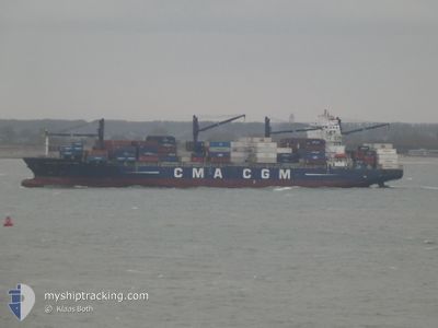
CMA CGM AFRICA ONE
Cargo
Current Trip
| Time Travelled | 5 days |
|---|---|
| Remaining Time | --- |
| Distance Travelled | 1846.08 nm |
| Remaining Distance | 1534.88 nm |
| AVG Speed | 13.7 Knop |
| MAX Speed | 17 Knop |
| AVG Wind | 15.1 knots |
| MAX Wind | 21.9 knots |
| MIN Temp | 21.2°C / 70.16°F |
| MAX Temp | 29.3°C / 84.74°F |
| Djupgående | 10.5 m |
| Position mottagen | 5 d sen |
Current Position
| Longitud | 57.46037° |
|---|---|
| Latitude | -20.10555° |
| Status | Under way using engine |
| Fart | 13.8 Knop |
| Kurs | 3.5° |
| Område | Indian Ocean |
| Station | T-AIS |
| Position mottagen | 5 d sen |
Info
Information
The current position of CMA CGM AFRICA ONE is in Indian Ocean with coordinates -20.10555° / 57.46037° as reported on 2024-04-17 23:55 by AIS to our vessel tracker app. The vessel's current speed is 13.8 Knop and is heading at the port of SINGAPORE. The estimated time of arrival as calculated by MyShipTracking vessel tracking app is 2024-04-28 03:00 LT
The vessel CMA CGM AFRICA ONE (IMO: 9451915, MMSI: 311043200) is a Cargo It's sailing under the flag of [BS] Bahamas.
In this page you can find informations about the vessels current position, last detected port calls, and current voyage information. If the vessels is not in coverage by AIS you will find the latest position.
The current position of CMA CGM AFRICA ONE is detected by our AIS receivers and we are not responsible for the reliability of the data. The last position was recorded while the vessel was in Coverage by the Ais receivers of our vessel tracking app.
The current draught of CMA CGM AFRICA ONE as reported by AIS is 10.5 meters
Weather
| Temperature | 29.1°C / 84.38°F |
|---|---|
| Wind Speed | 4 knots |
| Direction | 229° SW |
| Pressure | 1009.4 hPa |
| Humidity | 71.7 % |
| Cloud Coverage | 95 % |
Featured Company
Last Port Calls
| Port | Arrival | Departure | Time In Port |
|---|---|---|---|
| 2024-04-16 22:54 | 2024-04-17 23:46 | 1 d | |
| 2024-04-15 14:07 | 2024-04-16 09:37 | 19 h | |
| 2024-04-03 09:43 | 2024-04-06 00:59 | 2 d | |
| 2024-03-30 11:55 | 2024-04-01 13:20 | 2 d | |
| 2024-03-23 00:19 | 2024-03-24 09:53 | 1 d | |
| 2024-03-13 05:47 | 2024-03-14 06:59 | 1 d | |
| 2024-03-11 20:59 | 2024-03-13 02:47 | 1 d | |
| 2024-02-21 01:15 | 2024-02-21 16:06 | 14 h | |
| 2024-02-14 05:47 | 2024-02-17 05:32 | 2 d | |
| 2024-02-09 07:06 | 2024-02-11 18:45 | 2 d |
Last Trips
| Origin | Departure | Destination | Arrival | Distance | |
|---|---|---|---|---|---|
| 2024-04-16 13:37 | 2024-04-17 02:54 | 53.92 nm | |||
| 2024-04-06 02:59 | 2024-04-15 18:07 | 1661.84 nm | |||
| 2024-04-01 15:20 | 2024-04-03 11:43 | 515.89 nm | |||
| 2024-03-24 13:53 | 2024-03-30 13:55 | 1396.79 nm | |||
| 2024-03-14 14:59 | 2024-03-23 04:19 | 3441.29 nm | |||
| 2024-03-13 10:47 | 2024-03-13 13:47 | 24.65 nm | |||
| 2024-02-21 20:06 | 2024-03-12 04:59 | 3605.48 nm | |||
| 2024-02-17 07:32 | 2024-02-21 05:15 | 1338.85 nm | |||
| 2024-02-11 20:45 | 2024-02-14 07:47 | 517.15 nm | |||
| 2024-02-02 21:53 | 2024-02-09 09:06 | 1346.37 nm |
Events
| Tid | Event | Detaljer | Position / Dest | Information |
|---|---|---|---|---|
| 2024-04-17 23:58 | Status ändrad | Default Under way using engine |
-20.08999 / 57.46186
SGSIN
|
Fart: 13.8 kn Kurs: 3.5° |
| 2024-04-17 23:55 | UTANFÖR täckningsområde |
-20.10555 / 57.46037
Indian Ocean
SGSIN
|
Fart: 13.8 kn Kurs: 3.5° |
|
| 2024-04-17 23:52 | Byter havsområde | Mauritian part of the Indian Ocean R�union part of the Indian Ocean |
-20.11609 / 57.45942
Indian Ocean
SGSIN
|
Fart: 13 kn Kurs: 3.8° |
| 2024-04-17 23:52 | Status ändrad | Under way using engine Default |
-20.11609 / 57.45942
SGSIN
|
Fart: 9.5 kn Kurs: 309° |
| 2024-04-17 23:46 | AVGÅTT HAMN |
|
-20.13039 / 57.46824
SGSIN
|
Fart: 6.2 kn Kurs: 307° |
| 2024-04-17 23:44 | Status ändrad | Default Under way using engine |
-20.13412 / 57.47395
[MU] PORT LOUIS
|
Fart: 4.8 kn Kurs: 306° |
| 2024-04-17 23:32 | STARTAR förflyttning |
-20.14060 / 57.48819
[MU] PORT LOUIS
|
Fart: 3.1 kn Kurs: 271° |
|
| 2024-04-17 23:23 | Status ändrad | Under way using engine Moored |
-20.14127 / 57.49101
[MU] PORT LOUIS
|
Fart: Kurs: 239° |
| 2024-04-17 22:49 | Status ändrad | Moored Default |
-20.14138 / 57.49112
[MU] PORT LOUIS
|
Fart: Kurs: -1° |
| 2024-04-17 22:46 | Status ändrad | Default Moored |
-20.14167 / 57.49166
[MU] PORT LOUIS
|
Fart: Kurs: 239° |