
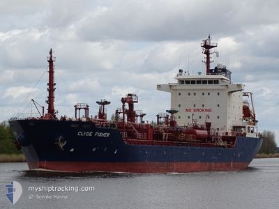
CLYDE FISHER
Oil/Chemical Tanker
Current Trip
| Time Travelled | 16 h, 29 mins |
|---|---|
| Remaining Time | 11 h, 29 mins |
| Distance Travelled | 105.97 nm |
| Remaining Distance | 71.46 nm |
| AVG Speed | 7.1 Knop |
| MAX Speed | 14.8 Knop |
| AVG Wind | 22.5 knots |
| MAX Wind | 28 knots |
| MIN Temp | 6.1°C / 42.98°F |
| MAX Temp | 9.2°C / 48.56°F |
| Djupgående | 5.5 m |
| Position mottagen | 1 m sen |
Current Position
| Longitud | 2.27005° |
|---|---|
| Latitude | 52.20535° |
| Status | Under way using engine |
| Fart | 6.1 Knop |
| Kurs | 12° |
| Område | North Sea |
| Station | T-AIS |
| Position mottagen | 1 m sen |
Info
Information
The current position of CLYDE FISHER is in North Sea with coordinates 52.20535° / 2.27005° as reported on 2024-04-16 20:30 by AIS to our vessel tracker app. The vessel's current speed is 6.1 Knop and is heading at the port of ROTTERDAM. The estimated time of arrival as calculated by MyShipTracking vessel tracking app is 2024-04-17 08:01 LT
The vessel CLYDE FISHER (IMO: 9298416, MMSI: 311855000) is a Oil/Chemical Tanker that was built in 2005 ( 19 År gammal ). It's sailing under the flag of [BS] Bahamas.
In this page you can find informations about the vessels current position, last detected port calls, and current voyage information. If the vessels is not in coverage by AIS you will find the latest position.
The current position of CLYDE FISHER is detected by our AIS receivers and we are not responsible for the reliability of the data. The last position was recorded while the vessel was in Coverage by the Ais receivers of our vessel tracking app.
The current draught of CLYDE FISHER as reported by AIS is 5.5 meters
Weather
| Temperature | 8.2°C / 46.76°F |
|---|---|
| Wind Speed | 18 knots |
| Direction | 347° NNW |
| Pressure | 1013.7 hPa |
| Humidity | 78.6 % |
| Cloud Coverage | 100 % |
Featured Company
Last Port Calls
| Port | Arrival | Departure | Time In Port |
|---|---|---|---|
| 2024-04-14 12:56 | 2024-04-16 04:03 | 1 d | |
| 2024-04-10 09:46 | 2024-04-11 17:15 | 1 d | |
| 2024-04-06 14:07 | 2024-04-07 23:46 | 1 d | |
| 2024-04-03 07:19 | 2024-04-04 05:54 | 22 h | |
| 2024-04-01 06:41 | 2024-04-02 13:16 | 1 d | |
| 2024-03-27 01:57 | 2024-03-27 12:31 | 10 h | |
| 2024-03-25 21:45 | 2024-03-26 12:13 | 14 h | |
| 2024-03-21 19:26 | 2024-03-23 23:13 | 2 d | |
| 2024-03-13 06:10 | 2024-03-15 10:36 | 2 d | |
| 2024-03-02 15:31 | 2024-03-03 17:28 | 1 d |
Most Visited Ports (Last year)
| Port | Arrivals | |
|---|---|---|
| 17 | ||
| 12 | ||
| 12 | ||
| 11 | ||
| 8 | ||
| 7 |
Last Trips
| Origin | Departure | Destination | Arrival | Distance | |
|---|---|---|---|---|---|
| 2024-04-11 19:15 | 2024-04-14 13:56 | 764.01 nm | |||
| 2024-04-08 01:46 | 2024-04-10 11:46 | 641.48 nm | |||
| 2024-04-04 07:54 | 2024-04-06 16:07 | 612.27 nm | |||
| 2024-04-02 15:16 | 2024-04-03 09:19 | 159.00 nm | |||
| 2024-03-27 13:31 | 2024-04-01 08:41 | 973.88 nm | |||
| 2024-03-26 13:13 | 2024-03-27 02:57 | 147.63 nm | |||
| 2024-03-24 00:13 | 2024-03-25 22:45 | 462.72 nm | |||
| 2024-03-15 10:36 | 2024-03-21 20:26 | 223.77 nm | |||
| 2024-03-03 18:28 | 2024-03-13 06:10 | 1661.29 nm | |||
| 2024-02-28 18:14 | 2024-03-02 16:31 | 637.39 nm |
Events
| Tid | Event | Detaljer | Position / Dest | Information |
|---|---|---|---|---|
| 2024-04-16 12:00 | Status ändrad | Under way using engine Default |
51.68195 / 2.04852
NL RTM
|
Fart: 4.1 kn Kurs: 10° |
| 2024-04-16 11:52 | Status ändrad | Default Under way using engine |
51.67410 / 2.04287
NL RTM
|
Fart: 4.2 kn Kurs: 13° |
| 2024-04-16 04:18 | Status ändrad | Under way using engine Moored |
51.44998 / .34055
NL RTM
|
Fart: 8.9 kn Kurs: 108° |
| 2024-04-16 04:03 | AVGÅTT HAMN |
|
51.47008 / .30798
NL RTM
|
Fart: 4.4 kn Kurs: 97° |
| 2024-04-16 04:03 | STARTAR förflyttning |
51.47028 / .30720
[GB] SOUTH STIFFORD
|
Fart: 4 kn Kurs: 101° |
|
| 2024-04-16 03:38 | ETA ändrat | 2024/04/17 18:00 2024/04/14 08:00 |
51.47155 / .30507
[GB] SOUTH STIFFORD
|
Fart: Kurs: 85° |
| 2024-04-16 03:20 | Djupgående ändrat | 5.5 7.8 |
51.47157 / .30508
[GB] SOUTH STIFFORD
|
Fart: 0.1 kn Kurs: 85° |
| 2024-04-16 03:20 | Destination ändrad | NL RTM GB GYS |
51.47157 / .30508
[GB] SOUTH STIFFORD
|
Fart: 0.1 kn Kurs: 85° |
| 2024-04-16 03:19 | I täckningsområde |
51.47157 / .30508
North Sea
[GB] SOUTH STIFFORD
|
Fart: 0.1 kn Kurs: 4° |
|
| 2024-04-14 13:21 | UTANFÖR täckningsområde |
51.47155 / .30507
North Sea
[GB] SOUTH STIFFORD
|
Fart: Kurs: 355° |