
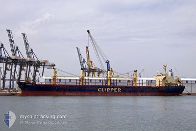
CLIPPER LIS
Bulk Carrier
Current Trip
DONG JIA KOU CN
| Time Travelled | --- |
|---|---|
| Remaining Time | --- |
| Distance Travelled | 1055.51 nm |
| Remaining Distance | --- |
| AVG Speed | 9.9 Knop |
| MAX Speed | 12.2 Knop |
| AVG Wind | 5.5 knots |
| MAX Wind | 14.9 knots |
| MIN Temp | 27.8°C / 82.04°F |
| MAX Temp | 29.3°C / 84.74°F |
| Djupgående | 9.8 m |
| Position mottagen | 4 d sen |
Current Position
| Longitud | 104.43230° |
|---|---|
| Latitude | 1.37005° |
| Status | Under way using engine |
| Fart | 12.2 Knop |
| Kurs | 57° |
| Område | South China Sea |
| Station | T-AIS |
| Position mottagen | 4 d sen |
Info
Information
The current position of CLIPPER LIS is in South China Sea with coordinates 1.37005° / 104.43230° as reported on 2024-04-19 04:20 by AIS to our vessel tracker app. The vessel's current speed is 12.2 Knop
The vessel CLIPPER LIS (IMO: 9515723, MMSI: 538007588) is a Bulk Carrier that was built in 2009 ( 15 År gammal ). It's sailing under the flag of [MH] Marshall Is.
In this page you can find informations about the vessels current position, last detected port calls, and current voyage information. If the vessels is not in coverage by AIS you will find the latest position.
The current position of CLIPPER LIS is detected by our AIS receivers and we are not responsible for the reliability of the data. The last position was recorded while the vessel was in Coverage by the Ais receivers of our vessel tracking app.
The current draught of CLIPPER LIS as reported by AIS is 9.8 meters
Weather
| Temperature | 28.9°C / 84.02°F |
|---|---|
| Wind Speed | 13 knots |
| Direction | 186° S |
| Pressure | 1007.2 hPa |
| Humidity | 80.8 % |
| Cloud Coverage | 1 % |
Featured Company
Last Port Calls
Last Trips
| Origin | Departure | Destination | Arrival | Distance |
|---|
Events
| Tid | Event | Detaljer | Position / Dest | Information |
|---|---|---|---|---|
| 2024-04-19 04:20 | UTANFÖR täckningsområde |
1.37005 / 104.43230
South China Sea
DONG JIA KOU CN
|
Fart: 12.2 kn Kurs: 57° |
|
| 2024-04-19 04:18 | Byter havsområde | Malaysian part of the South China Sea Malaysian part of the Singapore Strait |
1.36602 / 104.42602
South China Sea
DONG JIA KOU CN
|
Fart: 12.2 kn Kurs: 53° |
| 2024-04-19 03:07 | Byter havsområde | Malaysian part of the Singapore Strait Indonesian part of the Singapore Strait |
1.25820 / 104.22683
Singapore Strait
DONG JIA KOU CN
|
Fart: 10.5 kn Kurs: 81° |
| 2024-04-19 01:35 | Byter havsområde | Indonesian part of the Singapore Strait Singaporean part of the Singapore Strait |
1.23978 / 103.96547
Singapore Strait
DONG JIA KOU CN
|
Fart: 8.6 kn Kurs: 94° |
| 2024-04-19 00:51 | STARTAR förflyttning | 2.68 nm, North East of SINGAPORE |
1.27845 / 103.89415
DONG JIA KOU CN
|
Fart: 3.9 kn Kurs: 202° |
| 2024-04-19 00:45 | Status ändrad | Under way using engine At anchor |
1.28097 / 103.89667
DONG JIA KOU CN
|
Fart: 0.6 kn Kurs: 258° |
| 2024-04-18 23:48 | Djupgående ändrat | 9.8 9.7 |
1.28165 / 103.89717
DONG JIA KOU CN
|
Fart: Kurs: 219° |
| 2024-04-18 17:49 | Djupgående ändrat | 9.7 4.6 |
1.28018 / 103.89488
DONG JIA KOU CN
|
Fart: Kurs: 80° |
| 2024-04-18 17:49 | Destination ändrad | DONG JIA KOU CN BD-CGP |
1.28018 / 103.89488
DONG JIA KOU CN
|
Fart: Kurs: 80° |
| 2024-04-18 17:49 | ETA ändrat | 2024/04/29 07:00 2024/06/19 07:00 |
1.28018 / 103.89488
DONG JIA KOU CN
|
Fart: Kurs: 80° |