
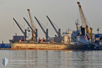
CHIOS LUCK
Cargo
Current Trip
| Time Travelled | 13 days |
|---|---|
| Remaining Time | --- |
| Distance Travelled | 3472.14 nm |
| Remaining Distance | --- |
| AVG Speed | 12.2 Knop |
| MAX Speed | 14.7 Knop |
| AVG Wind | 9.9 knots |
| MAX Wind | 18.6 knots |
| MIN Temp | 23.6°C / 74.48°F |
| MAX Temp | 29.6°C / 85.28°F |
| Djupgående | 9 m |
| Position mottagen | Nu |
Current Position
| Longitud | -61.13752° |
|---|---|
| Latitude | 14.39130° |
| Status | Under way using engine |
| Fart | 12.5 Knop |
| Kurs | 329° |
| Område | Caribbean Sea |
| Station | T-AIS |
| Position mottagen | Nu |
Info
Information
The current position of CHIOS LUCK is in Caribbean Sea with coordinates 14.39130° / -61.13752° as reported on 2024-04-20 02:19 by AIS to our vessel tracker app. The vessel's current speed is 12.5 Knop and is heading at the port of CHARLESTON.
The vessel CHIOS LUCK (MMSI: 241229000) is a Cargo It's sailing under the flag of [GR] Greece.
In this page you can find informations about the vessels current position, last detected port calls, and current voyage information. If the vessels is not in coverage by AIS you will find the latest position.
The current position of CHIOS LUCK is detected by our AIS receivers and we are not responsible for the reliability of the data. The last position was recorded while the vessel was in Coverage by the Ais receivers of our vessel tracking app.
The current draught of CHIOS LUCK as reported by AIS is 9 meters
Weather
| Temperature | 27.2°C / 80.96°F |
|---|---|
| Wind Speed | 10 knots |
| Direction | 83° E |
| Pressure | 1014.1 hPa |
| Humidity | 78.9 % |
| Cloud Coverage | 100 % |
Featured Company
Last Port Calls
| Port | Arrival | Departure | Time In Port |
|---|---|---|---|
| 2024-04-04 10:25 | 2024-04-06 15:29 | 2 d | |
| 2024-03-12 09:46 |
Last Trips
| Origin | Departure | Destination | Arrival | Distance | |
|---|---|---|---|---|---|
| 2024-03-12 06:46 | 2024-04-04 07:25 | 233.52 nm |
Events
| Tid | Event | Detaljer | Position / Dest | Information |
|---|---|---|---|---|
| 2024-04-20 00:56 | Djupgående ändrat | 9 8.9 |
14.24114 / -60.86731
US CHS
|
Fart: 12.7 kn Kurs: 292.1° |
| 2024-04-20 00:56 | Destination ändrad | US CHS BR VIX |
14.24114 / -60.86731
US CHS
|
Fart: 12.7 kn Kurs: 292.1° |
| 2024-04-20 00:55 | Byter havsområde | Guadeloupe and Martinique part of the Caribbean Sea Saint Lucia part of the Caribbean Sea |
14.24114 / -60.86731
Caribbean Sea
|
Fart: 12.7 kn Kurs: 292.1° |
| 2024-04-20 00:34 | Status ändrad | Under way using engine Default |
14.20493 / -60.79795
BR VIX
|
Fart: 13 kn Kurs: 300° |
| 2024-04-20 00:29 | Status ändrad | Default Under way using engine |
14.19500 / -60.78167
BR VIX
|
Fart: 13 kn Kurs: 300° |
| 2024-04-20 00:24 | Byter havsområde | Saint Lucia part of the Caribbean Sea Brazilian part of the South Atlantic Ocean |
14.18712 / -60.76521
Caribbean Sea
|
Fart: 13 kn Kurs: 300° |
| 2024-04-20 00:24 | Status ändrad | Under way using engine Default |
14.18712 / -60.76521
BR VIX
|
Fart: 13.1 kn Kurs: 300° |
| 2024-04-20 00:14 | I täckningsområde |
14.18712 / -60.76521
Caribbean Sea
|
Fart: 13 kn Kurs: 300° |
|
| 2024-04-12 01:23 | STARTAR förflyttning | 2.59 nm, North West of SALVADOR |
-12.94093 / -38.54890
BR VIX
|
Fart: 5.2 kn Kurs: 184° |
| 2024-04-11 18:04 | UTANFÖR täckningsområde |
-12.93295 / -38.54463
South Atlantic Ocean
|
Fart: Kurs: 294.9° |