
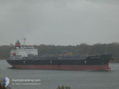
CHEMROAD ZENITH
Tanker C
Current Trip
MA SFI
| Time Travelled | --- |
|---|---|
| Remaining Time | --- |
| Distance Travelled | --- |
| Remaining Distance | --- |
| AVG Speed | --- |
| MAX Speed | --- |
| AVG Wind | --- |
| MAX Wind | --- |
| MIN Temp | --- |
| MAX Temp | --- |
| Djupgående | 9.9 m |
| Position mottagen | 2 d sen |
Current Position
| Longitud | -18.04512° |
|---|---|
| Latitude | 23.09366° |
| Status | Under way using engine |
| Fart | 14.3 Knop |
| Kurs | 207.2° |
| Område | North Atlantic Ocean |
| Station | T-AIS |
| Position mottagen | 2 d sen |
Info
Information
The current position of CHEMROAD ZENITH is in North Atlantic Ocean with coordinates 23.09366° / -18.04512° as reported on 2024-04-22 15:38 by AIS to our vessel tracker app. The vessel's current speed is 14.3 Knop
The vessel CHEMROAD ZENITH (IMO: 9926300, MMSI: 352001285) is a Tanker C It's sailing under the flag of [PA] Panama.
In this page you can find informations about the vessels current position, last detected port calls, and current voyage information. If the vessels is not in coverage by AIS you will find the latest position.
The current position of CHEMROAD ZENITH is detected by our AIS receivers and we are not responsible for the reliability of the data. The last position was recorded while the vessel was in Coverage by the Ais receivers of our vessel tracking app.
The current draught of CHEMROAD ZENITH as reported by AIS is 9.9 meters
Weather
| Temperature | 26.3°C / 79.34°F |
|---|---|
| Wind Speed | 7 knots |
| Direction | 344° NNW |
| Pressure | 1011.9 hPa |
| Humidity | 78.2 % |
| Cloud Coverage | 100 % |
Featured Company
Last Port Calls
| Port | Arrival | Departure | Time In Port |
|---|---|---|---|
| 2024-04-19 11:24 | |||
| 2024-04-16 14:51 | 2024-04-18 18:45 | 2 d | |
| 2024-04-01 17:55 | 2024-04-03 09:40 | 1 d | |
| 2024-03-31 02:10 | 2024-04-01 15:49 | 1 d | |
| 2024-03-27 04:32 | 2024-03-30 15:30 | 3 d | |
| 2024-03-19 05:51 | 2024-03-19 21:48 | 15 h | |
| 2024-03-17 04:03 | 2024-03-18 00:13 | 20 h | |
| 2024-02-09 16:46 | 2024-02-11 01:22 | 1 d | |
| 2024-02-05 07:58 | 2024-02-06 06:55 | 22 h |
Most Visited Ports (Last year)
| Port | Arrivals | |
|---|---|---|
| 4 | ||
| 3 | ||
| 3 | ||
| 3 | ||
| 2 | ||
| 2 |
Last Trips
| Origin | Departure | Destination | Arrival | Distance | |
|---|---|---|---|---|---|
| 2024-04-18 19:45 | 2024-04-19 12:24 | 91.70 nm | |||
| 2024-04-03 11:40 | 2024-04-16 15:51 | 1741.04 nm | |||
| 2024-04-01 17:49 | 2024-04-01 19:55 | 14.80 nm | |||
| 2024-03-30 16:30 | 2024-03-31 04:10 | 106.99 nm | |||
| 2024-03-19 22:48 | 2024-03-27 05:32 | 2014.95 nm | |||
| 2024-03-18 01:13 | 2024-03-19 06:51 | 5.37 nm | |||
| 2024-02-11 05:22 | 2024-03-17 05:03 | 9632.92 nm | |||
| 2024-02-06 09:55 | 2024-02-09 20:46 | 362.67 nm |
Events
| Tid | Event | Detaljer | Position / Dest | Information |
|---|---|---|---|---|
| 2024-04-22 15:55 | Status ändrad | Default Under way using engine |
23.03357 / -18.07698
MA SFI
|
Fart: 14.3 kn Kurs: 207.2° |
| 2024-04-22 15:38 | UTANFÖR täckningsområde |
23.09366 / -18.04512
North Atlantic Ocean
|
Fart: 14.3 kn Kurs: 207.2° |
|
| 2024-04-22 15:37 | Status ändrad | Under way using engine Default |
23.09790 / -18.04274
MA SFI
|
Fart: 14.3 kn Kurs: 207° |
| 2024-04-22 15:25 | Status ändrad | Default Under way using engine |
23.14072 / -18.01941
MA SFI
|
Fart: 14.1 kn Kurs: 205.6° |
| 2024-04-22 14:37 | Upptäckt i hav | Western Saharan part of the North Atlantic Ocean |
23.30721 / -17.92358
North Atlantic Ocean
|
Fart: 14.1 kn Kurs: 211.4° |
| 2024-04-22 14:37 | I täckningsområde |
23.30721 / -17.92358
North Atlantic Ocean
|
Fart: 14.1 kn Kurs: 211.4° |
|
| 2024-04-19 11:24 | ANLÄNDER HAMN |
|
32.31044 / -9.24933
[MA] SAFI
|
Fart: 2.1 kn Kurs: 74° |
| 2024-04-19 01:12 | Status ändrad | Default Under way using engine |
32.28501 / -9.30320
MA SFI
|
Fart: 3.7 kn Kurs: 39° |
| 2024-04-19 01:06 | UTANFÖR täckningsområde |
32.28015 / -9.30778
North Atlantic Ocean
MA SFI
|
Fart: 3.7 kn Kurs: 39.3° |
|
| 2024-04-18 18:52 | Djupgående ändrat | 9.9 6.8 |
33.12113 / -8.66222
MA SFI
|
Fart: 9.2 kn Kurs: 280.1° |