
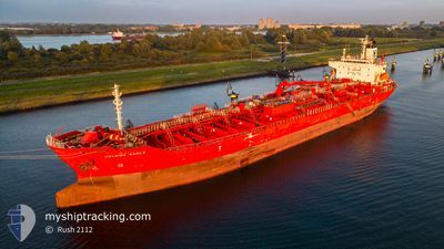
EASTERLY EAGLE
Oil/Chemical Tanker
Current Trip
LAST UPDATE TIME
| Time Travelled | 11 days |
|---|---|
| Remaining Time | --- |
| Distance Travelled | 3104.71 nm |
| Remaining Distance | --- |
| AVG Speed | 11.6 Knop |
| MAX Speed | 14 Knop |
| AVG Wind | 16.2 knots |
| MAX Wind | 24.8 knots |
| MIN Temp | 21.7°C / 71.06°F |
| MAX Temp | 28.6°C / 83.48°F |
| Djupgående | 10.5 m |
| Position mottagen | 3 d sen |
Current Position
| Longitud | -61.49328° |
|---|---|
| Latitude | 11.64577° |
| Status | Under way using engine |
| Fart | 11.3 Knop |
| Kurs | 92.6° |
| Område | Caribbean Sea |
| Station | T-AIS |
| Position mottagen | 3 d sen |
Info
Information
The current position of EASTERLY EAGLE is in Caribbean Sea with coordinates 11.64577° / -61.49328° as reported on 2024-04-15 18:26 by AIS to our vessel tracker app. The vessel's current speed is 11.3 Knop
The vessel EASTERLY EAGLE (IMO: 9423750, MMSI: 538003924) is a Oil/Chemical Tanker that was built in 2010 ( 14 År gammal ). It's sailing under the flag of [MH] Marshall Is.
In this page you can find informations about the vessels current position, last detected port calls, and current voyage information. If the vessels is not in coverage by AIS you will find the latest position.
The current position of EASTERLY EAGLE is detected by our AIS receivers and we are not responsible for the reliability of the data. The last position was recorded while the vessel was in Coverage by the Ais receivers of our vessel tracking app.
The current draught of EASTERLY EAGLE as reported by AIS is 10.5 meters
Weather
| Temperature | 27.4°C / 81.32°F |
|---|---|
| Wind Speed | 17 knots |
| Direction | 61° ENE |
| Pressure | 1011.3 hPa |
| Humidity | 75.7 % |
| Cloud Coverage | 100 % |
Featured Company
Last Port Calls
| Port | Arrival | Departure | Time In Port |
|---|---|---|---|
| 2024-04-05 11:40 | 2024-04-07 20:39 | 2 d | |
| 2024-04-03 23:54 | 2024-04-04 22:44 | 22 h | |
| 2024-04-01 21:12 | 2024-04-03 01:55 | 1 d | |
| 2024-03-29 03:07 | 2024-03-30 00:59 | 21 h | |
| 2024-03-25 13:57 | 2024-03-26 16:50 | 1 d | |
| 2024-03-10 19:19 | 2024-03-10 23:40 | 4 h | |
| 2024-02-17 09:24 | 2024-02-18 10:12 | 1 d | |
| 2024-02-10 13:38 | 2024-02-12 06:35 | 1 d | |
| 2024-02-06 07:31 | 2024-02-08 20:18 | 2 d |
Most Visited Ports (Last year)
| Port | Arrivals | |
|---|---|---|
| 8 | ||
| 3 | ||
| 3 | ||
| 2 | ||
| 2 | ||
| 2 |
Last Trips
| Origin | Departure | Destination | Arrival | Distance | |
|---|---|---|---|---|---|
| 2024-04-04 17:44 | 2024-04-05 06:40 | 146.52 nm | |||
| 2024-04-02 20:55 | 2024-04-03 18:54 | 160.28 nm | |||
| 2024-03-29 19:59 | 2024-04-01 16:12 | 121.13 nm | |||
| 2024-03-26 11:50 | 2024-03-28 22:07 | 385.77 nm | |||
| 2024-03-10 18:40 | 2024-03-25 08:57 | 560.95 nm | |||
| 2024-02-18 07:12 | 2024-03-10 14:19 | 6368.87 nm | |||
| 2024-02-12 03:35 | 2024-02-17 06:24 | 116.98 nm | |||
| 2024-02-08 17:18 | 2024-02-10 10:38 | 175.70 nm | |||
| 2024-01-24 15:21 | 2024-02-06 04:31 | 3652.98 nm |
Events
| Tid | Event | Detaljer | Position / Dest | Information |
|---|---|---|---|---|
| 2024-04-15 18:29 | Status ändrad | Default Under way using engine |
11.64563 / -61.48468
LAST UPDATE TIME
|
Fart: 11.3 kn Kurs: 92.6° |
| 2024-04-15 18:26 | UTANFÖR täckningsområde |
11.64577 / -61.49328
Caribbean Sea
|
Fart: 11.3 kn Kurs: 92.6° |
|
| 2024-04-15 18:26 | Status ändrad | Under way using engine Default |
11.64583 / -61.49494
LAST UPDATE TIME
|
Fart: 11.4 kn Kurs: 89° |
| 2024-04-15 18:08 | Status ändrad | Default Under way using engine |
11.64459 / -61.55188
LAST UPDATE TIME
|
Fart: 11.3 kn Kurs: 93.1° |
| 2024-04-15 18:03 | Status ändrad | Under way using engine Default |
11.64498 / -61.56670
LAST UPDATE TIME
|
Fart: 11.5 kn Kurs: 92° |
| 2024-04-15 17:49 | Status ändrad | Default Under way using engine |
11.64395 / -61.61301
LAST UPDATE TIME
|
Fart: 11.3 kn Kurs: 80.9° |
| 2024-04-15 17:05 | Upptäckt i hav | Grenadian part of the Caribbean Sea |
11.63224 / -61.75762
Caribbean Sea
|
Fart: 11.8 kn Kurs: 93.3° |
| 2024-04-15 17:05 | Status ändrad | Under way using engine Default |
11.63224 / -61.75762
LAST UPDATE TIME
|
Fart: 11.8 kn Kurs: 92° |
| 2024-04-15 17:05 | I täckningsområde |
11.63224 / -61.75762
Caribbean Sea
|
Fart: 11.8 kn Kurs: 93.3° |
|
| 2024-04-12 21:18 | UTANFÖR täckningsområde |
20.28382 / -71.68609
North Atlantic Ocean
|
Fart: 11 kn Kurs: 100° |