
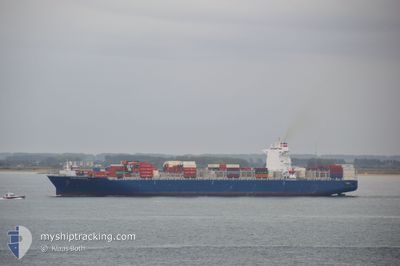
CCNI ARAUCO
Not available
Current Trip
ZADUR
| Time Travelled | 4 days |
|---|---|
| Remaining Time | --- |
| Distance Travelled | 2300.32 nm |
| Remaining Distance | --- |
| AVG Speed | 19.7 Knop |
| MAX Speed | 21.6 Knop |
| AVG Wind | 9.7 knots |
| MAX Wind | 20 knots |
| MIN Temp | 20.8°C / 69.44°F |
| MAX Temp | 28°C / 82.4°F |
| Djupgående | 11.8 m |
| Position mottagen | 4 d sen |
Current Position
| Longitud | 31.19536° |
|---|---|
| Latitude | -29.83743° |
| Status | Under way using engine |
| Fart | 18.2 Knop |
| Kurs | 86.7° |
| Område | Indian Ocean |
| Station | T-AIS |
| Position mottagen | 4 d sen |
Info
Information
The current position of CCNI ARAUCO is in Indian Ocean with coordinates -29.83743° / 31.19536° as reported on 2024-04-20 23:27 by AIS to our vessel tracker app. The vessel's current speed is 18.2 Knop
The vessel CCNI ARAUCO (IMO: 9683843, MMSI: 636092897) is a Not available It's sailing under the flag of [LR] Liberia.
In this page you can find informations about the vessels current position, last detected port calls, and current voyage information. If the vessels is not in coverage by AIS you will find the latest position.
The current position of CCNI ARAUCO is detected by our AIS receivers and we are not responsible for the reliability of the data. The last position was recorded while the vessel was in Coverage by the Ais receivers of our vessel tracking app.
The current draught of CCNI ARAUCO as reported by AIS is 11.8 meters
Weather
| Temperature | 27.9°C / 82.22°F |
|---|---|
| Wind Speed | 20 knots |
| Direction | 102° ESE |
| Pressure | 1011 hPa |
| Humidity | 79.2 % |
| Cloud Coverage | 100 % |
Featured Company
Last Port Calls
| Port | Arrival | Departure | Time In Port |
|---|---|---|---|
| 2024-04-13 19:41 | 2024-04-20 22:55 | 7 d | |
| 2024-03-18 09:04 | 2024-03-19 19:18 | 1 d | |
| 2024-03-07 10:29 | 2024-03-08 16:52 | 1 d | |
| 2024-03-02 17:34 | 2024-03-03 07:03 | 13 h | |
| 2024-02-24 03:13 | 2024-02-25 11:51 | 1 d | |
| 2024-02-16 04:08 | 2024-02-17 19:41 | 1 d | |
| 2024-02-05 15:19 |
Most Visited Ports (Last year)
| Port | Arrivals | |
|---|---|---|
| 10 | ||
| 6 | ||
| 5 | ||
| 5 | ||
| 3 | ||
| 2 |
Last Trips
| Origin | Departure | Destination | Arrival | Distance | |
|---|---|---|---|---|---|
| 2024-03-19 23:18 | 2024-04-13 21:41 | 1631.24 nm | |||
| 2024-03-09 00:52 | 2024-03-18 13:04 | 3350.07 nm | |||
| 2024-03-03 15:03 | 2024-03-07 18:29 | 1471.99 nm | |||
| 2024-02-25 19:51 | 2024-03-03 01:34 | 952.39 nm | |||
| 2024-02-18 03:41 | 2024-02-24 11:13 | 2229.41 nm | |||
| 2024-02-05 17:19 | 2024-02-16 12:08 | 4886.00 nm |
Events
| Tid | Event | Detaljer | Position / Dest | Information |
|---|---|---|---|---|
| 2024-04-20 23:31 | Status ändrad | Default Under way using engine |
-29.83633 / 31.21951
ZADUR
|
Fart: 18.2 kn Kurs: 86.7° |
| 2024-04-20 23:27 | UTANFÖR täckningsområde |
-29.83743 / 31.19536
Indian Ocean
|
Fart: 18.2 kn Kurs: 86.7° |
|
| 2024-04-20 23:07 | Status ändrad | Under way using engine Default |
-29.84761 / 31.09120
ZADUR
|
Fart: 9.9 kn Kurs: 60° |
| 2024-04-20 22:59 | I täckningsområde |
-29.84603 / 31.09496
Indian Ocean
|
Fart: 13.4 kn Kurs: 67.5° |
|
| 2024-04-20 22:55 | AVGÅTT HAMN |
|
-29.86650 / 31.05965
ZADUR
|
Fart: 7.6 kn Kurs: 39° |
| 2024-04-20 22:23 | STARTAR förflyttning |
-29.87601 / 31.02517
[ZA] DURBAN
|
Fart: 3.5 kn Kurs: 250° |